Tarique and I woke up early and decided to go and see where the gurgling sound water spring that we heard all night was coming from.
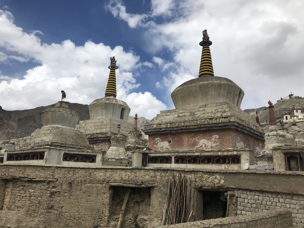
Since there was no direct access to the sound we were hearing, we decided to go through the village. It turned out to be a 2 km plus walk which led us to the small spring, which eventually led us to a huge freshwater melt from the glacier. It was next to the small monastery of the village in the mountains.
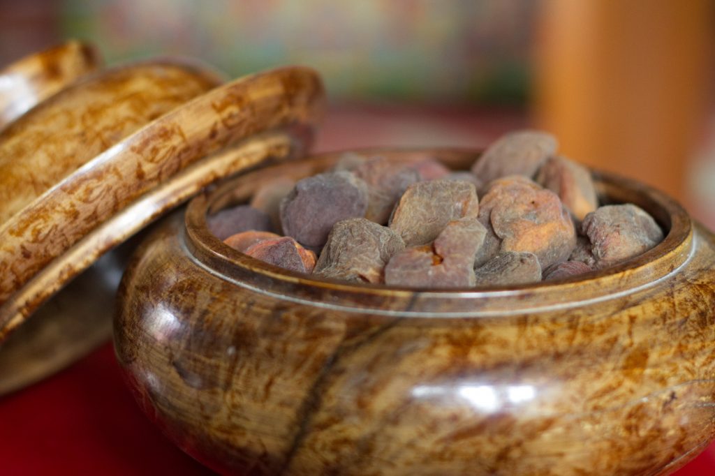
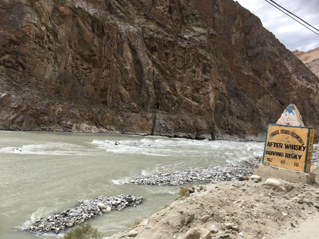
Stream at Hundar
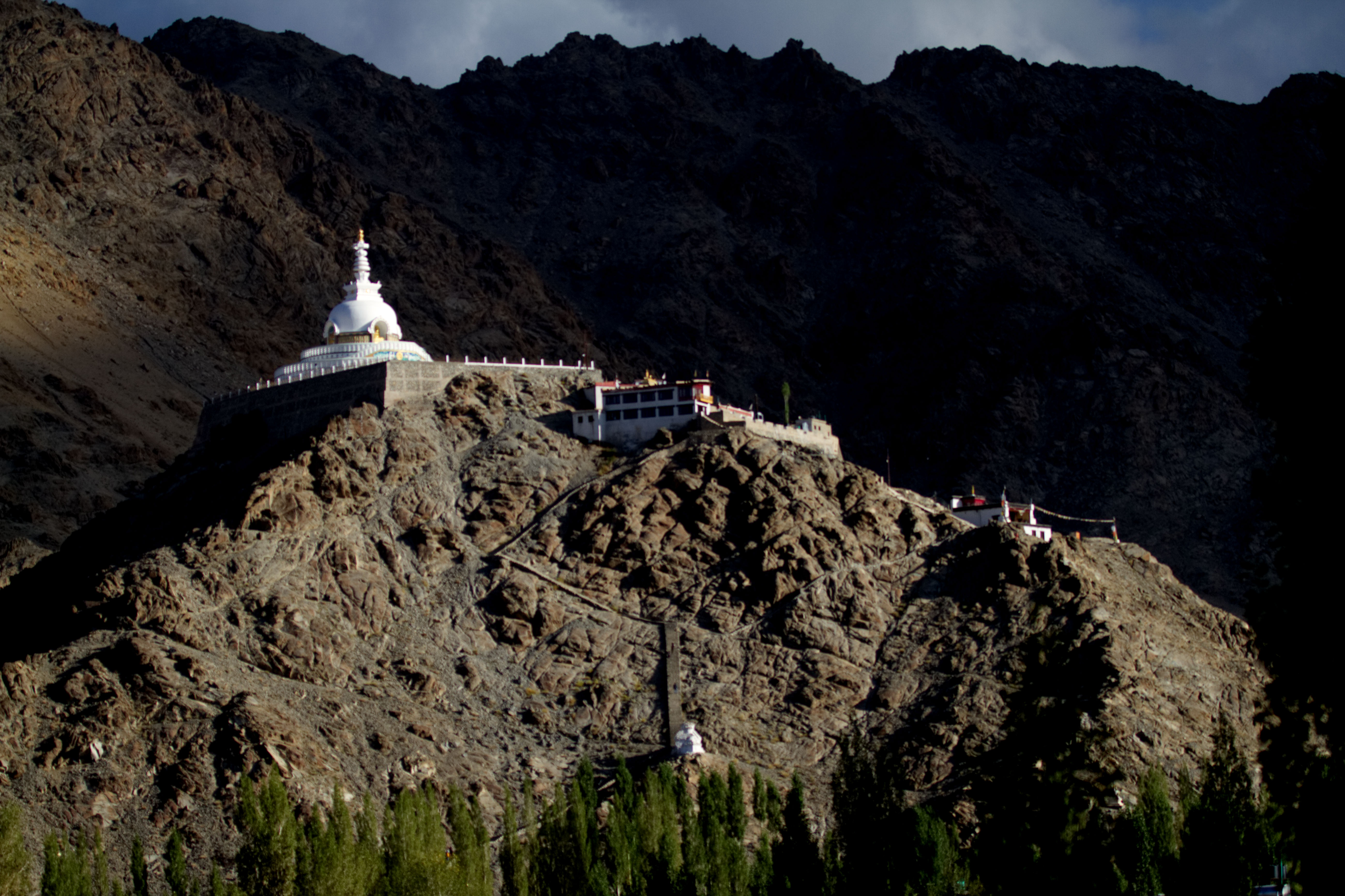
The Monastery of Hundar Village
The Border Road Organization (BRO for short) and Himnak have put up interesting boards throughout, and they were a constant source of amusement and laughter.
Another signboard
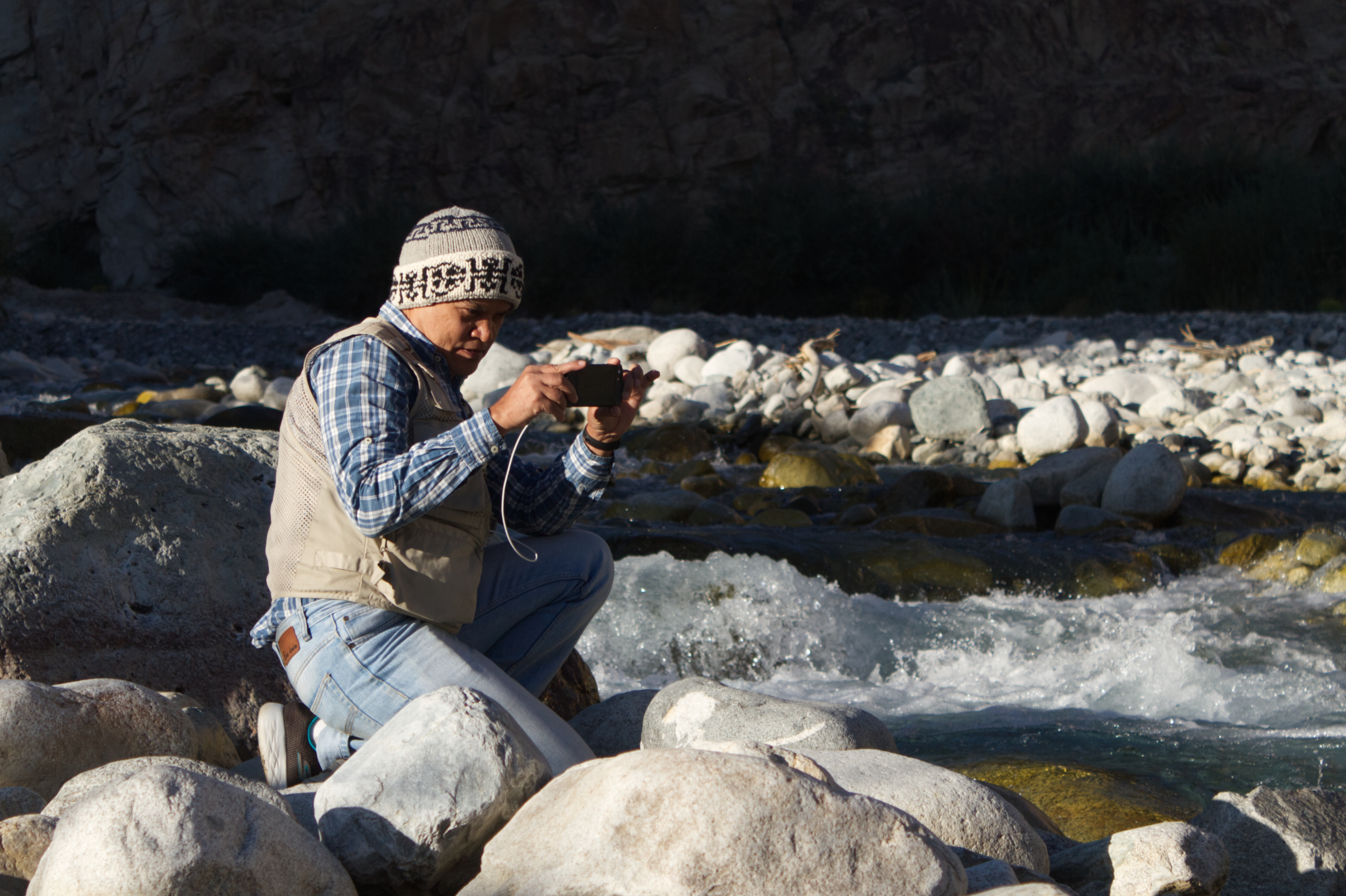
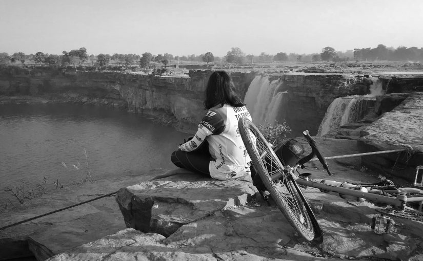
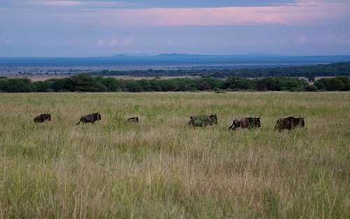
We walked along the stream for almost a kilometre before we turned back and were surprised to see a congregation of raptors – around 45-50 of them next to the mountains near the bridge of the main road. Cursing ourselves for just carrying the kit lens with the camera and not the 100-400 lens, we still took pictures. It turned out that it was a large migrating flock of kites. We stood there for quite some time observing them and then decided that it was getting late for the next item in our itinerary and promised ourselves to come the next day with a longer lens to photograph them.
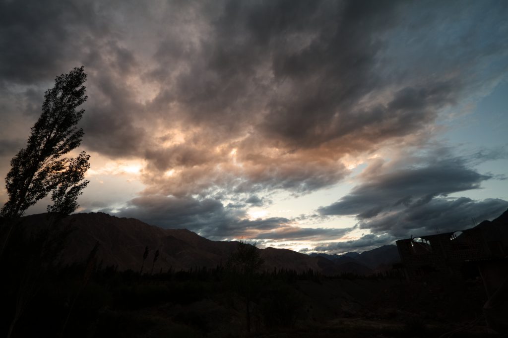
Early morning light, stream and the photographer.
It was time to go to the sand dunes to see the famous Bactrian Camels. The Bactrian Camel has two humps on it’s back, in contrast to the single-humped dromedary or Arabian camel. Their name comes from the ancient historical region Central Asia of Bactria which lies north of the Hindu Kush mountains. The population of these two-humped camels is around two million. About 100 of which are found in the Hunder town in Nubra Valley. This is the only place in India where Bactrian camels live.
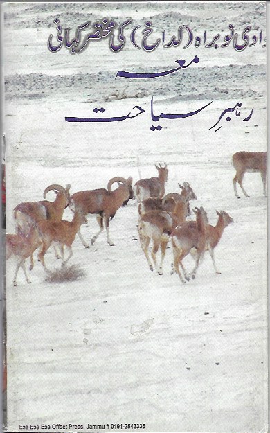
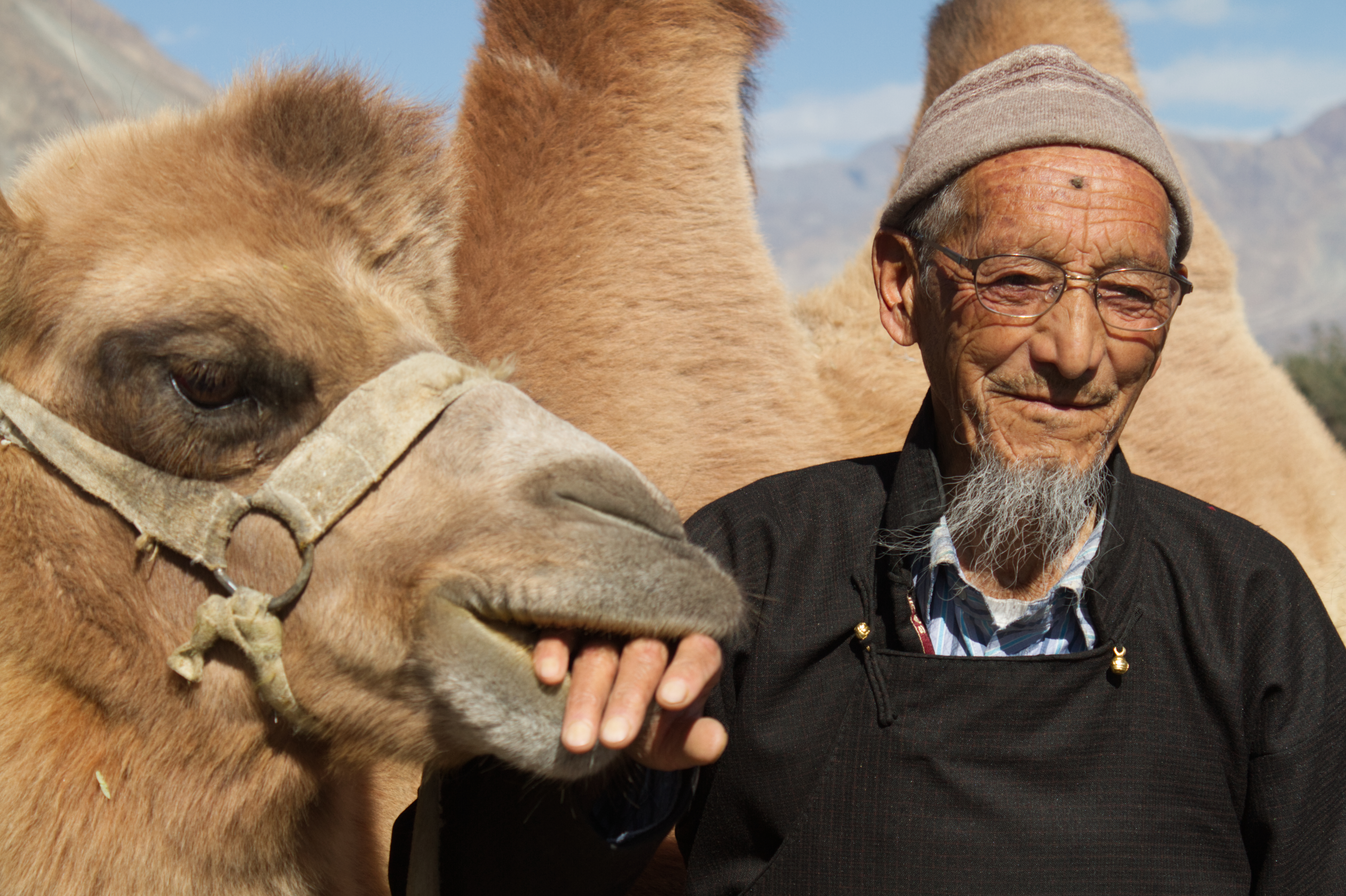
Iqbal Bhai’s uncle (Tayaji), Haji Abdul Razak Jamshed , an Urdu teacher from Nubra valley accompanied us to the sand dunes. Haji saheb owns one of the camels and was accompanying us for a photoshoot for the Urdu book he has written on the Nubra valley titled: Wadi e Nubrah ki mukhtasar kahani (وادی نوبرہ کی مختصر کہانی) The book has been translated into English and is in circulation already.
A brief history of Nubra Valley
Haji Saheb is 85 years old, still, fit and extremely knowledgeable about the region gave us a brief history of Nubra valley. He told us that before 1929, these sand dunes did not exist but Shyok was in floods 1929 due ice melt from the glacier and a breach in the dam, ,( an account of which I also found on the web), This left a part of Nubra valley completely submerged, but a huge pool of water here stayed much after the floodwaters receded, resulting in sand and over the years the forces of natures made this place a real cold desert, with daytime temperatures in summer being quite high, and the nights very cold.
Haji Abdul Razak Jamshed (Tayaji) with his pet camel
The cold desert of Nubra Valley at Hundar
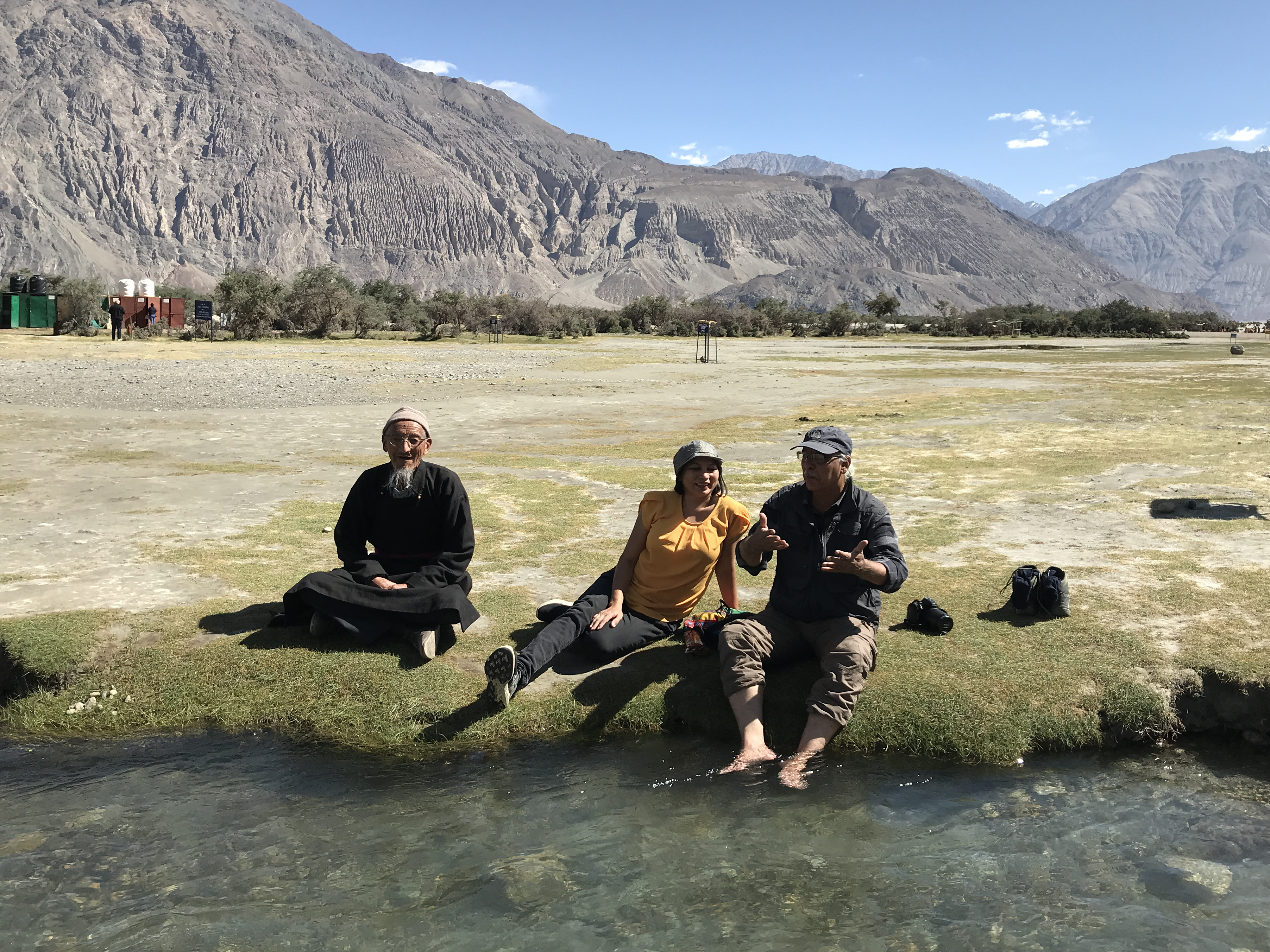
Sitting on the banks of a stream in the desert, discussing the history of Nubra Valley with Tayaji
The day started early as we were driving back from Kargil to Leh and were scheduled to stop in between to see the Lamayuru Monastery and the Moon landscape / Moonscape.
We were in high spirits, admiring the shape, textures and lovely pastel colours of the mountains. Shades of brown, gold and at times purple all around us.
The shades of cold desert mountainsThe colour of mountains: Details
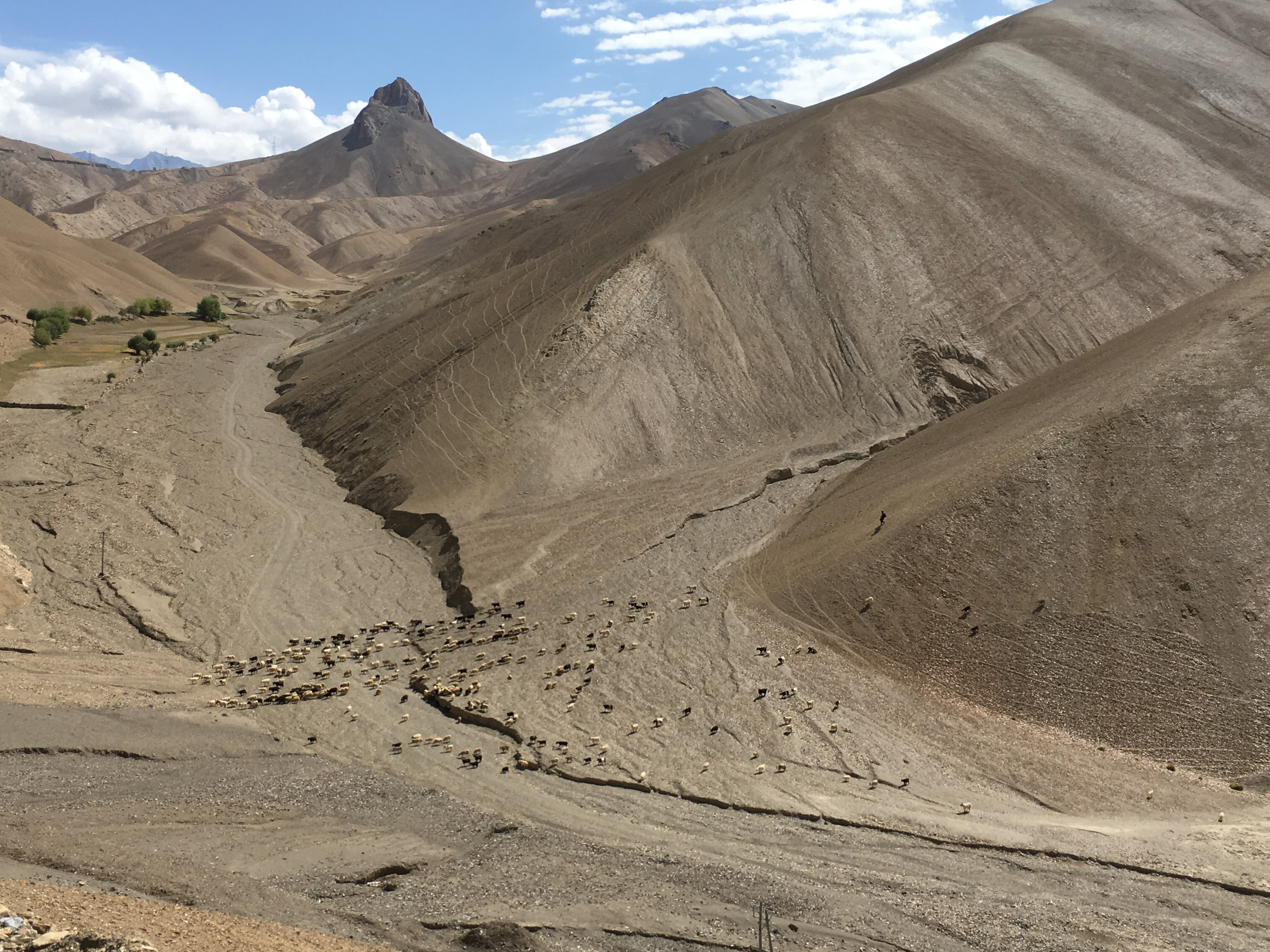
We must have been on the road for an hour or so when we spotted a shepherd with his flock of sheep in high mountains. Sensing a photo opportunity, all of us made Iqbal Bhai stop the car and jumped out.
The sheep on steep mountainsIt’s a tough job
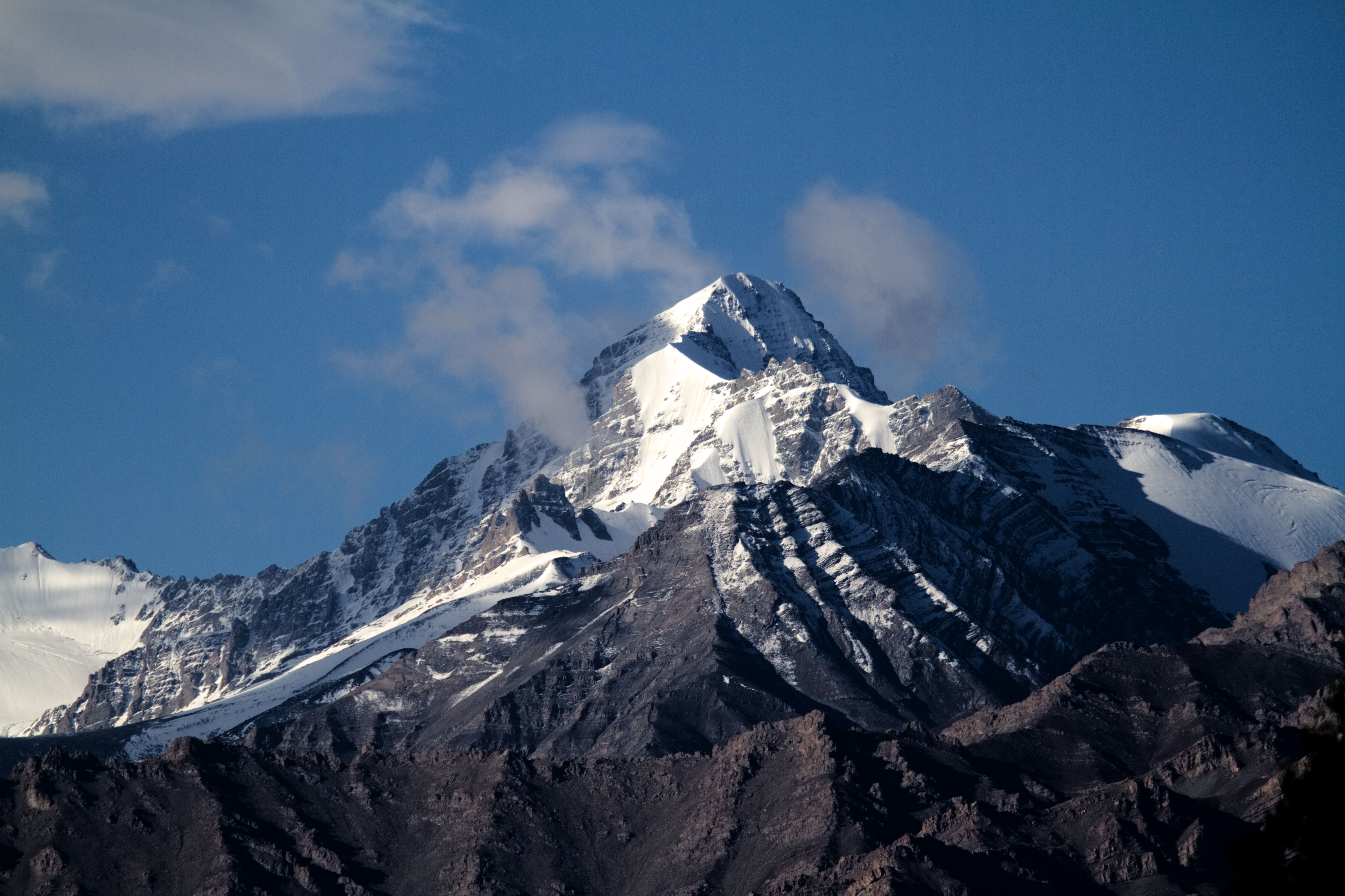
Happy with the results, we got back into the car. We had to cross two high passes on this road to reach Leh. The first one was familiar, Namik La, which we had crossed two days back to reach Kargil; and the second was Fotu La (Also called as Fatu La)
Fotu La is slightly higher pass than Namik La at 13479 feet. Towards the east of Fotu La, at a distance of about 15 km, is Lamayaru and located on the pass is the Prasar Bharti television relay station serving Lamayuru.
At the Fotu La pass
Fotu La: The 10 mm view
It was a smooth descent from the Fotu La towards the Lamayuru Monastery but, we had the time, and Himanshu decided to show us the curvaceous road above the Moonscape before reaching the monastery.
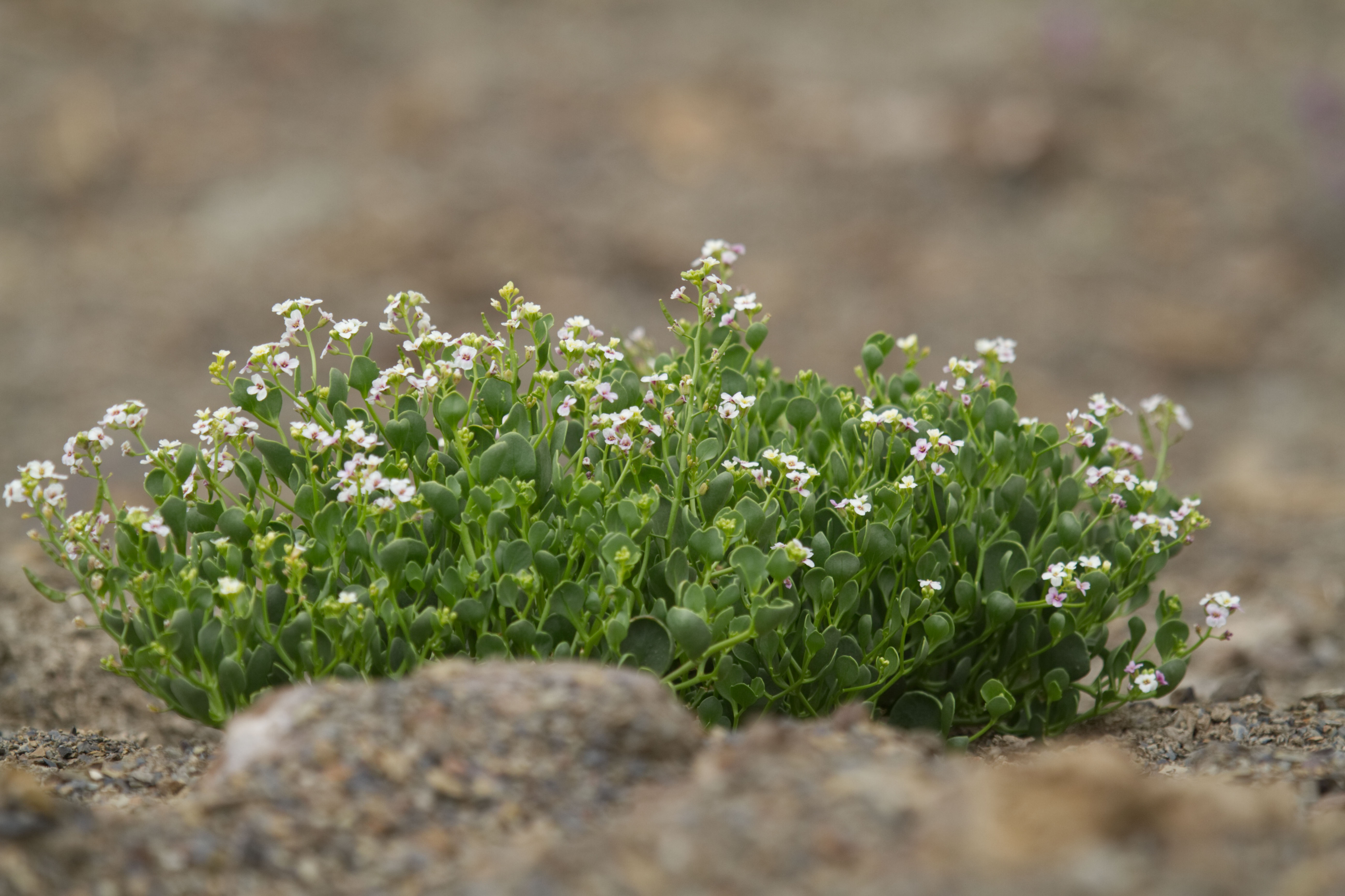
Unfortunately, the road above the Monastery was being worked upon and was closed for traffic, but we still managed to have some fun. Identified and collected the lavender plant which was in abundance here, and photographed some more wildflowers.
Wild Lavender flowers on the hillsWildflowers on the hillsMore wildflowers
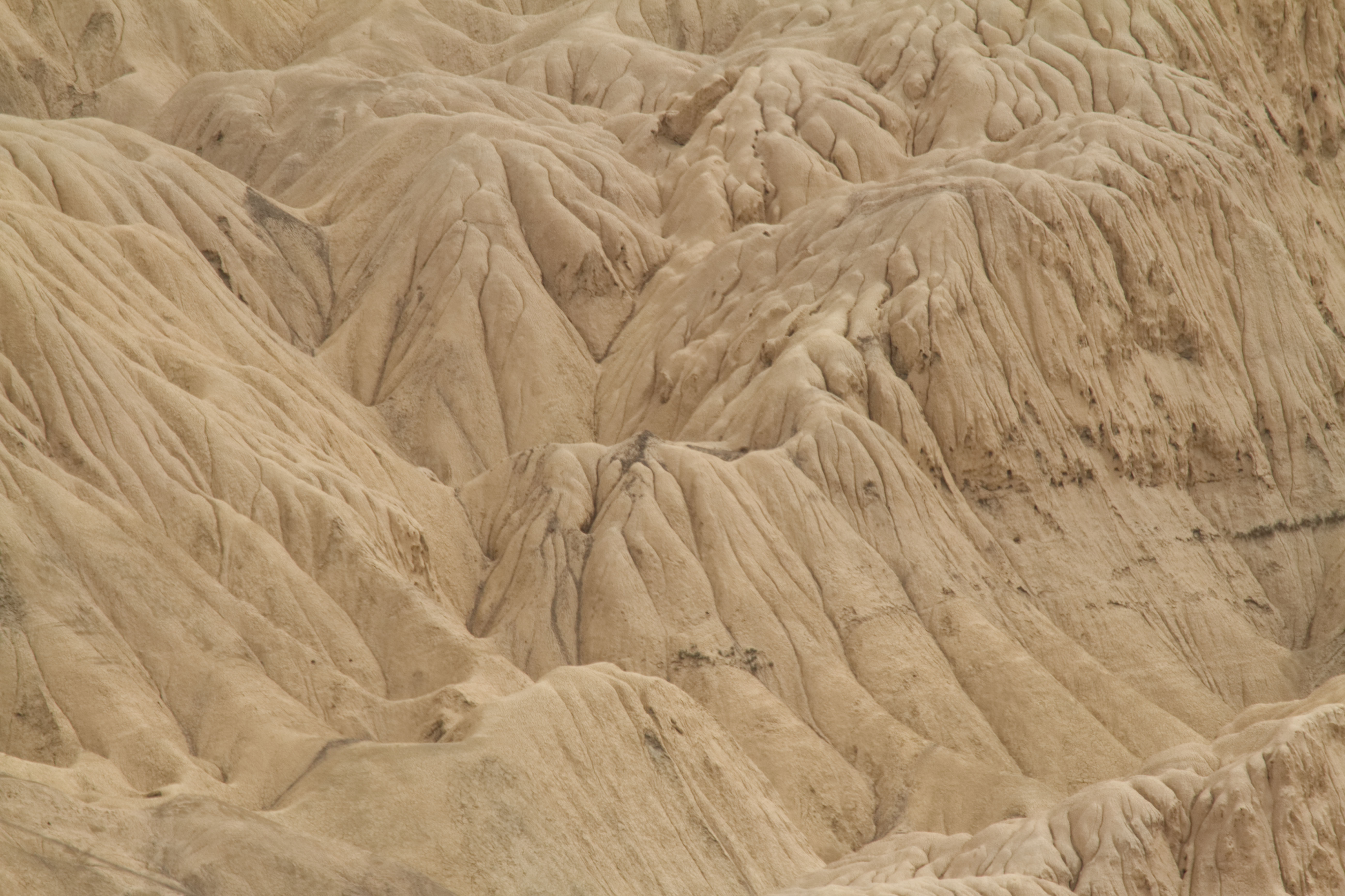
We also got a magnificent view of the Moonscape from this place. The serrated and ridged mountains near Lamayuru look like a typical lunar landscape, hence the name.
A road through the MoonscapeMoonscape Details
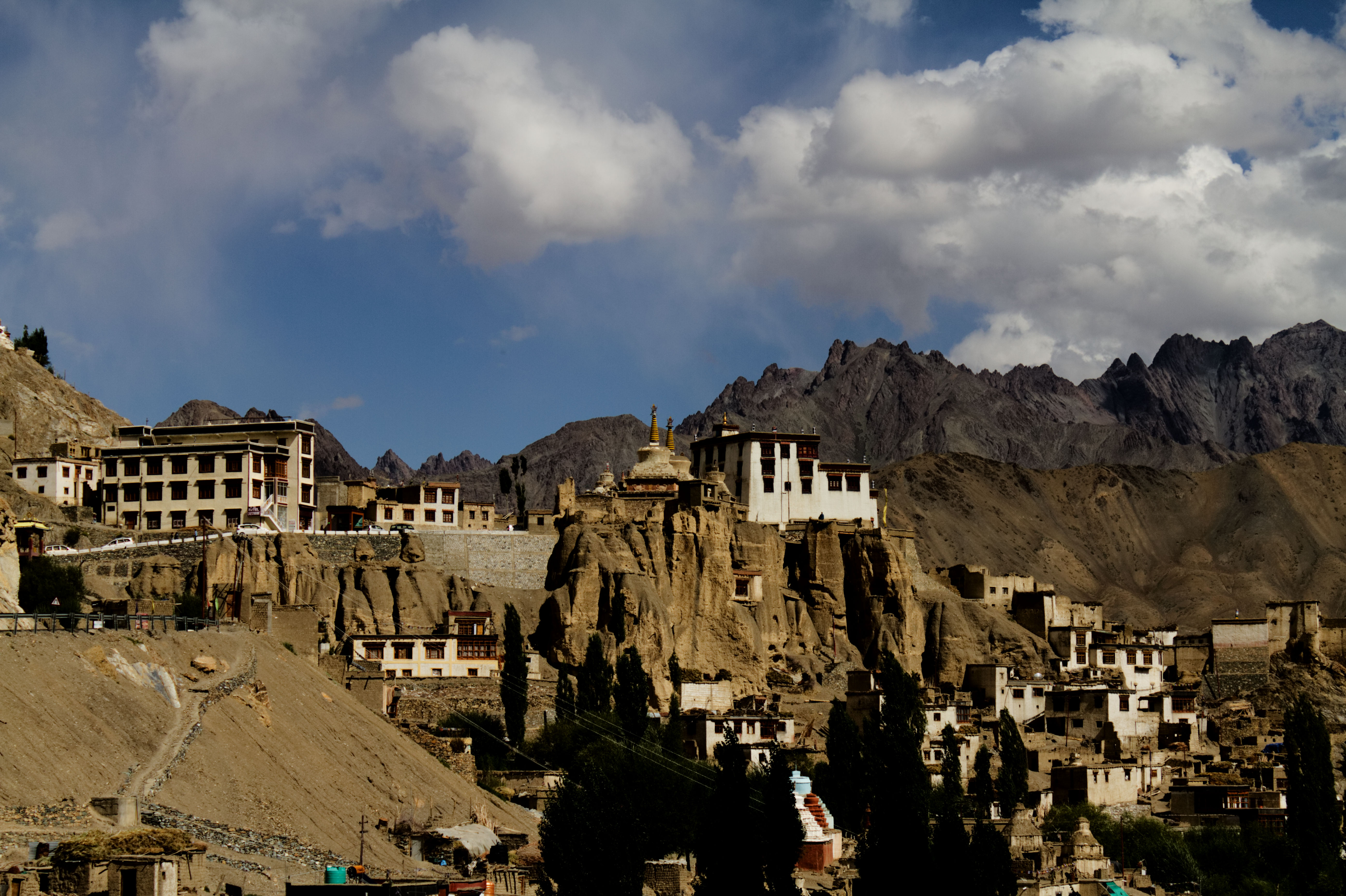
Next stop was the Lamayuru Monastery. Lamayuru monastery is a place which has many legends associated with it. It is one of the oldest and the largest in Ladakh. Out of the five gigantic temples, only one has survived. One can still see some old remnants of the monastery.
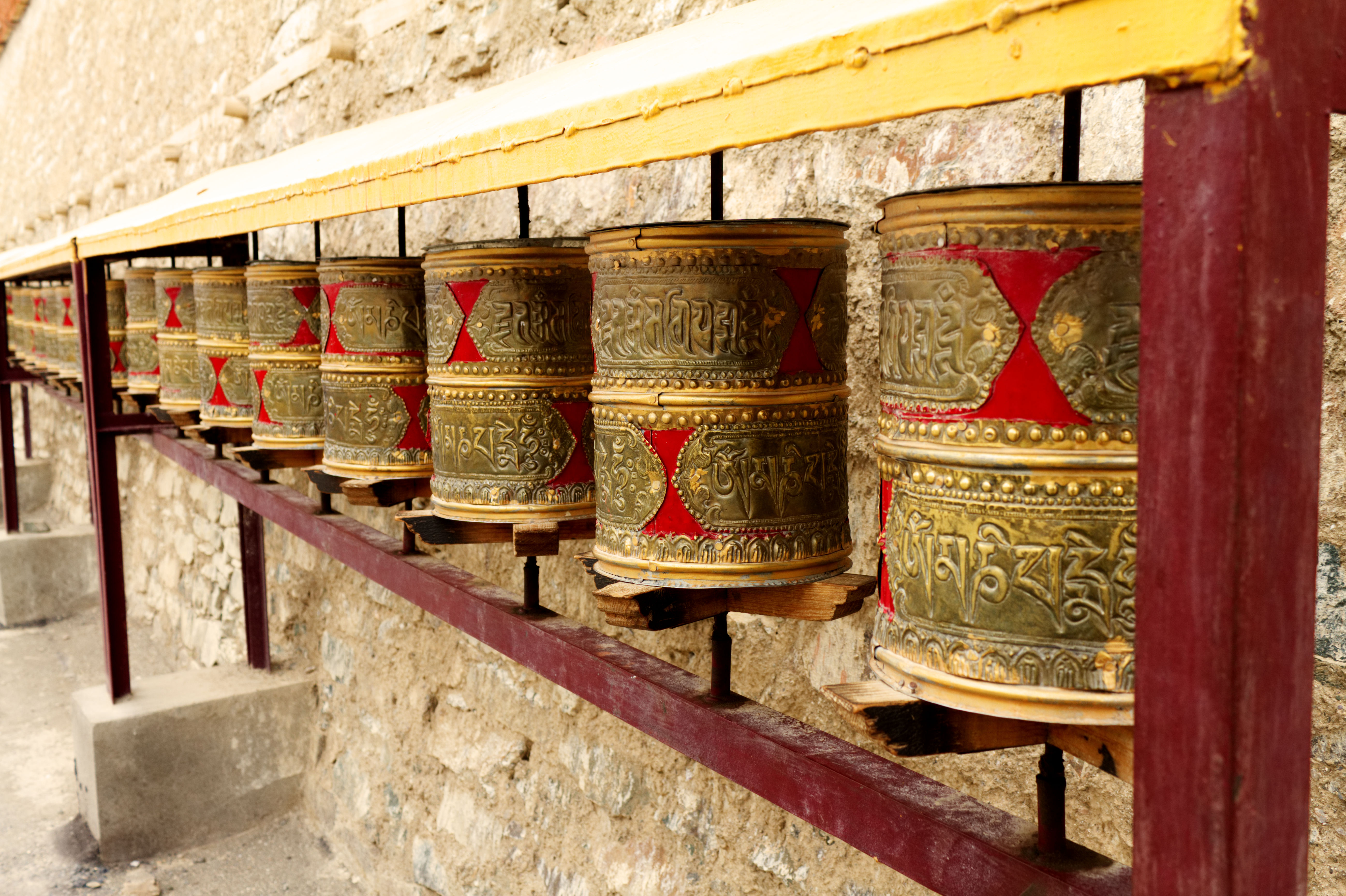
Lamayuru MonasteryLamayuru Monastery: Passage to the other sideLamayuru -remnants of the old monasteryThe Prayer wheels
As we entered the monastery, I encountered a beautiful old woman dressed in local attire.
The old woman at Lamayuru Monastery
When I reached her, she smiled and initiated the conversation, told me her name and asked mine. I requested her to introduce herself again to get it on the video. On second thoughts, instead of breaking into English, as it has become a habit, I should have spoken in Hindi as the locals know Hindi reasonably well.
As I followed her, I spotted three more friendly old women, who taught me how to use the prayer wheel. However, as we were moving ahead, they asked for Bakshish. I gathered that this was their livelihood.
Learning to use the prayer wheel
These old women sit in a particular corner, quietly praying and whenever a tourist comes, they talk and educate the tourist, post for photographs and videos. In return, all they expect is some bakshish so that they can survive. I learnt later that they have been doing this for many years.
Lamayuru Monastery: The famous fourThe Lamayuru town
We also visited the other portions of the monastery which houses the school and hostel for the monks, although we could not stay there longer as it was getting late and the place was shutting down for lunch.
We too were hungry, and the best place to eat near Lamayaru is a restaurant right next to the monastery. The restaurant also serves eggs and Tuna (and beer). We opted for Thukpa, momos, omelette, fried rice and some lemon tea. The food was so good that I ended up overeating and all I wanted to do was sleep. I had full intentions to take a nap in the car when Trishu exclaimed that his phone is catching network and has 4g and that was the end of our plans to nap – each of us requested a hotspot from him and were busy uploading pictures to Instagram.
After Lamayuru, we drove through a long straight road amongst the mountains. Trishu wanted to shoot videos and pictures of the road which I later learnt is a fascination for him. He has captured the visuals very well on this phone.
While he was shooting the road, I was fascinated with the unabashed blueness of the sky and wanted to capture that.
The deepest of blue skies
After a day’s drive, we arrived at Leh in the evening and realised that the hotel had a limited internet connection. I tried to talk to mom, but the network was bad, and could only send her some pictures from the trip.
The evening was booked for a stroll in the Leh market. I picked up two woollen caps and some essentials for the journey ahead.
Leh MarketA trinket shop at the Leh market
Tarique and I indulged in eating soft and succulent lamb kababs from a kabab stall on the roadside of the main market after which we all proceeded towards the German Bakery. Since we were to dine at the Hotel restaurant, we did not eat much but decided to pick up croissants, doughnuts, apple strudel and some more delicacies the next morning before departing for the Nubra Valley.
Lamb Seekh Kebabs
12th September
Since we woke up early and were ready for the next leg of the journey, Tarique decided to go up to the terrace of the hotel and click some pictures of the mountains, Leh fort and Castle, while I decided to enjoy some quiet time in the hotel garden.
Tea in the hotel gardensnow covered mountains as seen from our hotel in LehLeh MonasteryLeh Palace
As decided, we picked up the stuff from the German bakery before departing. Today was the 5th day of our 9-day visit to Ladakh. I was kind of disappointed that the holidays will soon end, and that I would have liked to spend more time at each of the places we visited. First stop was the hill of the Leh Monastery and palace. The monastery was not as big as some others but had a charm and the inherent peace. From here we could also see a part of the charming little town of Leh.
Birdseye view of Leh town.
We were very excited to cross the Khardung La. Khardung is the name of a village and La means a pass in Tibetan.
Himanshu showed us the direction of the pass from the monastery, and we quickly jumped in the vehicle and were driven around by Iqbal Bhai on the curvaceous roads leading to the Khardung La. Iqbal Bhai was looking quite dapper today, he had worn a new shirt that was gifted to him by Himanshu. We teased him a bit – after all, he was going home to his wife today. Iqbal Bhai lives in the town of Hundar in the Nubra Valley where we were scheduled to halt for the next two days.
Khardung La is a pass on the Ladakh range and is in the North of Leh. It is a gateway to the Shyok and Nubra Valleys, and the Siachen Glacier lies partway up the Nubra Valley. The Khardung pass was opened to the motor traffic in 1988. The pass is strategically important to India as it is used to carry supplies to the Siachen Glacier.
While the current road was built in the 20th century, this route was once a part of the old silk route that borders on the Karakoram range of mountains.
Our first halt was the South Pullu where we had to stop to show our permits. Pullu in Ladakhi means a place where travellers rest. So this was the southern end of Khardung La where travellers rested, at times overnight, before crossing the mountain pass.
While the formalities were being done, we got down of our vehicle, wore another layer of clothes as it was getting colder at this altitude, and as usual, clicked a few pictures and took some selfies.
South PulluAnd here are the selfies 🙂
Selfie at South PulluCaptured taking a selfie with Himanshu a little ahead of South Pullu.
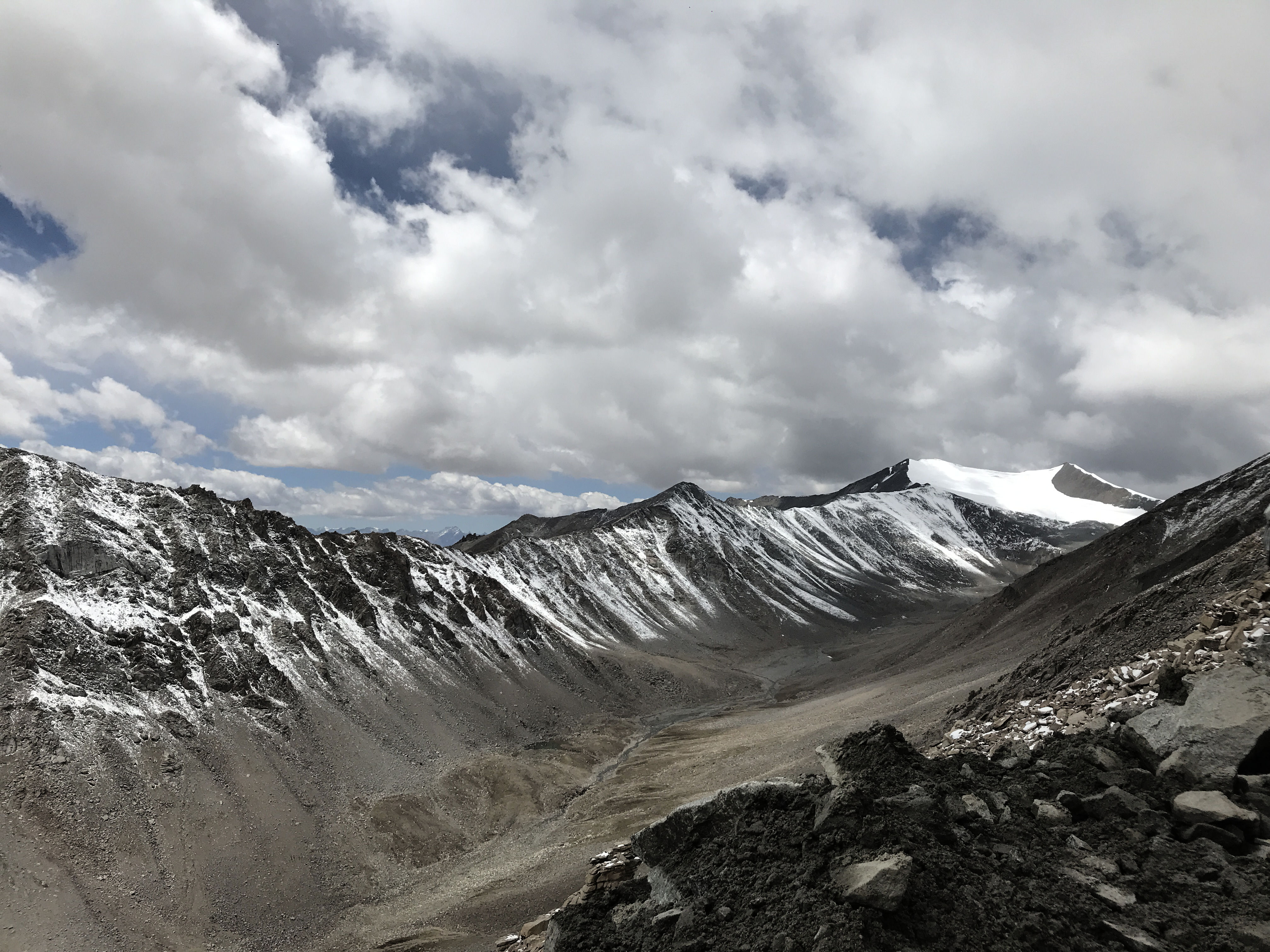
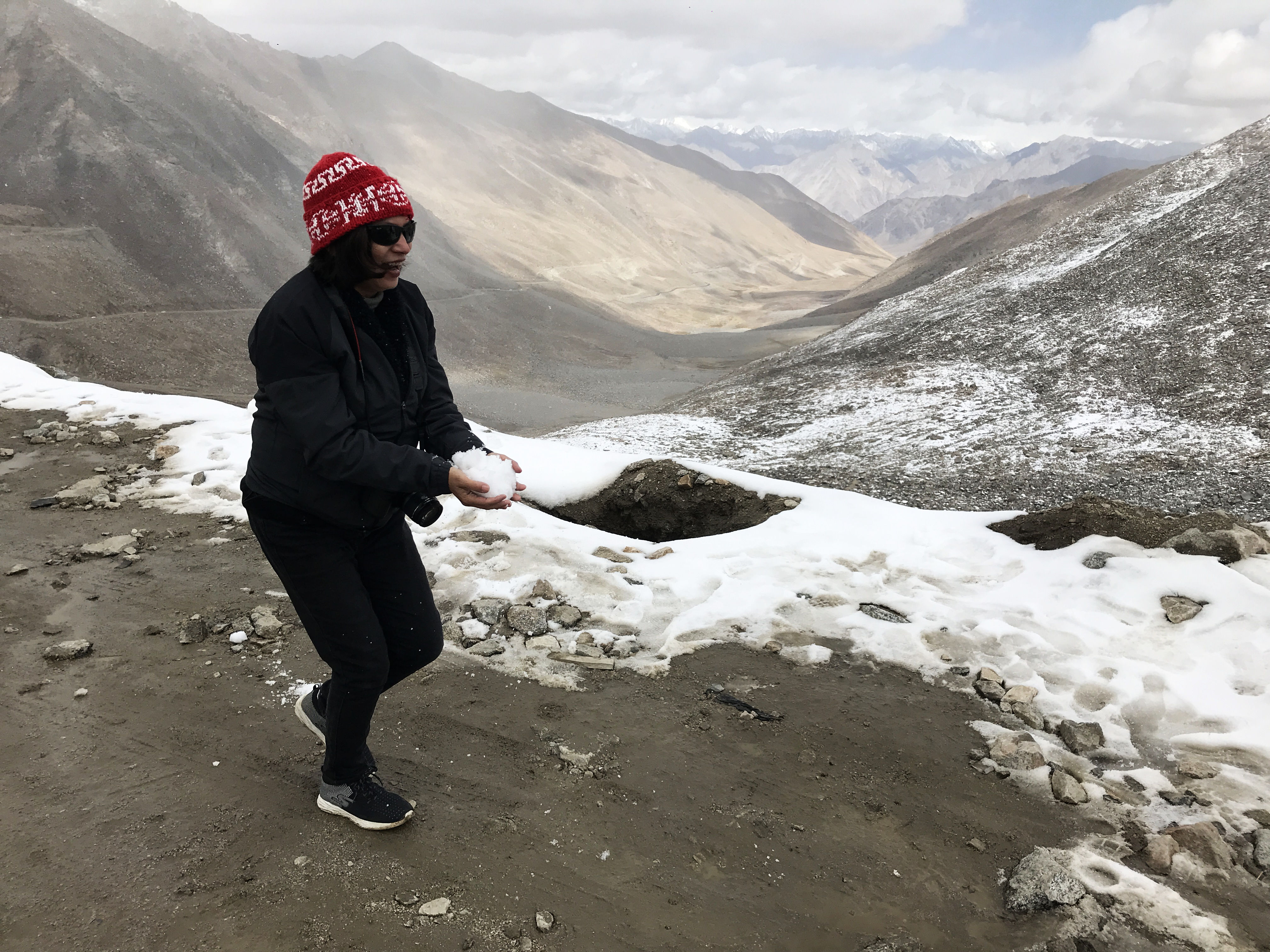
A few km ahead of South Pullu we stopped for a mini break; it had started to snow. We spotted a raptor overhead and heard a marmot call. Took some photographs of the winding road that got us here, and saw part of the glacier, which has shrunk to less than half its original size in the recent years.
Khardungla glacier that was
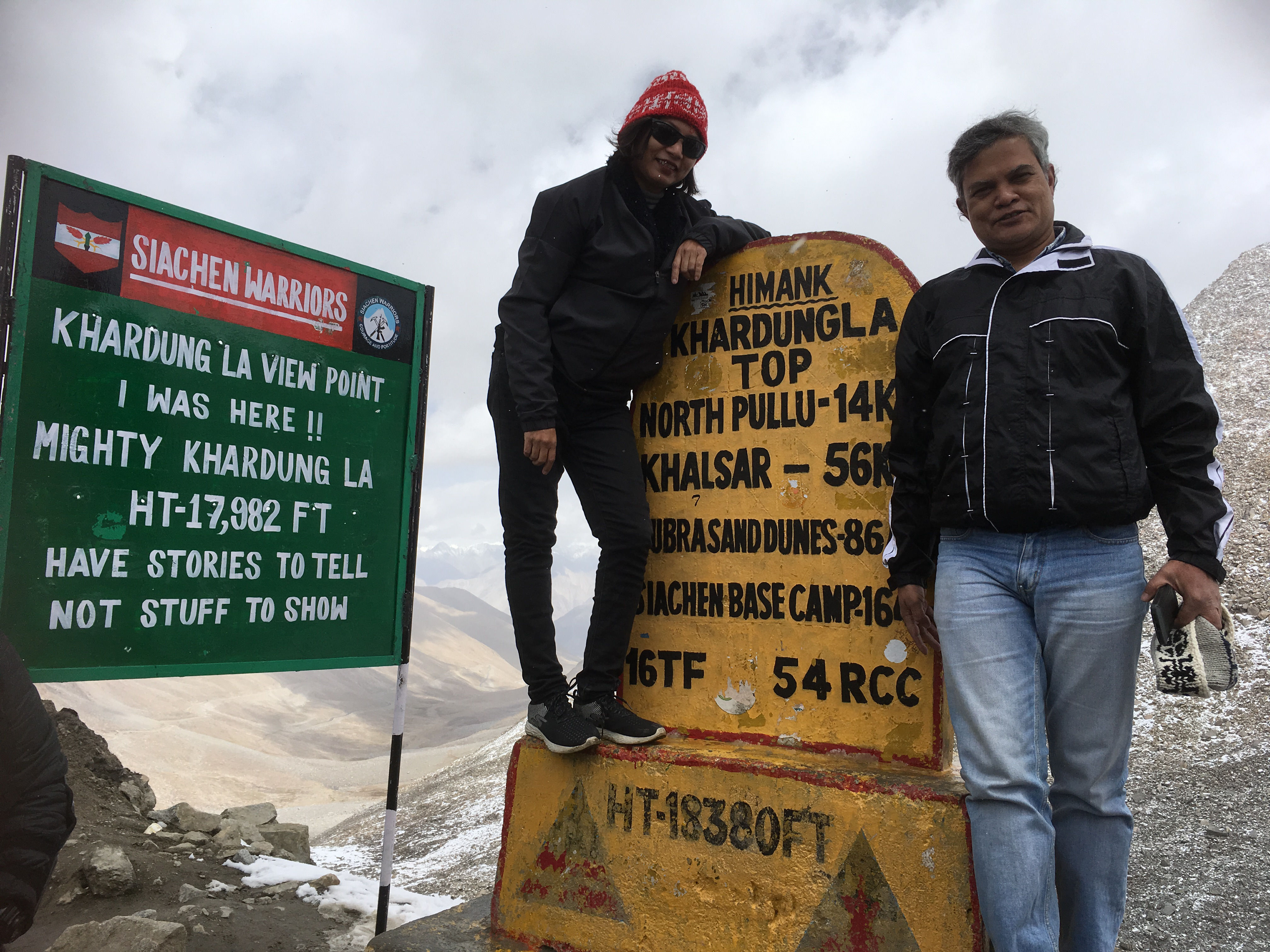
A few of Radhika’s “how much longer to reach” and we were at the top of the mountain at Khardung La. At 17982 feet from the sea level to be precise.
I did not experience any altitude sickness whatsoever, but my lungs were choked from breathing the polluted air from the numerous trucks, bikes and cars that were on the road. I was told, that the air pollution is due to the use of kerosene mixed with diesel (as kerosene stops diesel from freezing) and is proving detrimental to the fragile environ of the mountains and therefore soon there would be a limitation on the number of vehicles that can ply on this road.
Motorcyclists at Khardung La
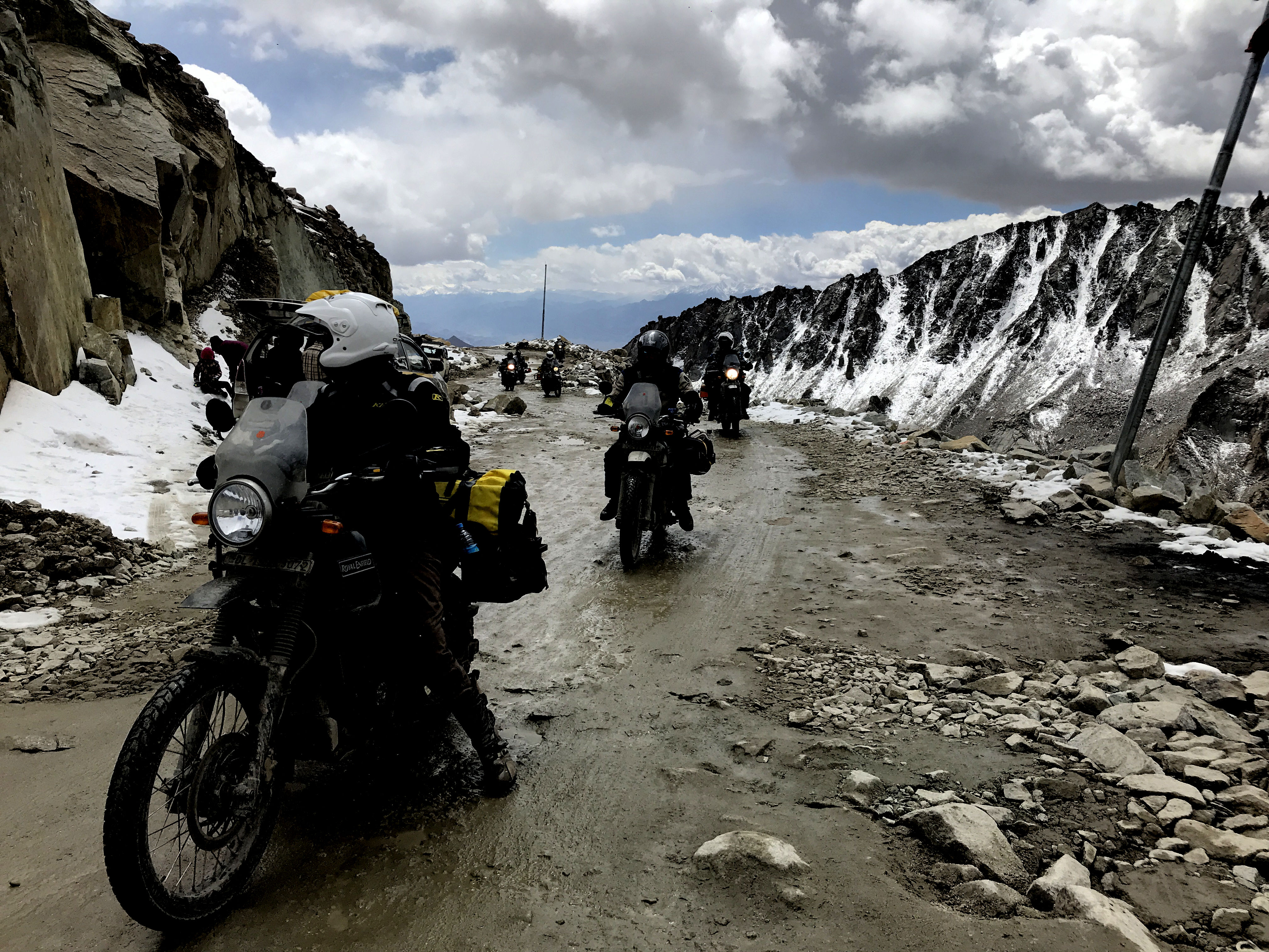
We did have our fun here though, did the normal touristy stuff and started our descent only to realise that the road ahead has been blocked for traffic by the Border Road Organisation (BRO) for some construction work. Someone took out a packet of Kurkure to pass the time.
Customary Khardung La photoKhardung La – top of the worldPlaying with snow
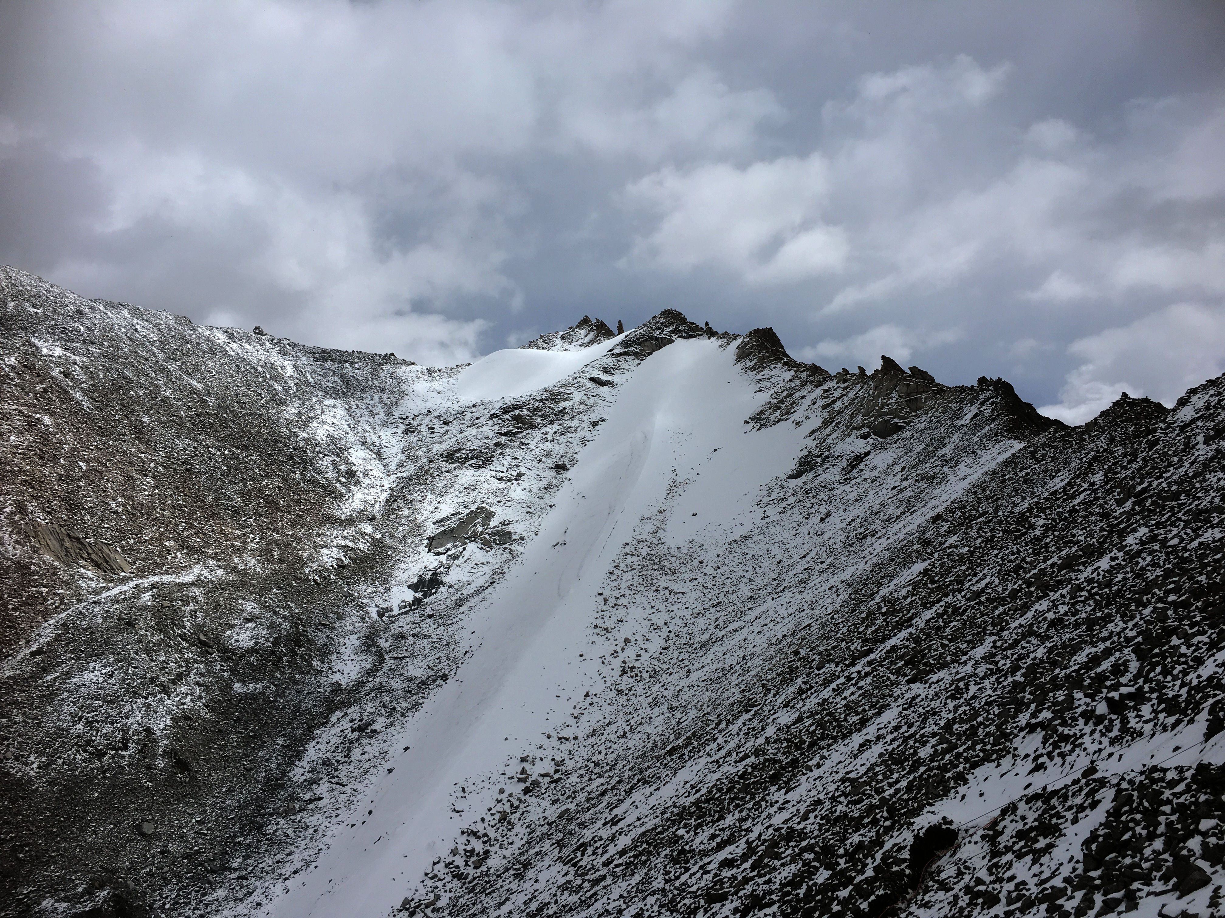
After the traffic cleared up, we moved ahead but stopped once more by the side of the road for a view of the mountains from the other side. This side of Khardung La had more snow, and there was a soft drizzle of snow all around. This was my first real snowfall, and I felt an uncontrollable urge to record it, so I managed to make a small video clip before being urged to climb back in the car.
And then it started snowing
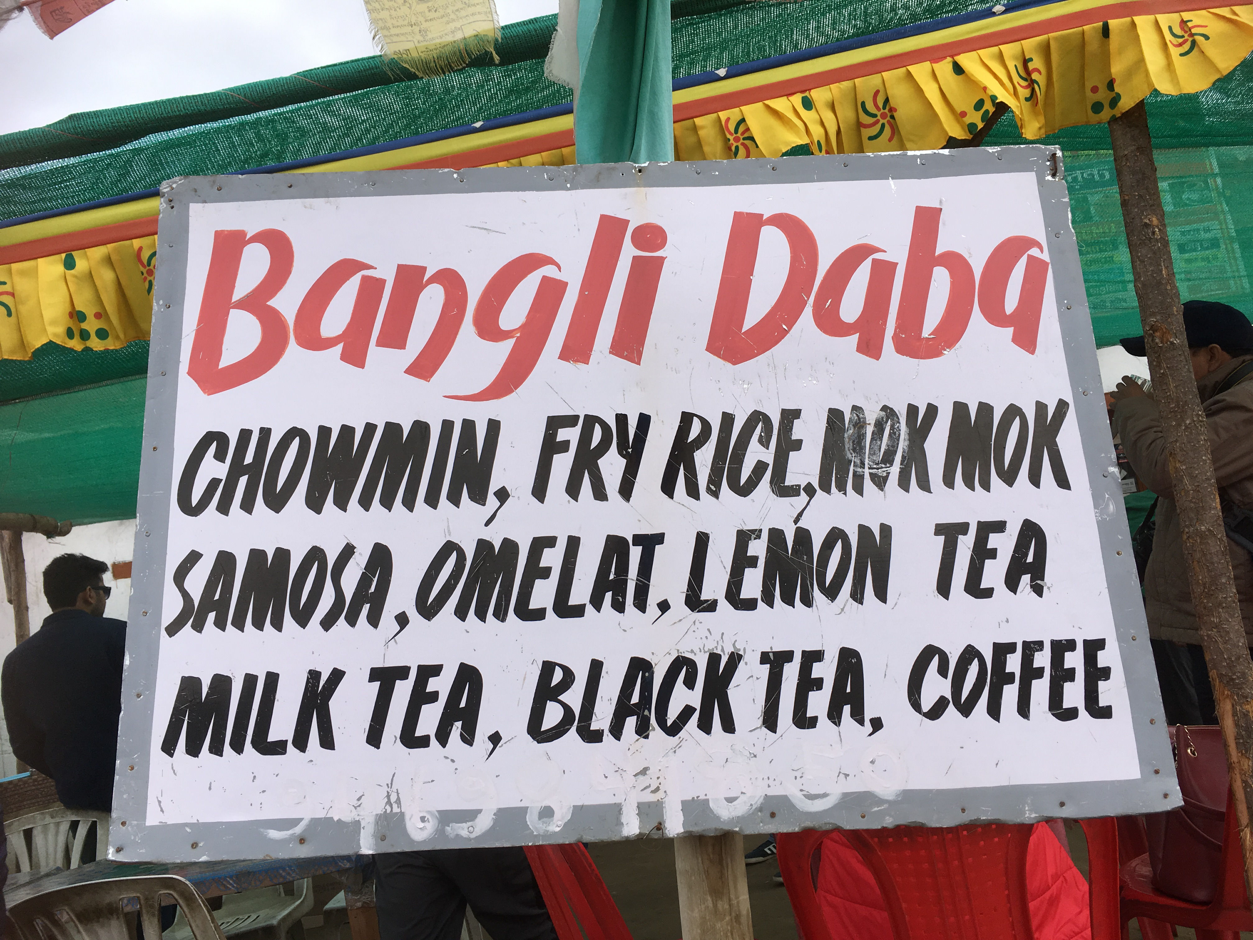
Our next stop was North Pullu to show the papers to the officials. We had decided to stop at the Bangli Dhaba for tea and delicacies from German Bakery. Radhika and I discovered that he was making Maggi.
Mountains and Maggi go together, and for a complete experience, one must have a plateful of steaming hot Maggi on the (not so cold now) mountain tops. The Shop owner was generous and sprinkled more Haldi, Mirchi and masala on our Maggi- which none of us could eat, so I went in the kitchen and made my version of masala Maggi with tomato sauce. I struck a conversation with the owner and learnt he was from Bengal and operated this Dhaba in the summer months for the tourists. On his recommendation, we also snacked on a plate of mok moks (momos) while the Maggi cooked.
Bangli dhaba at North Pullu
The extra layer of clothes and woollen that we had put on at South Pullu came off, and we climbed back in the car to continue our journey towards the Nubra Valley only to stop a km or so later to photograph some Marmots. We did not know we will see a lot of them in our journey ahead so a decent photo was must especially when the opportunity had presented itself.
A Marmot
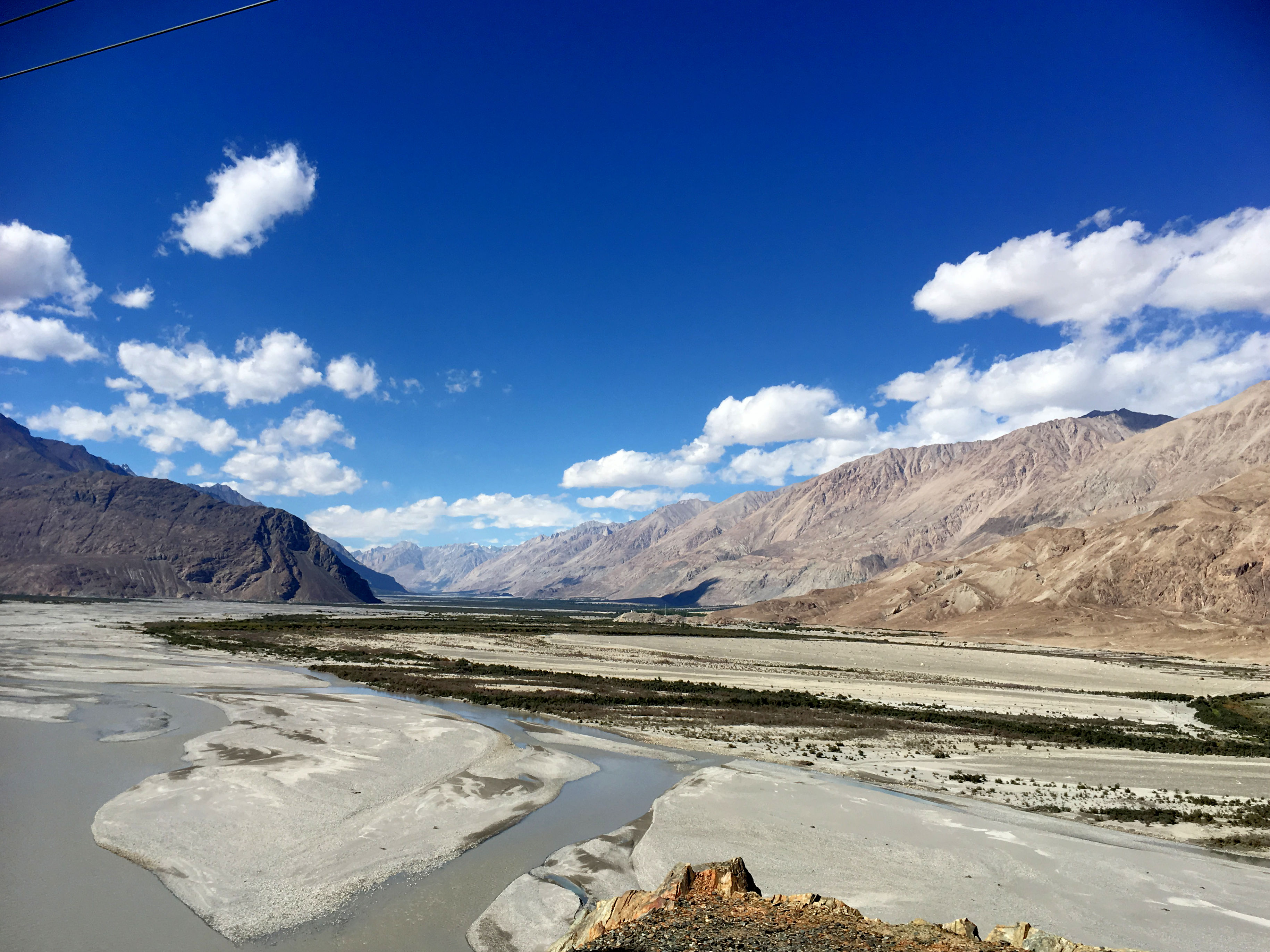
After climbing down Khardung La, we climbed back up the Shyok valley and drove by the side of Shyok river. The Shyok river is known for its floods, and the name Shyok or Dariya e Shyok is named as “river of death”. Sheo means death in a Turkic dialect. As we climbed, we saw the floodplains of the river and stopped at a place to have a good look.
The Shyok river originates from the Rimo glacier, which is one of the tongues of the Siachen Glacier The Shyok ultimately flows its waters into the Indus river.
The colour of the water was muddy in September, but we were told that it turns to turquoise in the winter months and is a sight to behold.
Floodplains of Shyok and the Nubra valley.
A little ahead the Shyok river meets the Nubra or Siachen river to form a large valley that separates the Ladakh and Karakoram ranges. Along with the river, we too left the Ladakh range and entered the Nubra Valley.
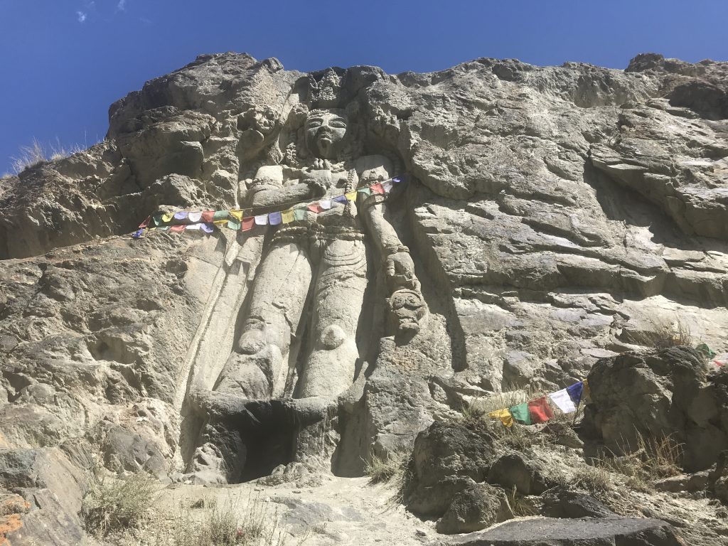
As we approached the Diskit town Monastery, our next stop, we saw a huge golden coloured 33-meter symbol of peace, a Maitreya Buddha facing towards (We were told) Pakistan. The construction of this statue was started in April 2006, and it was consecrated by His Highness the Dalai Lama on the 25th of July 2010. The statue was built to spread the message of world peace and specifically for the prevention of any further war with Pakistan.
Ladakh region has always borne the brunt of wars. And peace is, therefore, everyone’s mantra, and rightly so.
The huge Golden Buddha statue Facing Westwards towards PakistanDiskit The Golden Buddha
We were kind of hungry by now. While Himanshu and Sanjeev decided not to eat, the four of us dug into platefuls of noodles and fried rice at a cafe near the Diskit Monastery. As had become my habit, I asked the girl on the counter if they had an internet connection, and she readily gave me the wifi password. Next few minutes, as we ate, were spent on uploading the Khardung La photographs to our Instagram accounts.
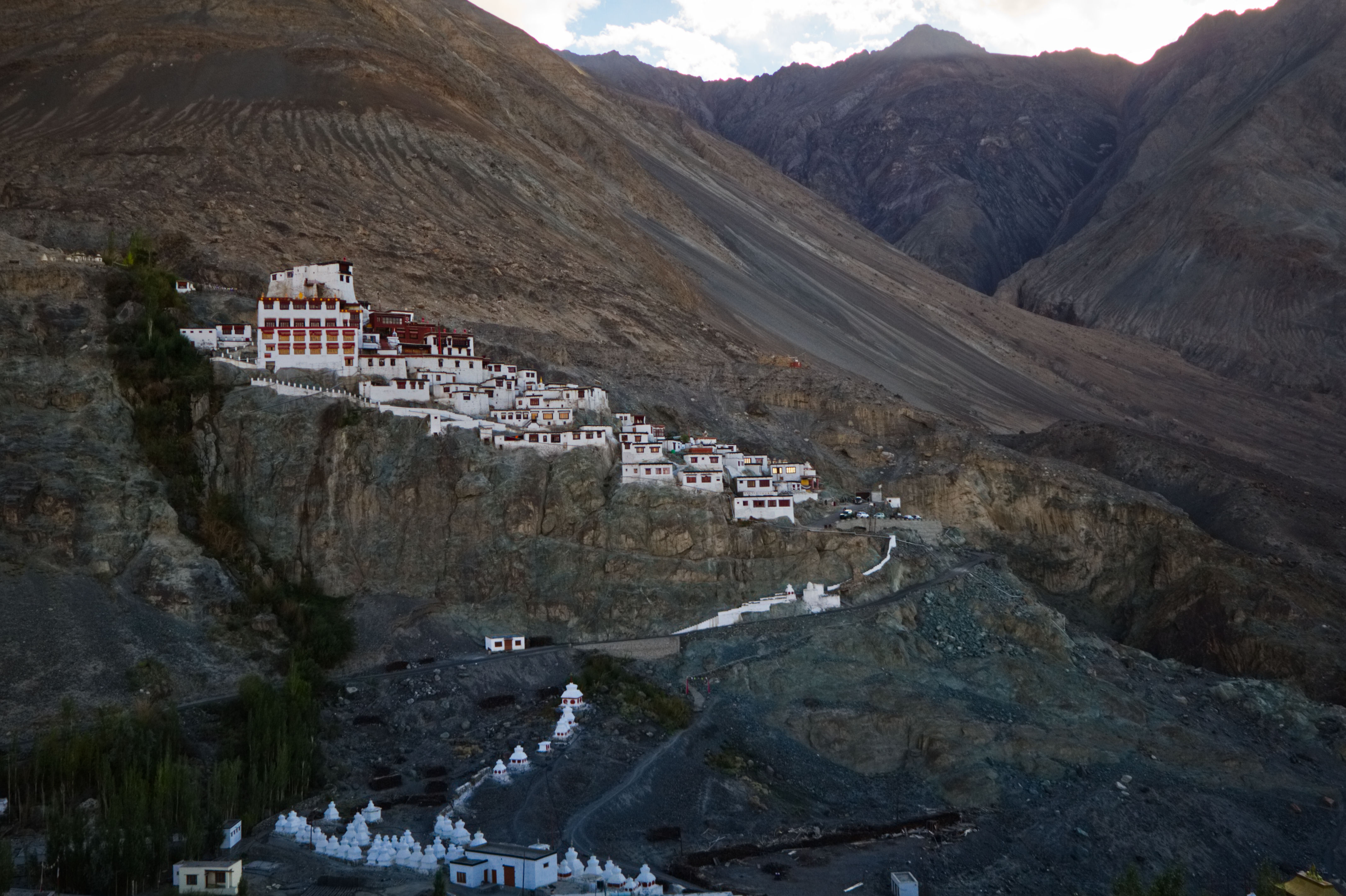
The Diskit Monastery or Diskit Gompa, founded in the 14th century, is the oldest and the largest monastery in the Nubra Valley. Built on a hill just above the floodplains of the Shyok river, at the end of the approach road, it is a striking structure and is visible from even a large distance.
The Nubra valley is at a lower elevation than the Ladakh range, it has a mild climate and has lush vegetation. It is therefore called the Orchard of Ladakh. The valley was a part of the caravan route between Tibet and China. The double-humped Bactrian Camel would travel the route and the ones left behind due to illness, or other reasons have flourished here.
Diskit Monastery
I was a bit tired after climbing the steep stairs and decided to rest in the verandah of the monastery when two kittens spotted me and were all over me.
One of the curious kitten
One of them even demanded that I scratched him and patted my hands whenever I stopped scratching him. I love cats, and I guess they love to reciprocate my affections as well.
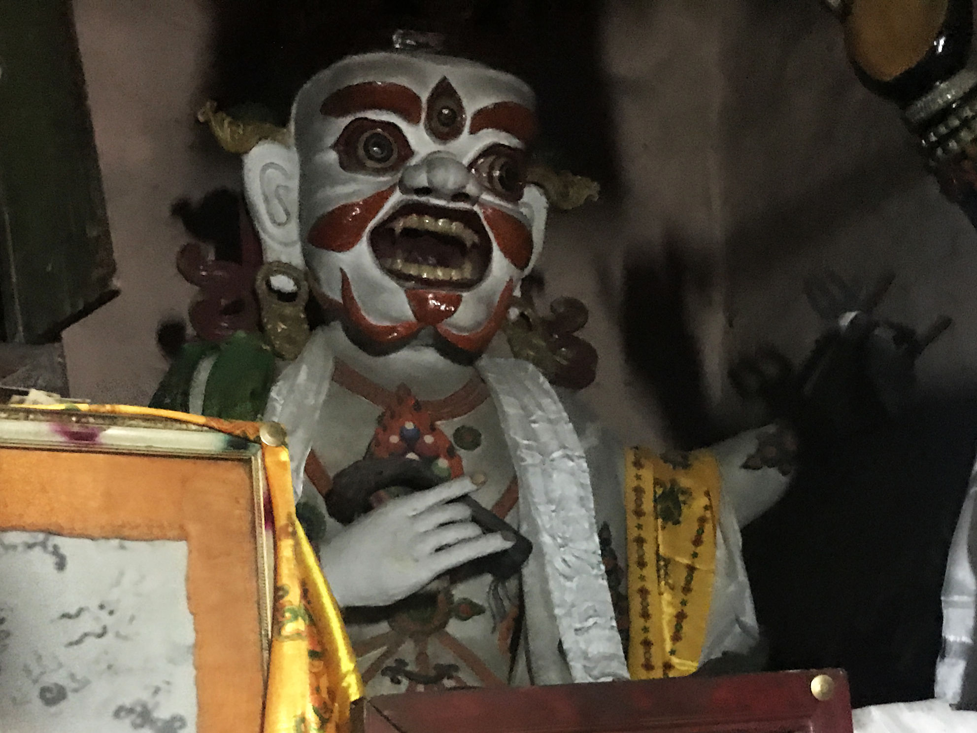
Happy with the interaction, I joined the others to visit the temples at the monastery. One interesting part of history the protector room of Diskit monastery has is the mortal remains of the hand and skull of a Mongolian warrior. The remains are shrivelled and real. Legend has it that the monastery is believed to be the place where an evil anti-Buddhist Mongol demon once lived and was killed near the monastery grounds but is said to have been resurrected several times, and the hand and head are of this evil demon.
Mongol Warrior
One more thing that I noticed is that the heads of several statues in the protector room (of all the monasteries we visited) are covered.
We spent a considerable amount of time here and clicked several pictures.
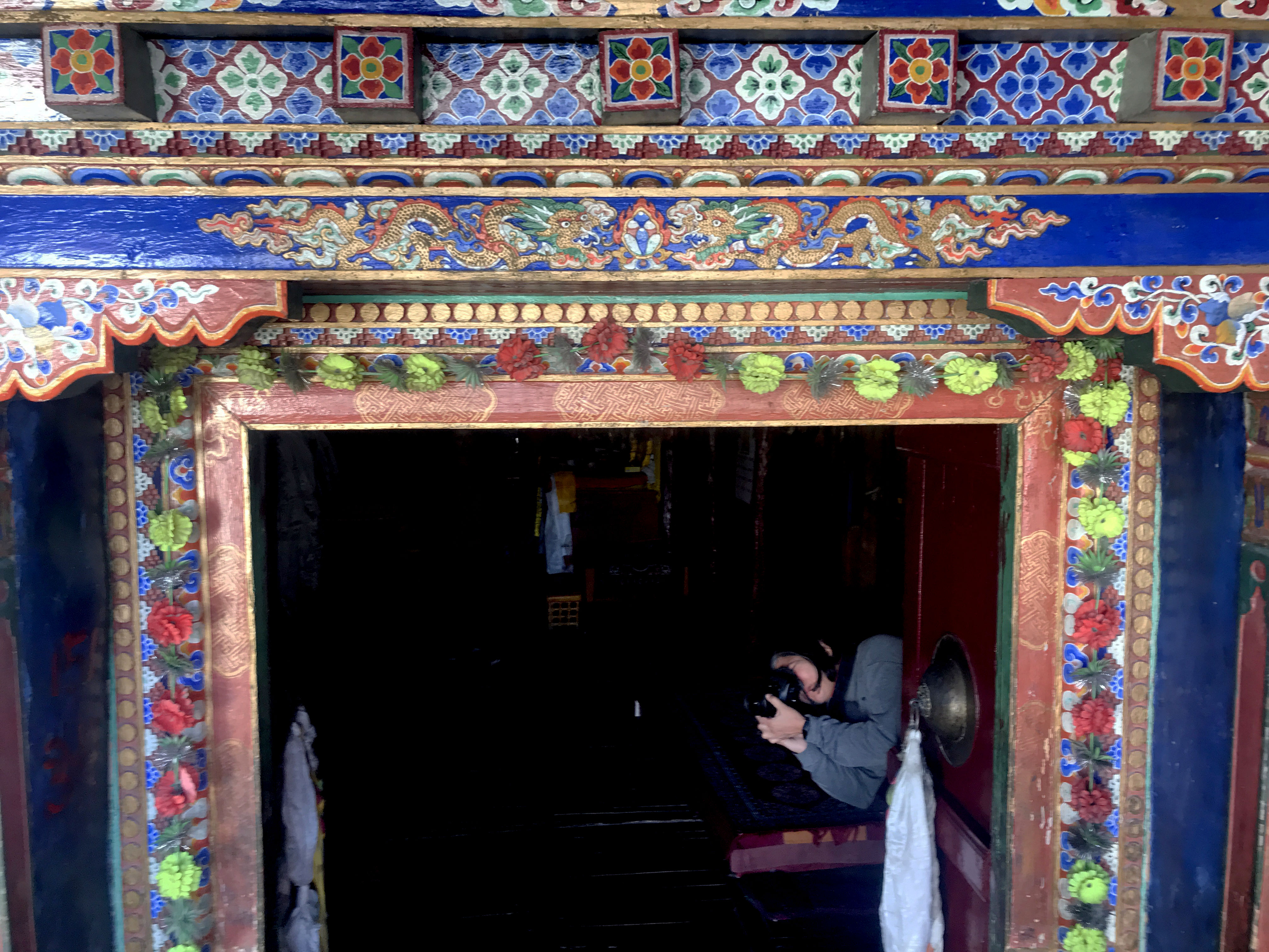
Door handlesDiskit Monastery – details of the doorMask at the Entrance
As we came out of the monastery, we noticed a very deep well. It was more of a freshwater spring, the path to which, was rickety and dangerous. It is said that the monks regularly used to go down this dangerous path (some monks still do) to get fresh water for the monastery. I could not go further than this point.
Diskit: Deep well with rickety stairs
Although the monasteries preserve the tradition, modern facilities and technology have reached here too. We saw a few monks using the latest cars and smartphones.
By this time the sun was about to set, and we decided to call it a day and proceed to Hunder which was about 15 km drive. It took us about 30 minutes to reach out campsite at the Desert Oasis camp. While some of us had lemon tea, Sanjeev and Himanshu had also picked up some beer and breezer and the day ended with Gup shup over drinks and pakodas. Post dinner we retired to our camps looking forward to an exciting morning the next day.
In the quiet of the night, we could hear a gurgling sound of water and slept peacefully to the sound of spring flowing somewhere behind our tents.
Ladakh. The name originates from “La-dvags” meaning the land of high passes. Ladakh connected India with Tibet, China and other central Asian countries via the “silk road” the parts of which still exist. I had so far seen only pictures of this amazing place and was always curious about this enigmatic place tucked away in faraway mountains.
When Himanshu announced the tour to Ladakh in June- July, aptly named, “Buddha Rocks tour” I was very disappointed that I won’t be able to visit this amazing place which was in my bucket list for very long.
Tarique insisted that I go, and I insisted that he come along, so a phone call and a while later, Himanshu suggested we all go there in early September. The weather would be good and the inflow of tourists will be far less than the peak summer months. Plans finalised, we booked the tickets and looked forward to the trip of a lifetime.
By last week August, I was checking the temperatures at various places that we were to visit, and I started making a list of clothes, woollen and medicines accordingly. I am a listophile and I get pretty listless without my lists 😀
On 7th September we were to leave for Delhi and our flight to Leh was on the 8th. Delhi is a place I love to go to because a lot of my dear friends from IIMC are in NCR and it makes me immensely happy to meet them.
The flight landed on time and we landed at Shilpa’s door. There was so much to talk, and so little time. Reema met us in the evening and we spent the time chatting and catching up with each other over dinner.
With Shilpa and Reema
8th September 2018: Leh and Alchi
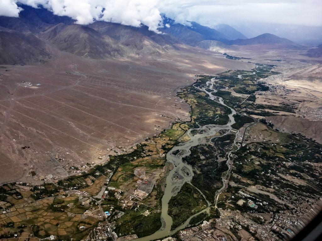
We arrived at the Delhi airport to catch a flight to Leh. Himanshu and Sanjeev joined us and we discovered that the Leh airport is temporarily shut due to bad weather at Leh. The weather, however, improved quickly and our flight departed on time. Despite having window seats, the snow-capped peaks of mighty Himalayas eluded us – they were engulfed in a thick blanket of clouds. However, as we approached Leh, the sky cleared up and the Leh town on the banks of a serpentine Indus river, and its tiny landing strip became visible.
Aerial view of Leh town
Trishu and Radhika had taken an earlier flight and were waiting for us with Iqbal Bhai at the Leh airport when we landed. Iqbal Bhai was our go-to person for everything throughout the duration of the tour. A superb guide, he has the knowledge of flora, fauna, history and culture of Ladakh and being with him made for a very enriching experience. During our 8 day stay, Iqbal Bhai drove us around through the length and breadth of Ladakh covering a distance of approximately 1200 km.
Leh is at an altitude of 3500 meters (11480 feet). For anyone travelling from the mainland, this altitude can mean a lot of trouble. To tackle the altitude sickness, I and Tarique both had started taking Diamox twice a day as soon as we arrived in Delhi. So except for a bit of light-headedness that lasted about 10 minutes, we did not face any issues. I, however, had to stop taking my diabetes medicine (Janumet- which has metformin) when I took Diamox as it was messing with my digestive system.
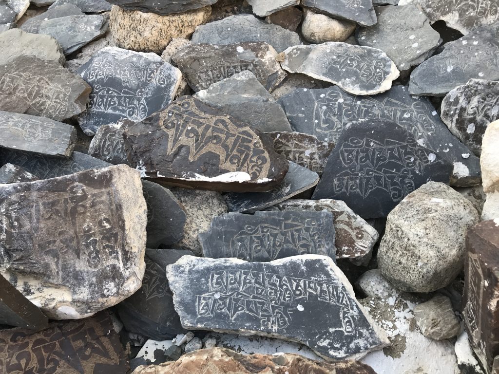
One of the first sights, as we hit the road, was that of the Chorten. These striking, stupa-like structures are built mostly near villages and monasteries, and they symbolise the Buddha, and the five elements of nature – Earth, Water, Fire, Air, and space. Most Chorten also have a Mane Wall along with them, this is a wall built by the followers and believers, and it is made of numerous etched stones kept in rows. It is mostly the six syllable prayer of peace and harmony, Om Mane Padme Hum that is etched on each of the stones that line the Mane wall.
Chortens
A Mane Wall- details
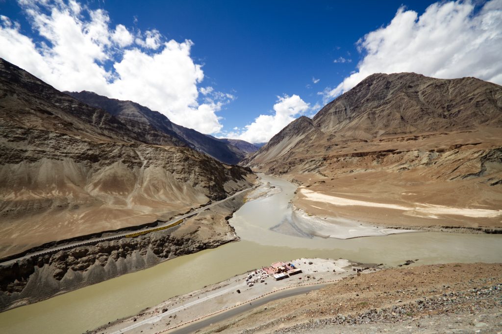
We drove to Alchi directly from the airport. Alchi is at a lower altitude of 3100 meters or approximately 10,000 feet and travelling to Alchi from Leh helped us cope with the altitude better. Enroute we stopped to see the Indus river. Sindhu, as it is called in Hindustani, gives our country its name. The confluence of Indus and Zanskar rivers was a sight to behold.
The Indus Zanskar Confluence near the Leh town
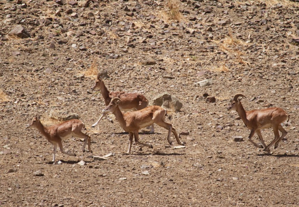
Looking forward to an exciting vacation, we jumped back in the cars only to get down a bit later as Iqbal Bhai spotted a herd of Urials. Urials (Ovis orientalis), or Shapo are wild sheep of Ladakh region and are found in Western Central Asia. It was the start of mating season for them and the male of the species were putting up an amazing display.
Urials
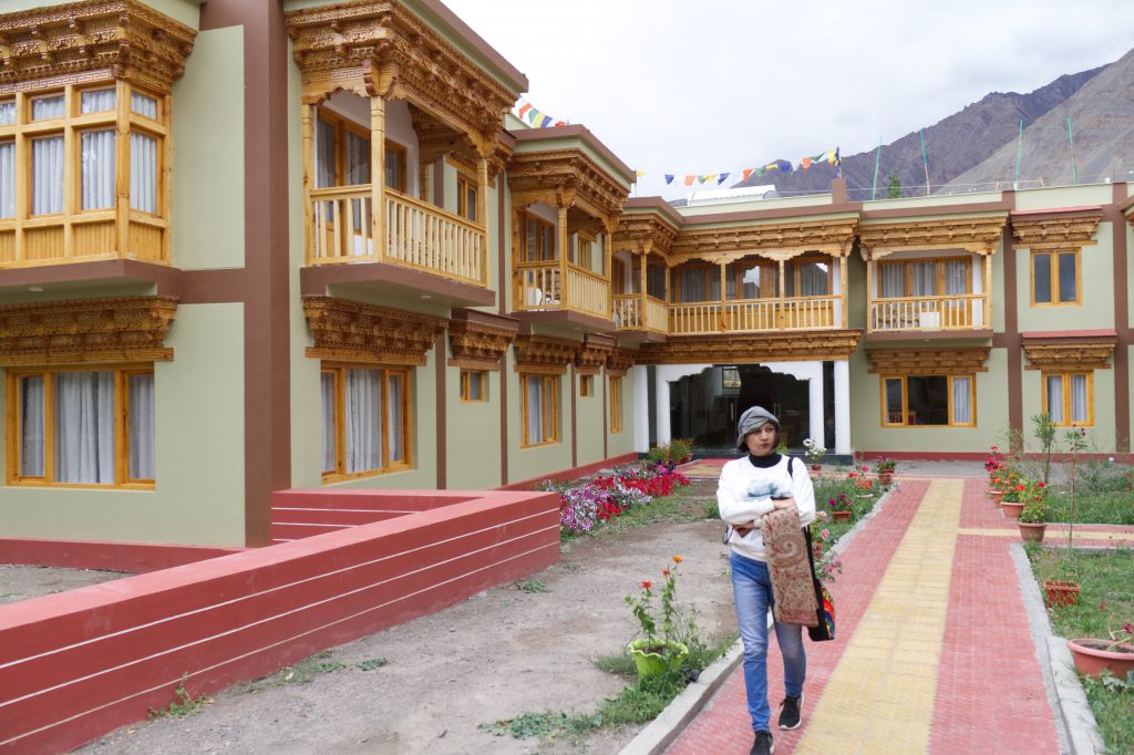
We arrived at Alchi a little after lunchtime, we had already eaten a sumptuous meal of momos and Thukpa en route, we reached our destination. After checking in at the Zimskhang holiday home, at Alchi, we were ready to explore the small monastery town.
Zimskhang holiday home, Alchi
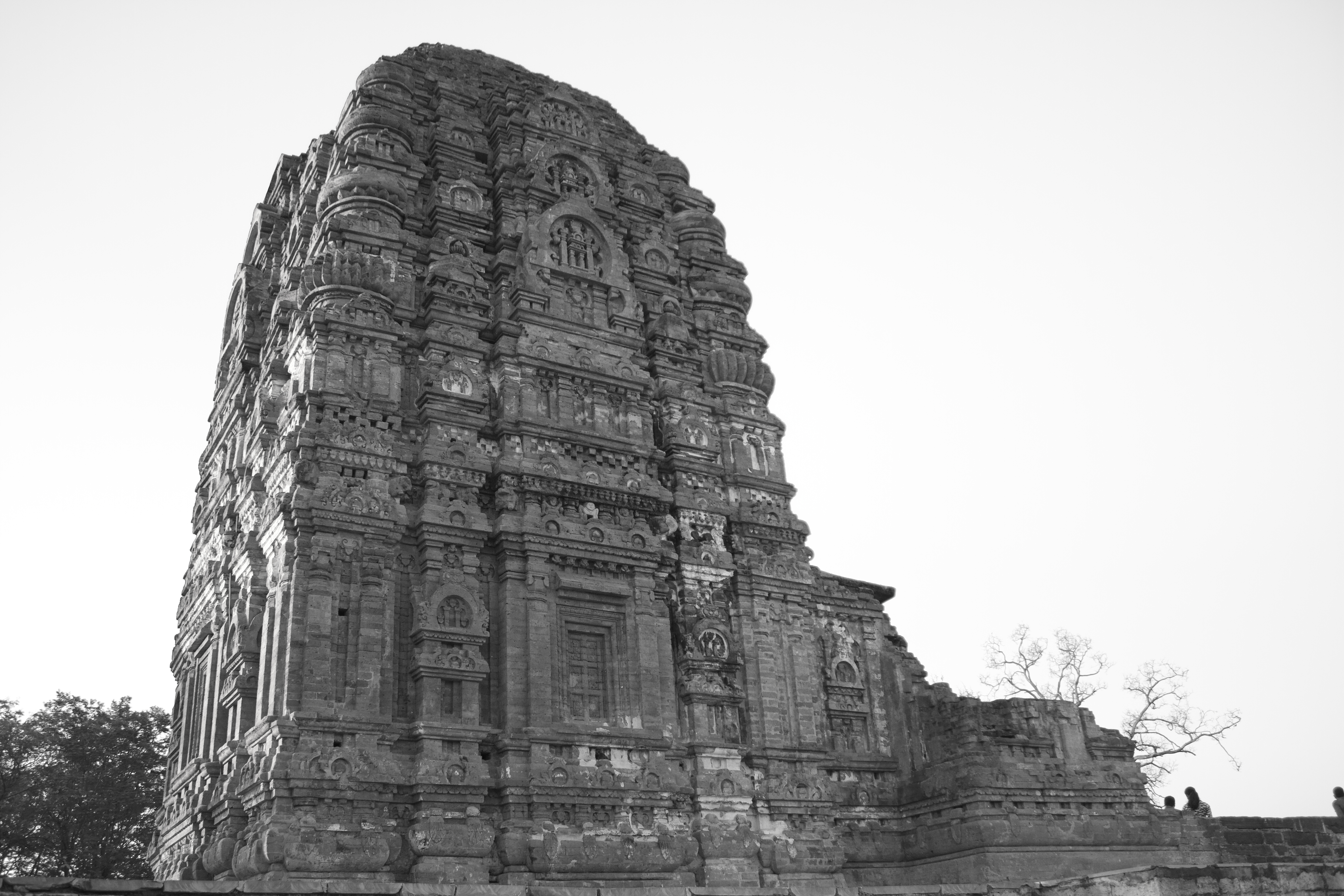
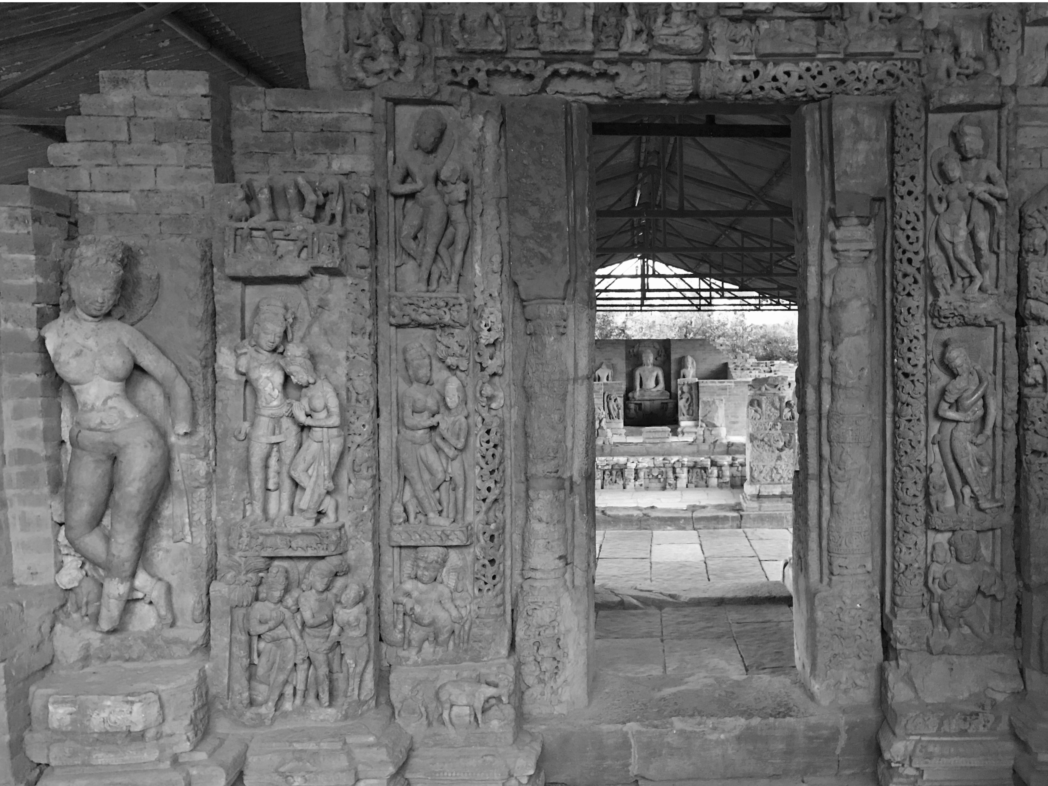
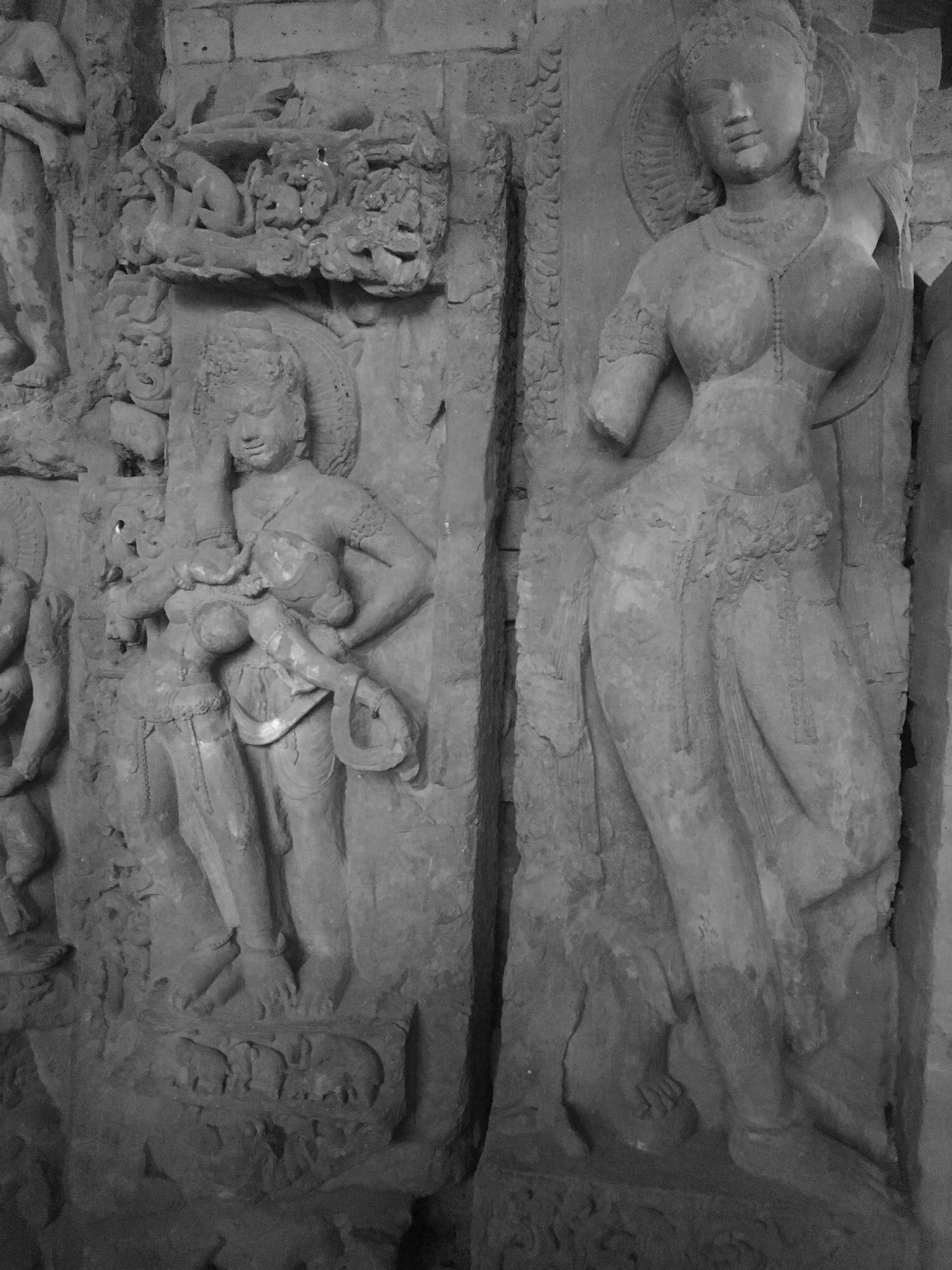
Alchi is a historical place and has one of the oldest Buddhist monasteries. It is actually a Chos-‘khor, a place where monks are taught the ways of Buddhism. The Alchi Gompa comes under the Gelugpa order from Likir which looks after the monks and the upkeep of the monastery.
The Alchi Gompa is often called as Ajanta of Ladakh, because of the fine artmanship display on its walls. The paintings on the walls are regarded as one of the oldest and most extensive in the entire region.
The mud sculptures in the monastery are also unique to the region. It is said that the Alchi Gompa is was built between 958 and 1055 AD by the great Guru Rinchen Zangpo who translated the Sanskrit Buddhist texts into Tibetian The artistic and spiritual details of both Buddhism and the Hindu kings of that time in Kashmir and Himachal Pradesh are reflected in the wall paintings in the monastery. These are some of the oldest surviving paintings in Ladakh. The complex also has huge statues of the Buddha and elaborate wood carvings and artwork comparable to the baroque style.
One of the striking features of this monastery is the fact that it is not on a hill like other monasteries of the region, but is on a flat land, next to the river Indus.
ASI has declared this a protected monument and photography inside the monastery is not allowed.
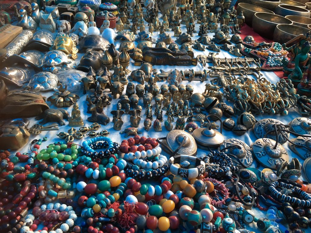
A visit to this monastery is incomplete without first stopping for a cup of tea and some butter cookies at the German bakery opposite the monastery complex and a look at the trinket shops that line the path to the monastery.
A trinket shop near the Alchi Gompa
It was soon dark and all of us decided to take a pre-dinner walk. It would have been impossible to do all this on the first day of arrival had we stayed back at Leh. However, coming to a lower altitude place, not only gave us a chance to utilize the day but also helped us cope better with altitude change. The dinner was sumptuous and all of us ended up overeating. We eagerly went to our rooms and hit the sack.
9th September: Domkhar – Mulbekh and Kargil
While the others slept, I and Tarique, being early risers, decided to take a walk alongside the Indus river before we departed for Kargil.
The view was breathtaking, the sunrise was spectacular with the reflection of the deep blue sky of in the river. We also saw some snow on the mountain tops of Alchi, and on being told about it, Himanshu mentioned that he had never seen snow near Alchi so early in the season.
On the banks of the river Indus at Alchi . Some snow is visible on the distant peak.
Post breakfast we departed for Kargil. The route was planned via the Domkhar Rock Art Sanctuary.
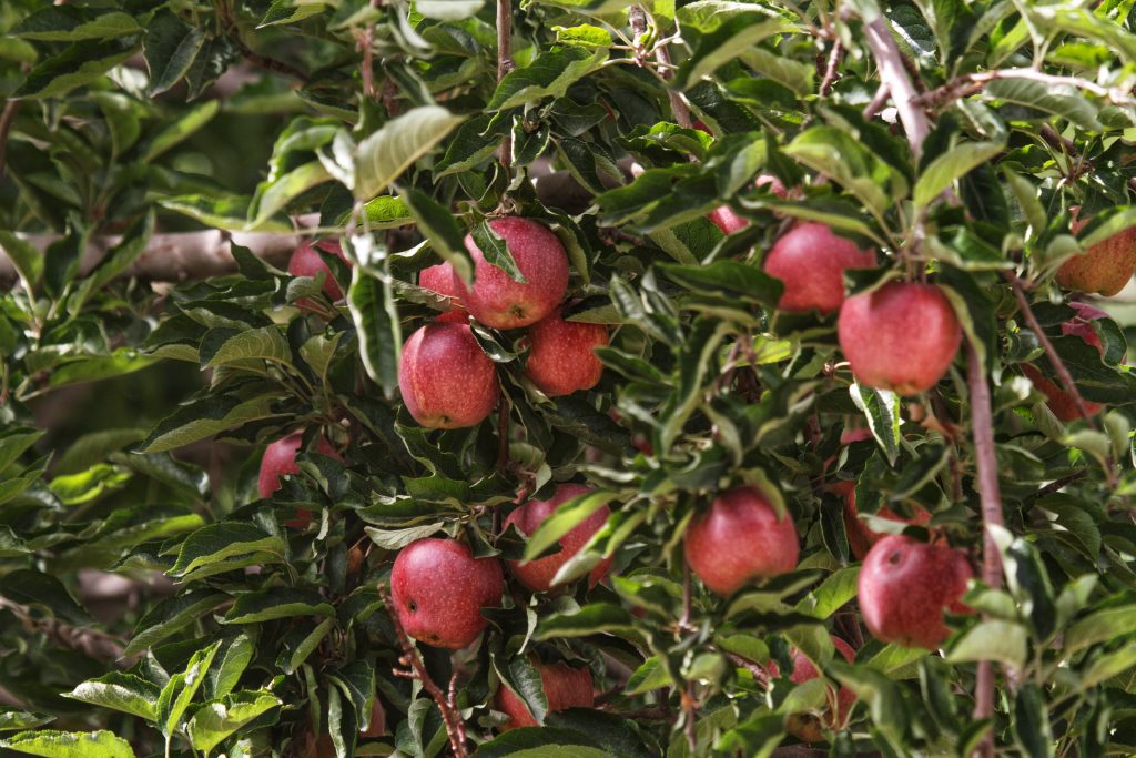
Enroute we stopped to buy fresh fruits and almonds. And saw that absolutely fresh Apples and Apricots were sold by the roadside.
Apple trees by the roadside
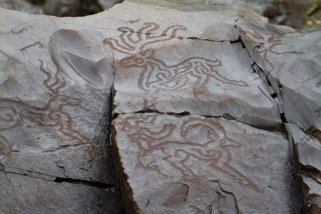
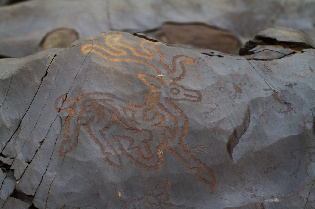
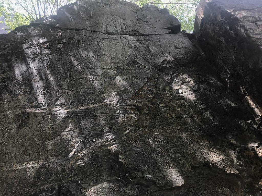
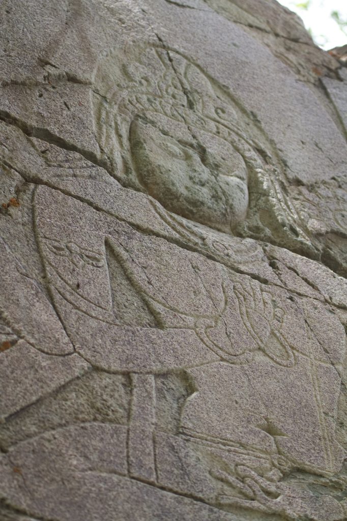
For many centuries traders, travellers, hunters and pilgrims have crossed Ladakh and have left their mark on the rocks of the region in the form of Petroglyphs. These pre-historic art forms are found all across the region, and one such site we visited was on a private property on the banks of Indus in the sleepy little village called Domkhar.
The rock art of Domkhar is on black rocks and is assumed to be 2000-4000 year old. These petroglyphs depict various images of animals, hunting scenes, figurines, calligraphy and symbols.
Petroglyphs of Domkhar
It was a fantastic locale for a photo shoot, and when one travels with like-minded people who are also photographers, an opportunity like this can never be missed.
RadhikaTrishuIqbal BhaiHimanshuSanjeevTarique and I
People of Domkhar grow apricots, apples and numerous vegetables. This is also known as the Apricot region and the apricots here were extremely juicy and sweet.
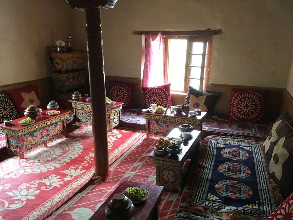
We were invited to the home of the owner of the private land where the Domkhar Rock Art Sanctuary stands and were treated to some snacks and delicious tea.
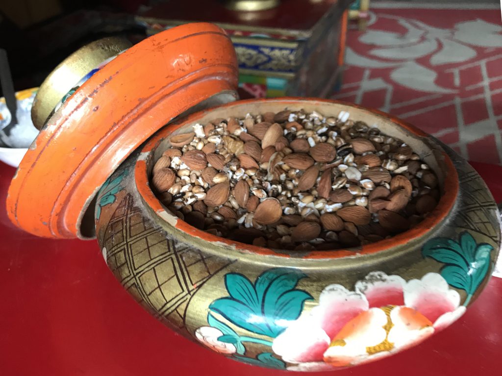
The guest room at Domkhar rock art sanctuaryDried Apricots served to usAlmonds and other snacksThe Kitchen help at Domkhar who served us tea and snacks.
After a satisfying and gratifying break at Domkhar, we continued our journey on the Batalik Road along the Indus river. Batalik is the last Indian town and the river Indus enters Pakistan from here.
Enroute we passed some Aryan Villages (Hanuthang and Baima). It is believed that the settlers of these villages are of pure Aryan race. These people are indeed different. They have distinct features. Tall with green eyes, high cheekbones, fair skin, they claim to be the pure bloodline of the Aryans and settlers from the army of Alexander. Their attire is also different from the traditional Ladakhi attire and women sport fresh flowers in their headgear. Pity I could not take photographs of villages or the people there.
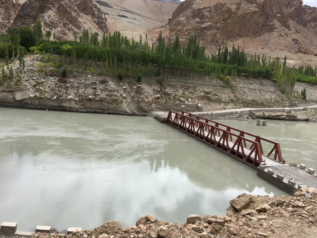
As we travelled I noticed the river getting wider and Himanshu told us that in 2017, a huge landslide left the road to Batalik unusable as it caused the water levels of Indus to rise very high, submerging a bridge and washing away the road leading to Batalik. The landslide destroyed several homes as Indus grew to dangerous levels. Since then a new road has been constructed at a higher altitude but the portions of the old submerged road can still be seen underwater. One can still see the river dangerously undercutting parts of the mountains posing danger to the road and nearby villages in the future.
An almost submerged bridge andThe submerged road
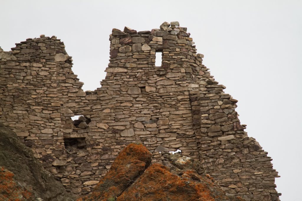
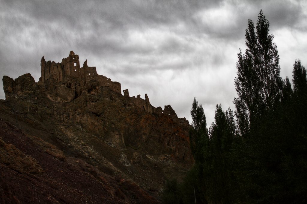
We left the Batalik road and took the Khangral-Sanjak road some 33 km short of the Batalik town and entered a small gorge (Chiktan Valley) that had a freshwater stream as a tributary of Indus. We had lunch on the streamside and continued our journey toward the ruins of the historical Chiktan Fort(or Chiktan Khar). Very sketchy details are available about this fort but it is said that the Fort is a 16th Century fort that was built by Balti craftsmen. Tahtah Khan, the Prince of Baltistan had run away after surviving a failed attempt to kill him. Legend has it that he took shelter in Chiktan and mesmerised by the beauty of the region decided to stay back. He constructed a palace here in the 8th century.
In the 16th century, some Balti Craftsmen built the now famous Chiktan fort as the royal residence of the rulers of the region. With glorious mountains as a backdrop, the fort was built with stone and mud and is said to have marvellous woodwork by the architect Shinkhen Chandan. The castle used timber to support the ceiling and had a revolving wooden room which used the power of winds to rotate the structure. It also is said that this fort was one of the masterpieces of Ladakh and Tibetian Architecture and was a symbol of unity, strength, brotherhood and community for the people of the region.
The castle was attacked several times but was not abandoned until the late 19th century. But now neglect and forces of nature have completely destroyed the woodwork and the castle is in advance stages of decay. Although this captivating fort is completely withered and is in utter ruins, with no signs remaining of the famous woodwork, the regal aura still remains.
The ruins of Chiktan FortA long shot of Chiktan Fort
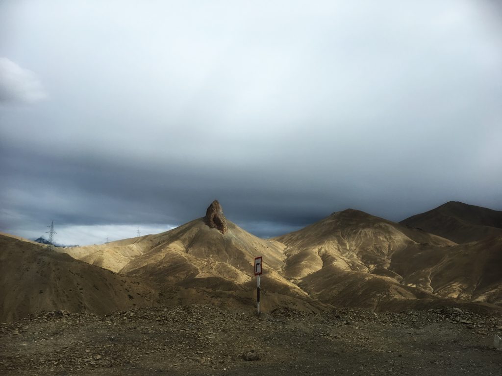
After taking a few photos of the fort from a nearby hill, we continued our travel and joined the National Highway NH1 at Khangral. NH 1 (Previously NH 1A) On NH 1, the Leh-Kargil main highway, we climbed up to 12300 feet to go through the Namik La pass – our first from this road trip. (The spelling of Namik is written incorrectly at several places as Namki.)
The rock at Namik La- the pass is named after this pillar-shaped rock
A glorious view of the mountains greeted us as the sun started setting. The Namik La is named so because of the mountain on which this pass is, looks like a pillar (which is Namik in the local Ladakhi language).
Another hour on the road and we reached Mulbekh to see the four-hand Buddha. This 28 feet Buddha statue, the tallest one in Ladakh, is also one of the most popular ones. Perhaps because of it being on the National Highway that connects Srinagar to Leh (Via Kargil).
While the statue stood on the roadside for a long time, a small monastery has now come up which completely encloses the statue. As per the information available there, it is said that the Buddha was carved here in the 1st century BC during the Kushan period. However, the studies point out that the carving is from the 7th Century. This Buddha statue has a stupa lodged in the hair which a common attribute found in the Maitreya Buddha.
In Ladakhi, the Maitreya Buddha is called Chamba. The Mulbekh buddha we saw had four hands; the lower left arm holds a water pot, or a kamandal, a constant in Indian and Kashmiri Buddhist iconography; the upper left arm has a flower; and the upper right arm, a rosary. Since it is believed that the Maitreya Buddha will be born in a Brahmin family, he also has a sacred thread across his chest. He is adorned with a pearl necklace, bangles and a belt. Also, on both sides of his legs, at the bottom, rows of devotees are carved, facing up to the Buddha.
As per a prophecy, the Maitreya, or Chamba or the Future Buddha is a bodhisattva who will appear on this earth in the future, he will achieve complete enlightenment and teach pure dharma. As per the scriptures, Maitreya will be a successor to the present Gautama Buddha. This prophecy refers to the arrival of Maitreya to a time in future when the dharma would be forgotten by most in this terrestrial world.
The Maitreya Buddha of MulbekhThe Buddha of Mulbekh – details of the carvings
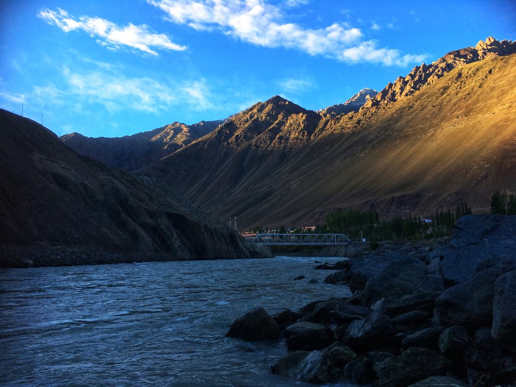
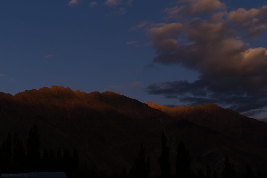
We arrived at the Kargil Tourist Camp, on the edge of Kargil town just in time to see a glorious sunset in the mountains.
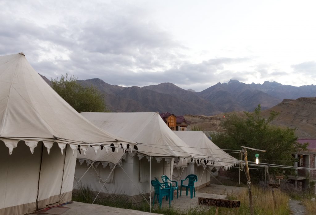
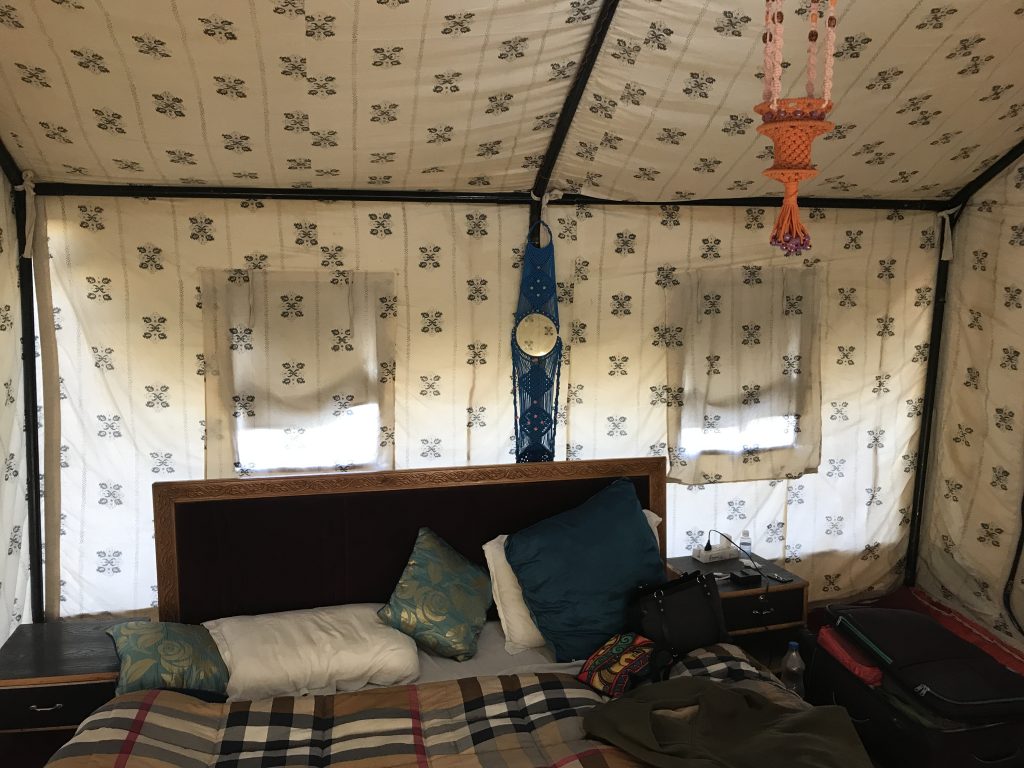
Kargil Tourist Camps- TentsKargil Tourist Camps- Tents from inside
While Sanjeev and Tarique busied themselves trying to take a time-lapse of sunset, I sipped the lemon tea and clicked some pictures. We took a quick dinner and retired early to capture the early rays of sun on the mountains.
Kargil Sunset
10th September: Kartse Khar, Nun Kun Peaks, LOC and Apati
First rays of sun hitting the mountain tops
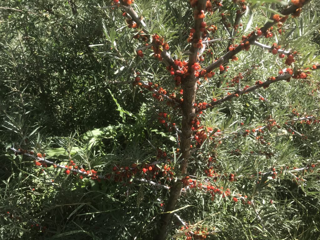
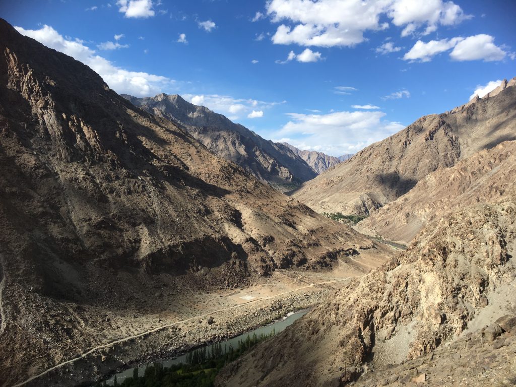
The sun rose in all its glory and the day started getting much warmer. We started early as there was much to do. After a long-ish drive, we stopped just before Sanku for the view of Suru Valley where we saw several thorny shrubs of Seabuckthorn (Hippophae rhamnoides) full with berries. Seabuckthorn grows wild in this region and some of us tasted the berry, which has a peculiar taste. The Seabuckthorn berry juice was marketed under the brand name of Leh berry, and is said to have health benefits. We were not too inclined to taste the juice. Although on second thoughts, I think, I should have tried it at least.
Rest of the drive was along the river Suru. The Suru river originates near Penzila, the gateway to Zanskar.
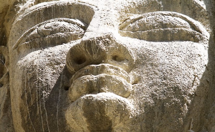
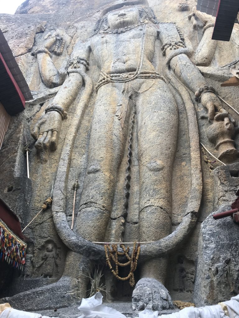
A bit later we crossed the Suru river and took the dirt road as we wanted to visit the village of Kartse Khar known for it’s giant Buddha carving. We parked our car in the outskirts of the village and started on foot along the small stream. After walking for about 800 meters, we encountered a huge Buddha carved in the early 7th century on the rock beside the stream. The statue is about 21 feet high. This is also the future Buddha or Maitreya Buddha. However, what differentiates this one from others is the crown and the body structure. The carving is very detailed, the crown has a triple sharp pointed diadem. Pearl bands hang beneath the crown. Two flying Gandharvas flank the head of the Buddha. A drape comes down from the crown and is twisted on the shoulders and arms. According to some experts, this style is derived from Pativ, a Persian emblem of the royalty adopted by the Kashmiri Buddhists. The lower garment of the Kartse Khar buddha resembles a dhoti.
The Buddha at Kartse Khar
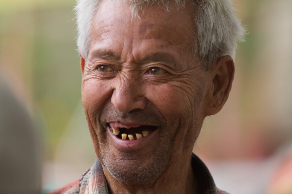
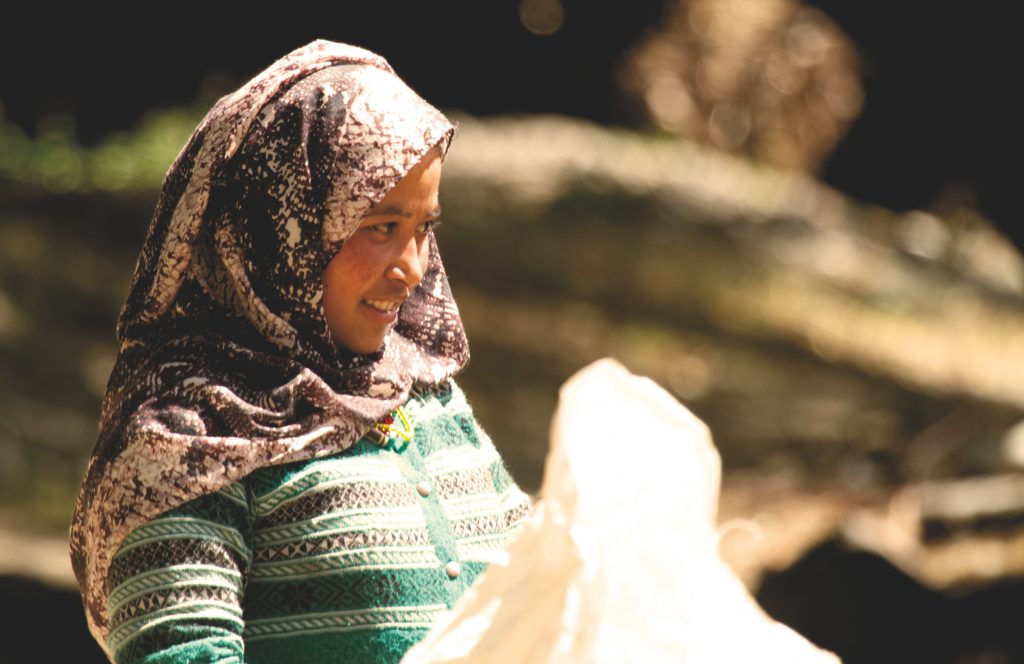
We took several photographs and while Himanshu and Sanjeev were shooting some videos, I chatted with the local women who were in the process of washing, drying and storing the grains for winter. Usually, the women are shy and refuse to be photographed, but I managed to click this beautiful girl-woman as she was less reserved than the others and readily posed.
A pretty woman of Kartse Khar village
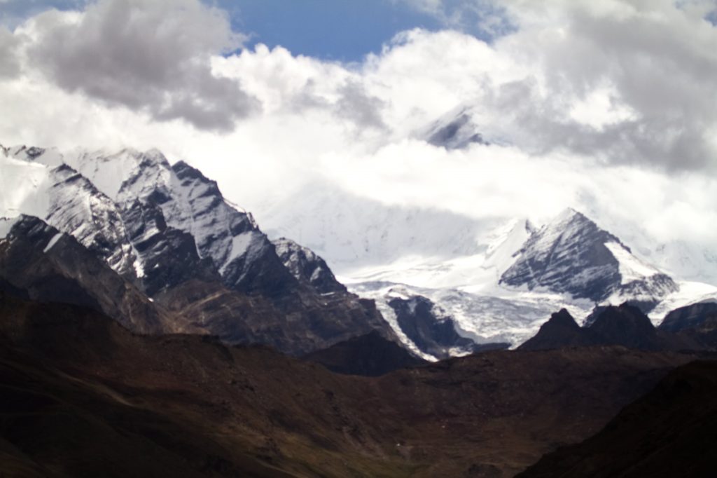
The morning was getting warmer, it was still just about 11 am so Himanshu decided to take a chance to drive about 15 km to the village Diasma on the Kargil-Zanskar road (also called as Kargil – Padum road) and show us the Nun-Kun peaks from the banks of Suru river. At 23000+ feet the Nun-Kun peaks are the highest peaks in the Ladakh range.
However, by the time we reached the banks of the Suru river, it was almost noon and the peaks were engulfed in the clouds and were barely visible. We did manage to get a few glimpses of the impressive peaks though.
Nun- Kun Peaks -Upper part of Kun, the black mountain is visible in this pictureWhile the lower portion can be seen in this one.
We were a bit disappointed because the view was not clear and the peaks were hidden beneath the clouds, but the view of the valley, the river, the passing clouds and the beautiful surroundings made us forget the disappointment. Trishu had by now learnt how to time-lapse pictures and was busy with Himanshu and Sanjeev taking photos, while Tarique, and I made ourselves busy by taking pictures of the beautiful surroundings and ourselves. I somehow don’t remember what Radhika was doing. Perpahs she was quietly standing there and watching us all go crazy.
Peace and serenity on the banks of Suru River.
By the time we finished taking photographs, we all were really hungry and we still had one stop to make before lunch.
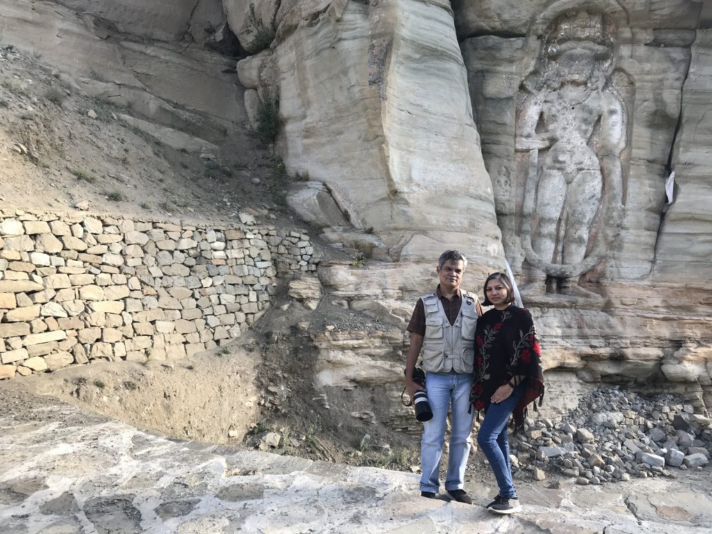
On the Kargil -Padum road, just a few kilometres before Sanku the Suru river takes an impressive turn. Here in the field by the side of road In the village of Skimertse, on a private property is a 13-14 century carving of Buddha that is unlike any other in the entire region. Etched in low relief, it is a representation of the feminine looking Avalokitesvara, flanked by Apsaras on either side. These are more stylised carvings and have elements that are not seen elsewhere. There is a depiction of a warhorse, some disciples, stupa, and an undecipherable script. The Avalokiteshvara has six arms but what they are holding is unclear, although it seems that one of the left arms holds a water pot. There is a stupa etched at the bottom of the slab, but that looks relatively recent as it has not weathered to the extent that the rest of the rock-relief has.
The Stone is lying next to the road, in someone’s field and it seems it got uncovered as a result of a rock fall. It is under no protection and perhaps very few know about it.
Buddha etched on a rock at SkimertseBuddha etched on a rock at Skimertse – Details
Next hurried stop was lunch at a roadside cafe and then we proceeded towards the village of Hundurmaan for the LOC view.
Every Indian is proud of the bravery of our armed forces, and the effort they take us to protect our country’s borders. It made our hearts soar when we saw the tri-colour fluttering in the winds at the LOC on the banks of Drass river, just before the village of Hundermaan.
It is also normal I guess, for any Indian to be curious as to how Pakistan looks. Although the terrain is same, the people similar and we originate from the same roots, or maybe it is the fact that we share the same legacy, a साँझी विरासत that makes us so curious. The dargah on the Pakistan side, the remnants of a village that was and the river bank that divides the two countries is what we could see there.
Photography at this point was not allowed, so we took some shots of the surroundings and continued our travails.
Near the LOC at HundurMaan – the mountains seen at a distance are in Pakistan
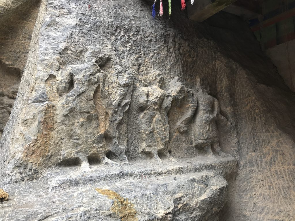
Next stop was Apati Buddha, approximately 15 km from Kargil, in the sleepy little village of Apati in the Sot Valley on the Kargil Batalik road.
This rock-carved Buddha is perhaps the oldest in Ladakh as it is said to be carved at the turn of the 6th Century, approximately the same time when Bamian Buddhas were carved. To reach the Apati Buddha, we carried our already tired bodies through the paved stairs of the traditional and sleepy village of Apati.
It is often said that to find the Buddha, you must take efforts, so we did and climbed innumerable flights of stairs and walked through the stone paved alleys of the village to reach this unexplored carving of Maitreya Buddha. The oldest of the bas-relief buddhas in Ladakh, this 16-foot tall statue is the least known of all.
Carved in limestone, the Buddha statue has a triple sharp pointed diadem, the body structure is masculine and very impressive. It seems there were colours and stones used, but one can only see the remnants of these now.
The 6th Century Apati BuddhaApati Buddha – a perspective of size
The villages located in the Sot Valley are solely dependent on the snow melts and there is no regular source of water here. Sot in the local language means death, pointing to the lack of water sources in the region. Interestingly, the local people here have a saying about Apati, that when three villages are destroyed by floods, then one Apati is settled. The people, especially children of the village were curious and friendly. some accompanied us right till the Buddha statue and stayed with us till we departed.
Children at a village near Apati
A long day for us ended at sunset and we drove back to the Kargil Tourist Camp for a quick bath and dinner.
This was an account of three days out of our 8 day adventure at Ladakh. More to come soon.
When we take active vacations together, we tend to push our limits, and we have more fun. We meet and connect with other adventure seekers, and at times make friends for life. Tarique and I have almost always taken active vacations (Yes, a wildlife safari counts as an active vacation)
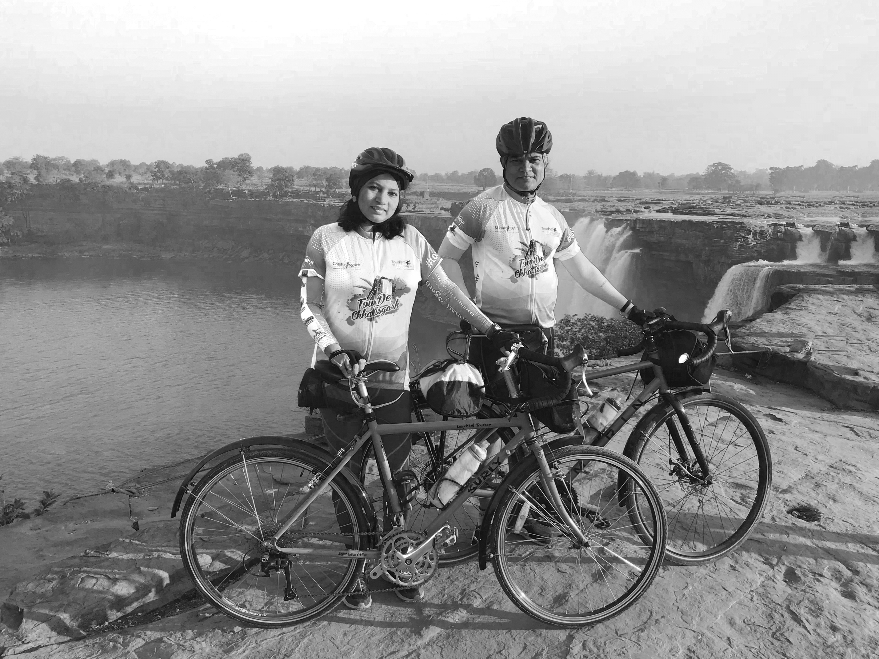
It had been long, and a holiday was long overdue. Cycle Safari announced a tour de Chhattisgarh from 26th to 30th January 2018, and even though I was not fit enough to cycle long distances; and Tarique was recovering from an injured knee, we decided to go for it for two reasons. Chhattisgarh was a place that had been on our list of “to visit” places for very long and this was a fully supported tour, we had a choice of cycling for a part of the distance and travel in the support vehicles. I also decided to take our DSLR along, and it was a wise decision.
Despite not being in a great physical shape I ended up cycling the entire distance of 82 km on the first day but cycling such a distance after almost a year’s gap sprained my left iliotibial band.
Took a day off to rest on day 2 and put my SLR to good use. The rest helped me recover, and I could cycle on day 3 and day 4. On an aside, just before we got on our bikes on day 3, I slipped and fell down injuring both my knees. But that was hardly a deterrent.
What we brought back were tons of beautiful memories and lots of photographs. After reaching home Tarique and I were browsing and processing the pictures taken during the trip on the iPad when I realised that black and white brought out the mood of the trip much better than colour pictures.
Tarique has written a more detailed journal entry, you can read it here.
So here’s the story of our cycling vacation through the beautiful state of Chhattisgarh in black and white pictures.
Click on the thumbnails of the pictures to view them in higher resolution.
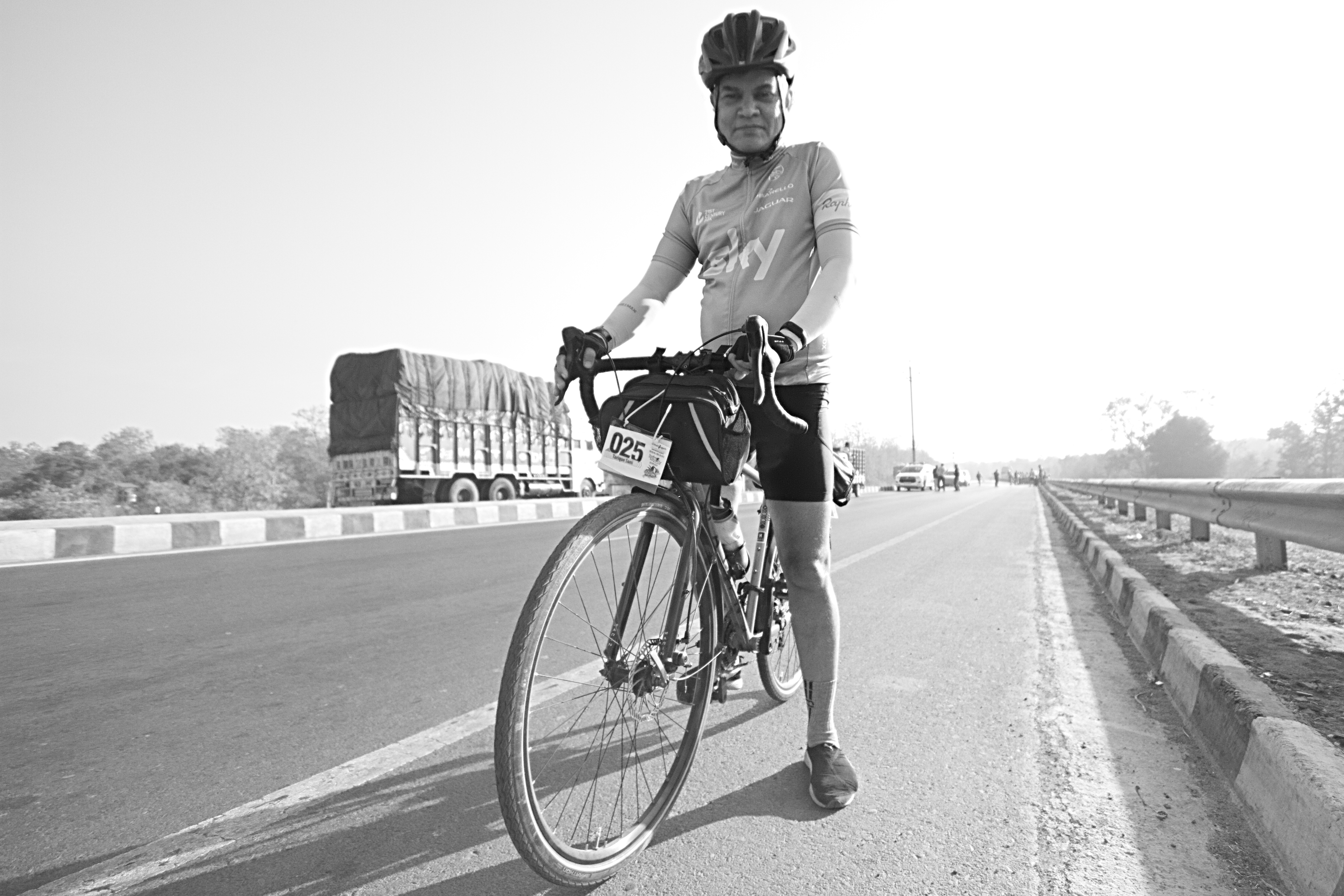
Ready to hit the road.
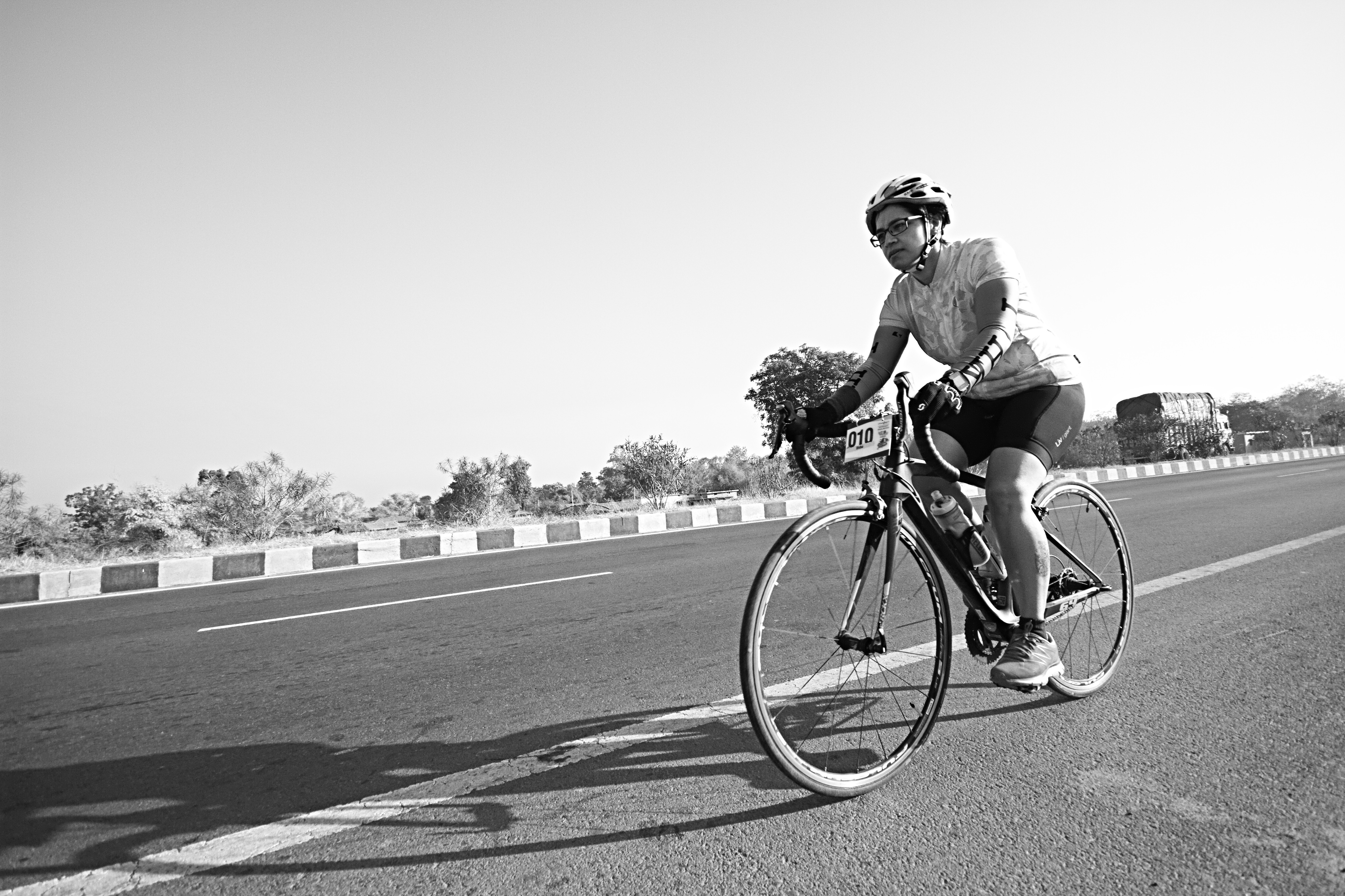
Riding through day 1
Lakshman Temple at Sirpur
Lakshman temple
Customary touristy picture I
Customary touristy picture 2
A 6th century artefact at the Lakshman temple.
Tweerdwo Buddhist monastery. An ancient centre for meditation, residential and study place of Buddha Bhikshus.
Stone carvings -details
Surang Tila, a 7th Century Shiva Temple
Alexi videographing his newly wed wife
Kids had a gala time on their bikes
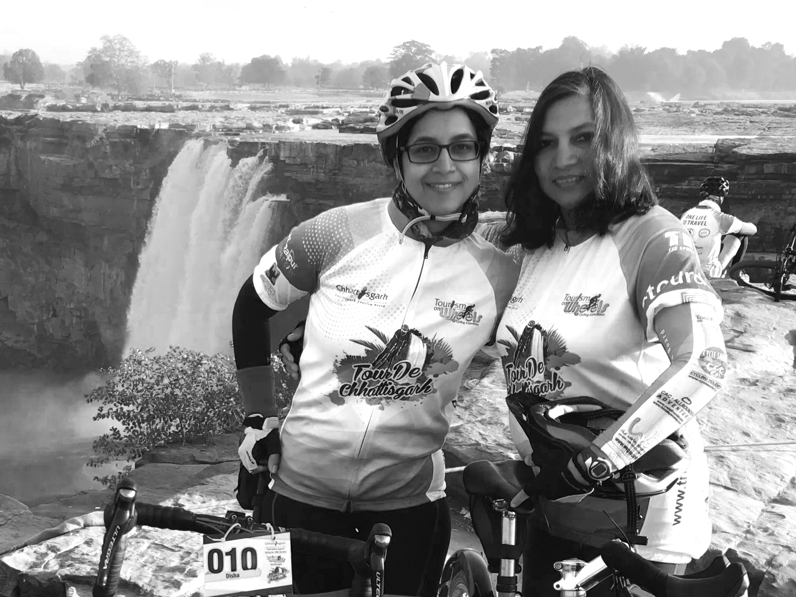
Under the watchful eye of a mother. Disha and her son, Siddhant.
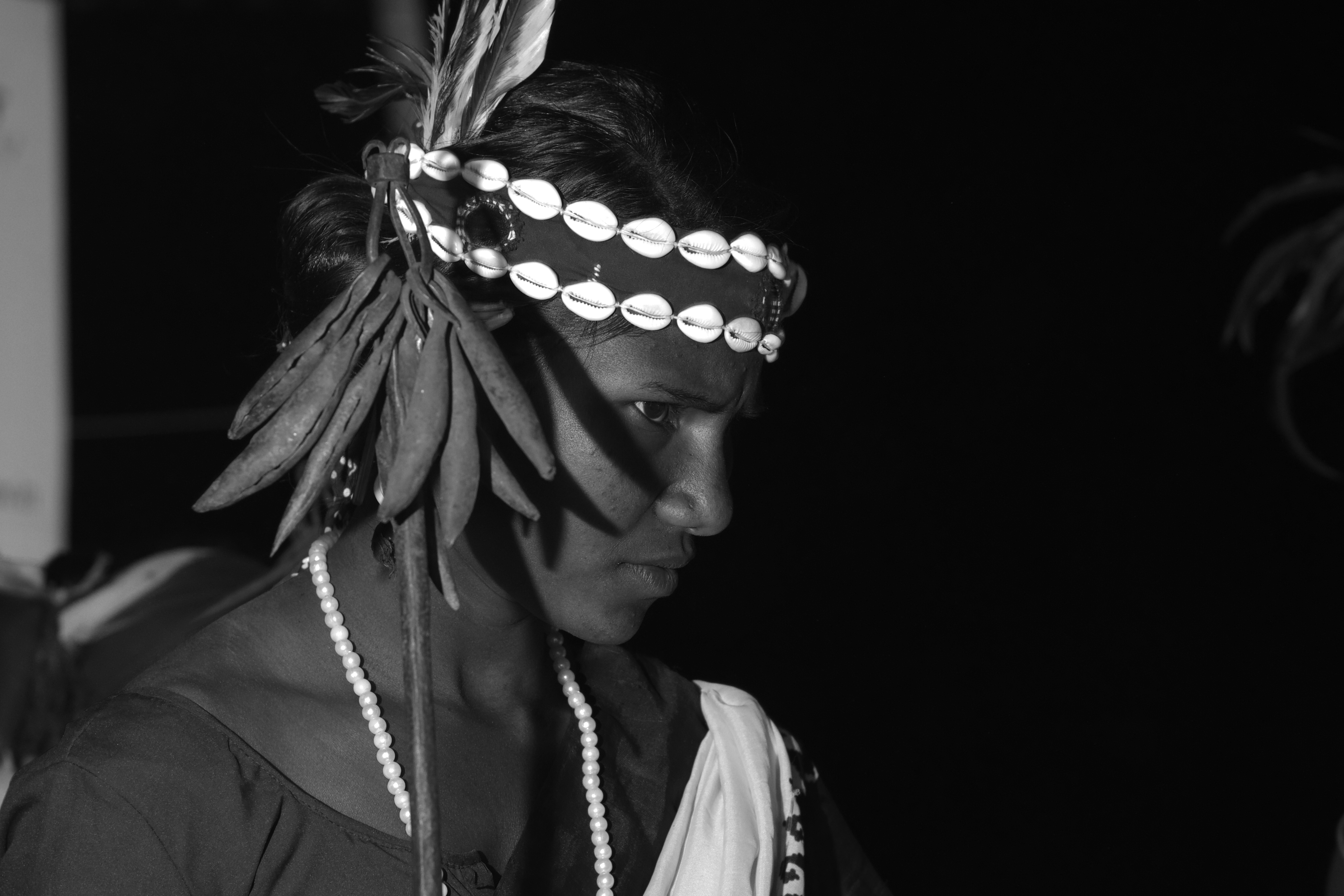
Some friendships just are!
The 10-20mm lens magic
Disha riding with full concentration
Ben and Stephanie on their fixies.
Namrata chasing a pup.
Always in a good mood, Anil Jaiswal.
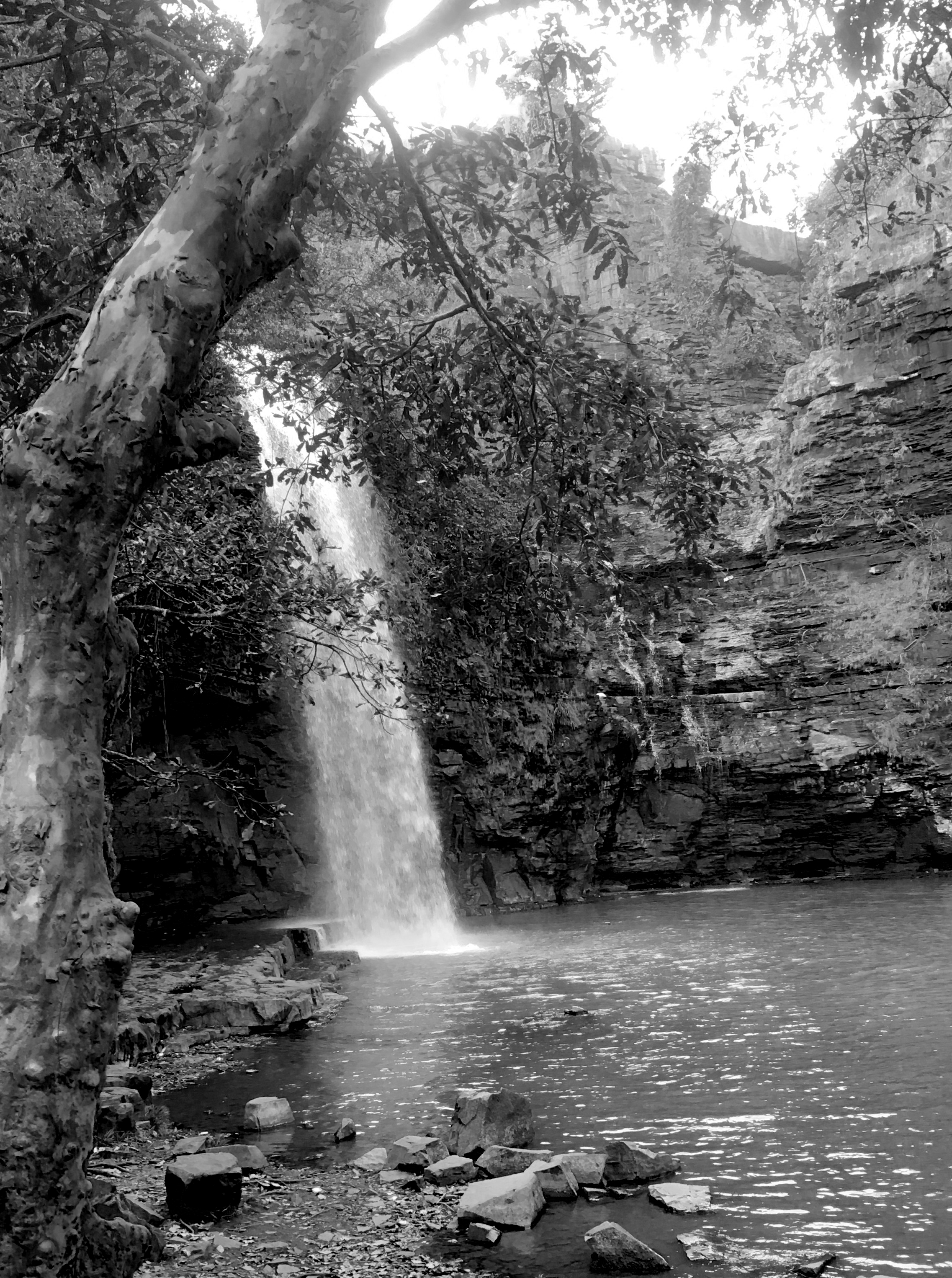
Chitrakote falls through the dense vegetation.
Capturing the serenity
All i need are two wheels that go everywhere i want to.
This was one vacation I was really looking forward to specially after the fiasco of plans to spend a weekend in Pench. 17 years of togetherness, friends and jungle – nothing beats the combination and we did have whale of a time. NH7 was a pleasure to drive and I averaged 60km and covered 180 km distance in 3 hours. That meant driving at 140km/hr for some distance but then the roads were clear and smooth and Innova lends itself wonderfully to highway driving.
We were at the park in peak summer and the heat was unbearable (mid day temperature was about 44° C) and there was very little water available -so most of the wild action was at concentrated around the water holes.
A tigress came to the water hole with four of her cubs to quench her thirst and cool herself down while down the same road another water saucer, made by the forest department saw a barking deer patiently waiting his turn to drink water while the bigger grazer, a Sambhar deer quenched his thirst.
In smaller puddles birds frolicked in territorial displays and fought with each other while the butterflies that were mud puddling became meals of the fly catchers. We saw one handsome orange headed thrush in an extremely bad mood shooing another one of his own species till a white-browed fan-tail fly catcher got better of him and claimed the place as his own territory.
Hierarchy : Barking deer waiting for his turn.
Not far away was another family of tigers, two adults, a male and a female with two cubs frolicking in mud and playing tag on the bund of a small water body.
We are resolved into the supreme air,
we are made one with what we touch and see,
with our heart’s blood each crimson sun is fair;
with our young lives each spring impassioned tree
flames into green, the wildest beasts that range
the moor our kinsmen are, all life is one, and all is change.
— Oscar Wilde
I could not have put into words more appropriately than this what I felt when we reached Gorukana on the winter morning after saying goodbye to FOSS.IN/2010. **Gorukana (pronounced goru-kana; meaning a web) is a community based tourism initiative which involves running a wildlife resort unlike any other. Nestled in the beautiful web of trees in the forest of BR Hills, south of Bangalore, karnataka; this picturesque forest refuge was conceived by Kalyan Varma and is very lovingly tended to by Shilpa Sequeira. Gorukana is run and managed by the local tribesmen, Soligas and the money raised through this initiative goes back to their own community. Continue reading Gorukana
After the morning game drive at Manyara national park, we proceeded towards the Serengeti National park which is about 200 kms and 4 hours of drive through the beautiful Ngorongoro caldera rim. Serengeti gets it’s name from the Masaii language word “seringitu” which means endless plains. The Serengeti plains are formed because of the volcanic ash strewn by the Ngorongoro volcano when it was active and are full of sulfurous salts, thus no dense forest here.
Early morning Serengeti scapeUmbrella acacia -trademark serengeti
Rajai (our driver and guide) told us that before the Government of Tanzania declared Serengeti as a national park, it was home to two tribes; the Masaii, Datoga and *Hazabe Bushman tribe who were constantly clashing with each other over land and cattle. After the formation of the park, Masaii were given rights to live near the Serengeti while the Hazabe settled near Lake Eyasi. The Hazabe bushmen are hunters and eat the meat of wild animals (sometime even raw meat). The only animal they don’t eat is a Hyena as it is considered unclean. The Bushmen and speak the “click language” by clicking their tongue, teeth and palate**. The Datogas make ornament by melting iron, they are also adept in making spears and other hunting instrument which they sell to the Hazabe bushman in exchange of meat or money. Today under government protection while the numbers of Masaii are increasing, and they are even being schooled; the Hazabe bushman and Datoga are uneducated, culturally backward and their numbers are fast shrinking perhaps also due to genetic defects because of inbreeding which is very common, often within families too.
Ngorongoro crater from the rim
The Oldupai plant
While Rajai was briefing us of the local Masaii culture, we couldn’t take eyes off the scenic beauty of the Ngorongoro Caldera rim which we had to cross to reach the Serengeti plains. The caldera rim at it’s highest was 2400 meters above sea level and the entirely covered with clouds. As we descended, we went by the 48 km long oldupai (also called as olduvai) gorge***. The fossiliferous gorge is named after the Olduvai plant, Sansevieria ehrenbergii, used by the Masaii as an antiseptic as a natural bandage and for stomach ailments. They also use it to make ropes, baskets, roofs and carpets. An Agave family plant, it is also a favourite food of Baboons, elephants, etc for it’s water content.
Our plane was about to descend and I caught my breath as I saw a peak, completely covered with snow rising above the clouds. It was Mount Kilimanjaro, the highest mountain in Africa. As we touched down and taxied we spotted a few Zebras grazing along the runway (we later learned it was a private farm) and several raptors. Our 9 day sojourn in the African wilderness had begun. The drive from Nairobi, Kenya to Namanga, Tanzania Border, and then to Arusha was bumpy as most of the roads were under construction but we were not complaining. The country side was green, cool and fresh; the deep blue skies, a welcome relief. We proceeded to Arusha, a sleepy Tanzanian town for lunch and from there straight to the Manyara National park for a game drive.
Giraffe with calf
Nairobi to Manyara National park is a 7 hour drive, we reached in time to the park gate for a short safari. Part of the Manyara lake is still outside the national park area and is used by the locals for fishing specially by the residents of the village Mto wa Mbu.. Mto wa Mbu means Mosquito river and the village is named after the river by the same name that flows near the entrance of Manyara National Park. Baboons and other bolder animals regularly stray into the village for food (specially Bananas) and water. Continue reading about Manyara. Has more photos.
On 23rd May, 2010 I and Tarique were booked business class to fly from Nairobi to Mumbai. We took our boarding passes, and went to the lounge. The lounge itself was cramped and stuffy, but we endured. Around 4 PM we went out to check out the duty free shops and we heard boarding announcement for our 5.45 PM flight. We returned and found out that the announcement in the lounge was completely different. The receptionist told us that our flight KQ 202 to mumbai has been delayed by an hour. We relaxed, thinking there is still time for boarding. She said that the boarding announcement for business class passengers would be made around 6 PM and we can relax till then. After an 8 hour drive from Ngorongoro to Nairobi on terrible roads, we were really looking forward to a relaxed flight back home.
At 5.45 PM the receptionist called me and Tarique and told us that we have been downgraded to economy class as two pilots have been allotted our seats. When we protested we were told to meet the duty manager at the boarding gate. The duty manager told us a different story. She said that yes, the pilots are there but we are not being downgraded because of the pilots but because the seats allotted to us were not serviceable and they did not know about it. I raised my voice and asked for a senior person from Kenya airways. While I was talking to the duty manger, Tarique heard the other person on the desk giving order to offload our baggage. All this, while Aasim who held a valid business class ticket was already boarded and was waiting for us.
He frantically told the person not to offload the baggage and that our son is already in the craft. The duty manager coolly looks at us and says you only have one choice if you want to travel today – go economy class, there wont be any refund, and got us to sign some paper which according to her will allow us a free business class upgrade on our next KQ flight. All this was happening while the craft was already preparing to take off without us. Given a situation with no choice, we ensured that out baggage is loaded back and boarded the plane On our way we found out that all the seats of the business class were fully functional and occupied. The duty manager had lied to us about them being not serviceable. Feeling cheated we proceeded to our seats.
An hour after take off, dinner was being served. When the hostess reached us, I asked for a chicken meal, only to be told that it is finished and if I need to eat I will have to make do with rice. The hot meal had nothing else but rice served along side a croissant and some salad. Needless to say it was totally inedible, but eat I did as my sugar levels were going low and I needed to eat something before I got completely hypoglycemic. Asking for water after I finished eating was another nasty experience. The hostess told me that she was occupied with serving coffee and water will come when it will. I saw her 2 minutes later standing on the aisle talking to another hostess. She stayed there laughing and talking for 10 minutes before I got off my seat went to her and asked for water again to which she pointed towards the serving area and said very rudely “go take it from there”. Kenya Airways treats it’s passengers very shabbily. Makes our own Indian Airlines/Air India look much better in front of them.
Unfortunately for traveling non stop to Nairobi from Mumbai there is no option but this horrid airline. I am already dreading my next flight with them.
Very close to Banni grasslands is a place called Naliya, also called as Kutch Bustard Sanctuary, one of the very few places in India where the Great Indian Bustard is still found. While we did not get lucky to spot the GIB, the beautiful black partridge numerous raptors satiated our birdwatching appetite. After scouring the Naliya grasslands, we drove further west to a beautiful coastal town of Mandvi.
Traditional Ship Building Center, Mandavi
This 16th century town was once a summer retreat for the Maharaja’s of Kutch. The old city was inside the fort the ruins of which can still be seen. The city also houses a 400 year old traditional ship building center. It is said that the ships, built completely of wood would sail to far off lands and were much in demand. The center still makes ship the traditional way.
Spot billed duck
We passed the town of Mandvi stopping only for lunch as our destination was the Motwa beach, south of Mandvi where we were going to see and photograph coastal birds. Motwa is a fishermen village and the beach is untouched by tourists and thus has a loads of birds. By the time we reached the beach the fisher folks were returning home, sun was setting in the ocean limiting the photography opportunities. We too decided to take a long drive back armed with loads of memories and some stunning photographs.Continue reading Coastal Kutch : Naliya Mandvi and Motwa