11th September
The day started early as we were driving back from Kargil to Leh and were scheduled to stop in between to see the Lamayuru Monastery and the Moon landscape / Moonscape.
We were in high spirits, admiring the shape, textures and lovely pastel colours of the mountains. Shades of brown, gold and at times purple all around us.

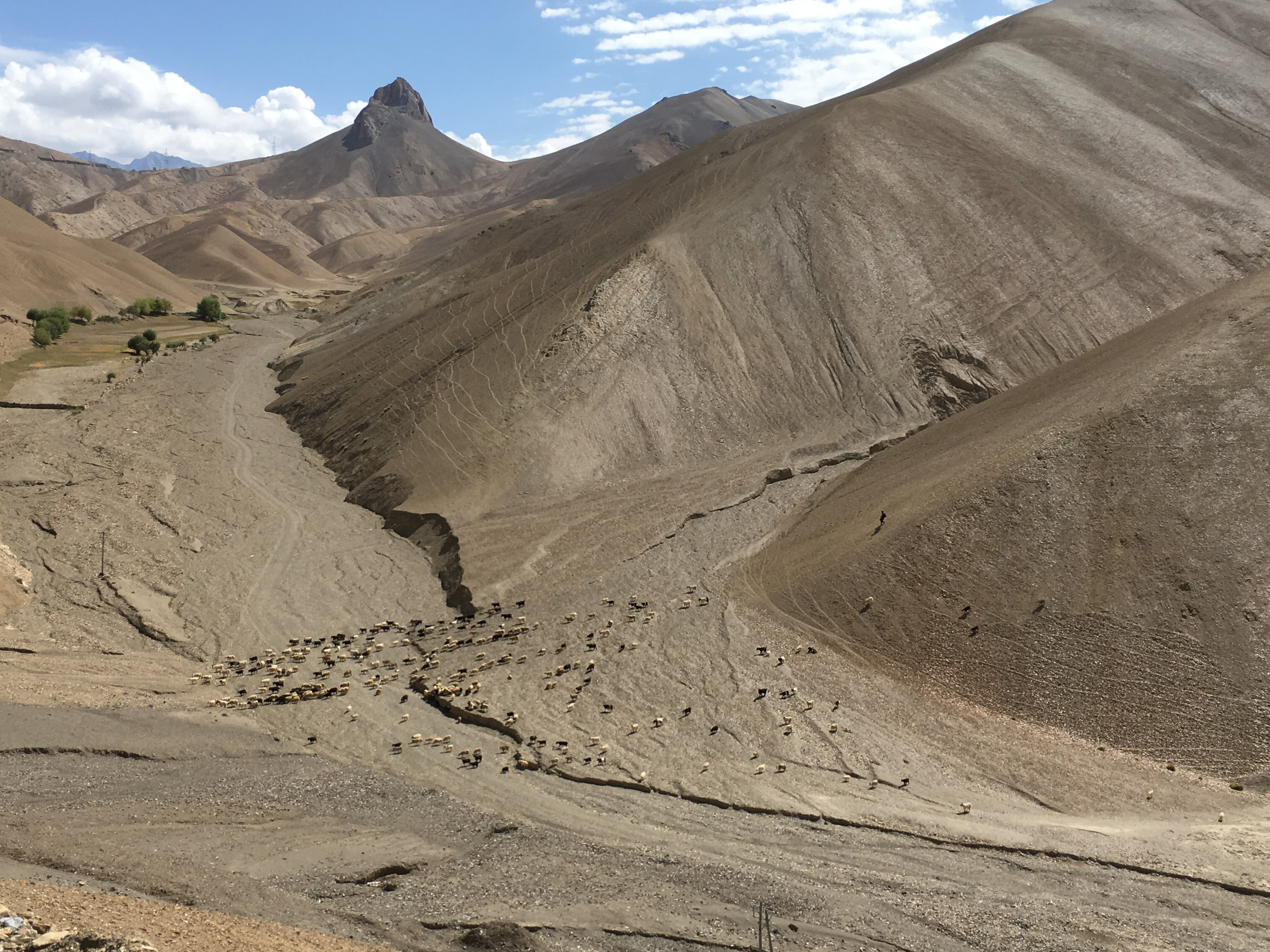
We must have been on the road for an hour or so when we spotted a shepherd with his flock of sheep in high mountains. Sensing a photo opportunity, all of us made Iqbal Bhai stop the car and jumped out.

Happy with the results, we got back into the car. We had to cross two high passes on this road to reach Leh. The first one was familiar, Namik La, which we had crossed two days back to reach Kargil; and the second was Fotu La (Also called as Fatu La)
Fotu La is slightly higher pass than Namik La at 13479 feet. Towards the east of Fotu La, at a distance of about 15 km, is Lamayaru and located on the pass is the Prasar Bharti television relay station serving Lamayuru.
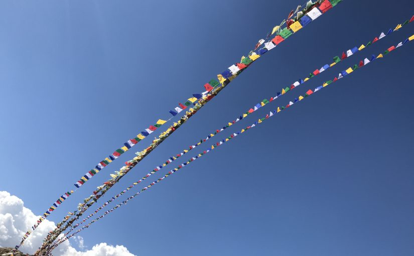
 At the Fotu La pass

It was a smooth descent from the Fotu La towards the Lamayuru Monastery but, we had the time, and Himanshu decided to show us the curvaceous road above the Moonscape before reaching the monastery.
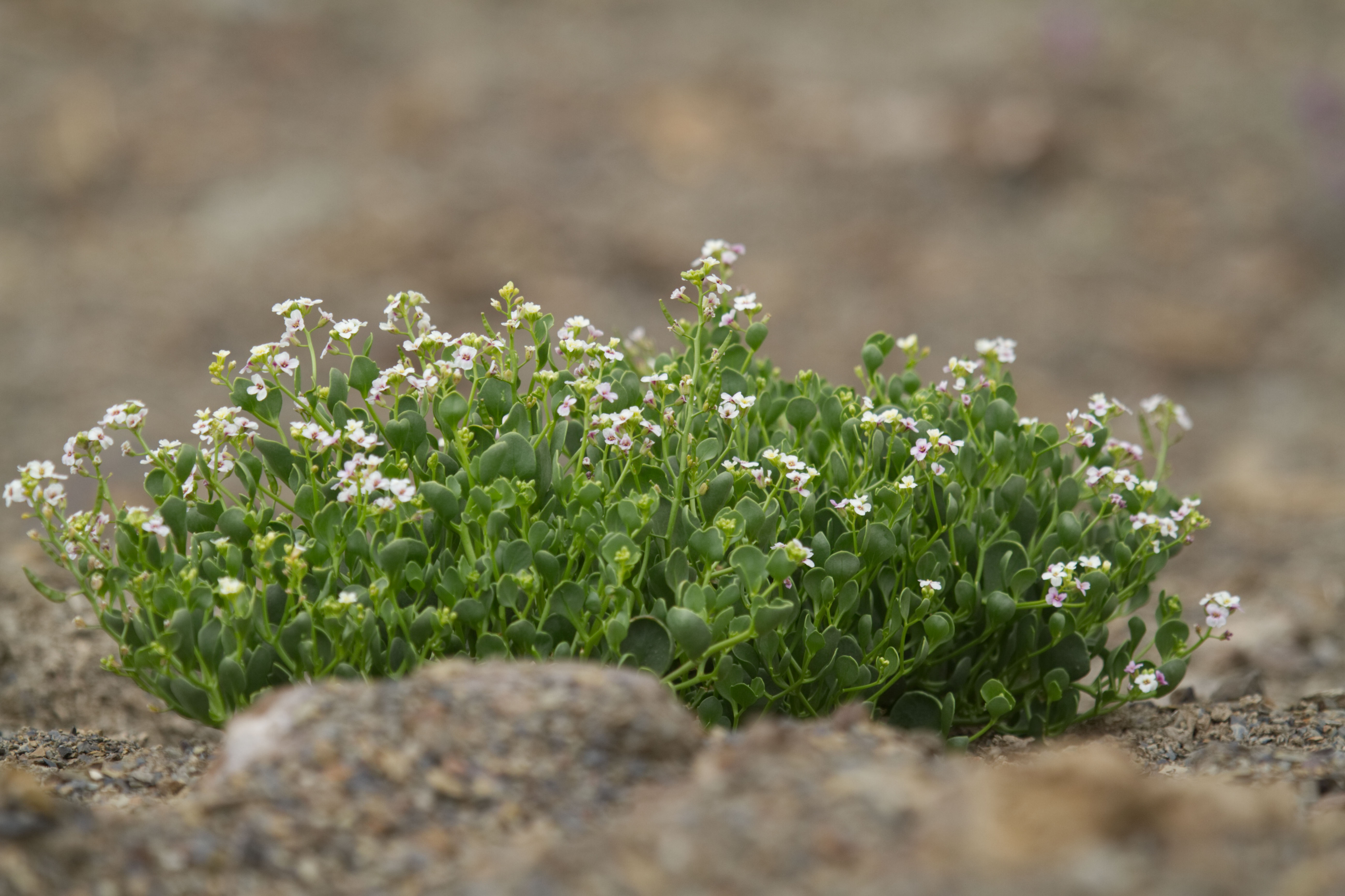
Unfortunately, the road above the Monastery was being worked upon and was closed for traffic, but we still managed to have some fun. Identified and collected the lavender plant which was in abundance here, and photographed some more wildflowers.


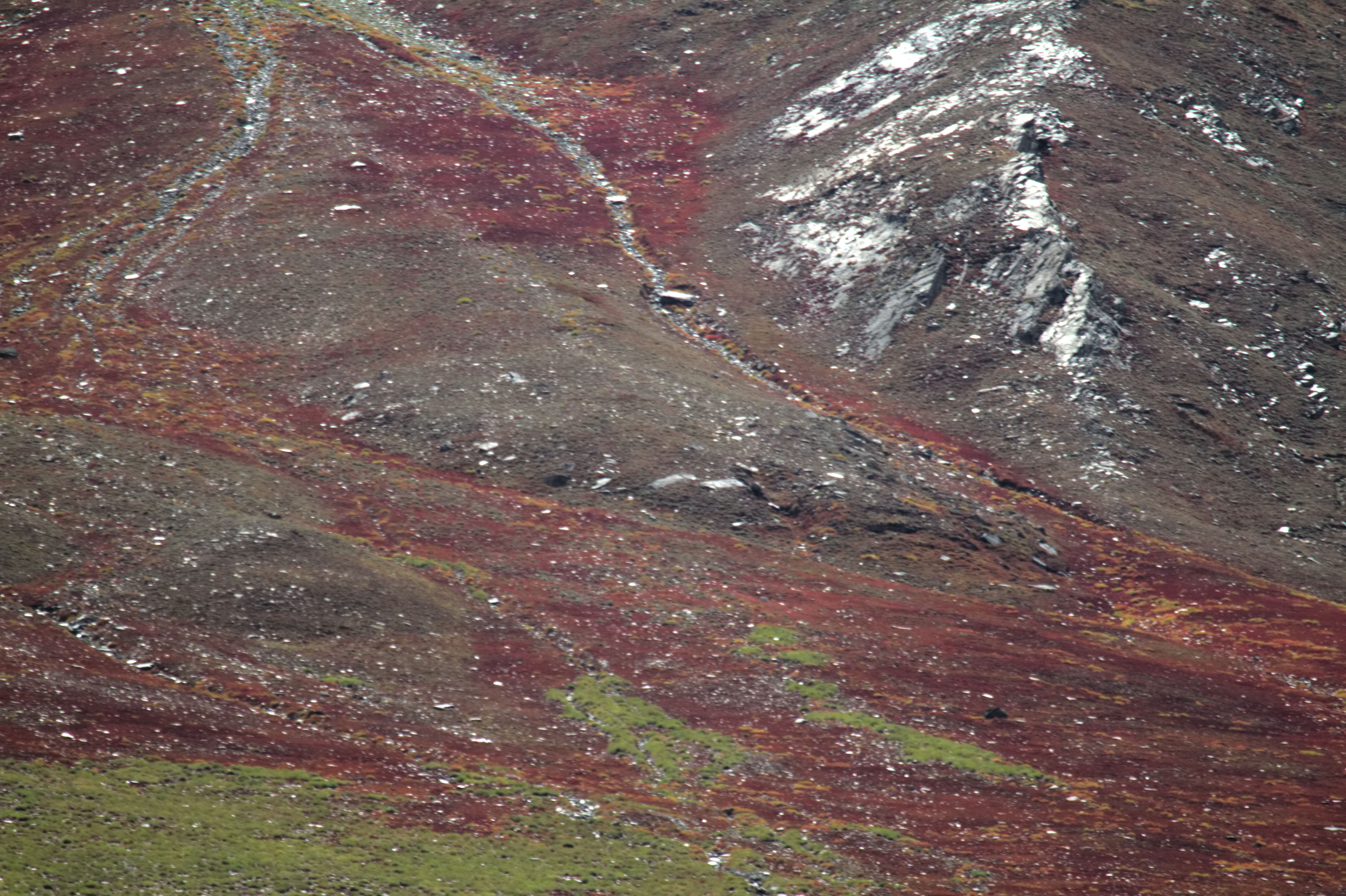
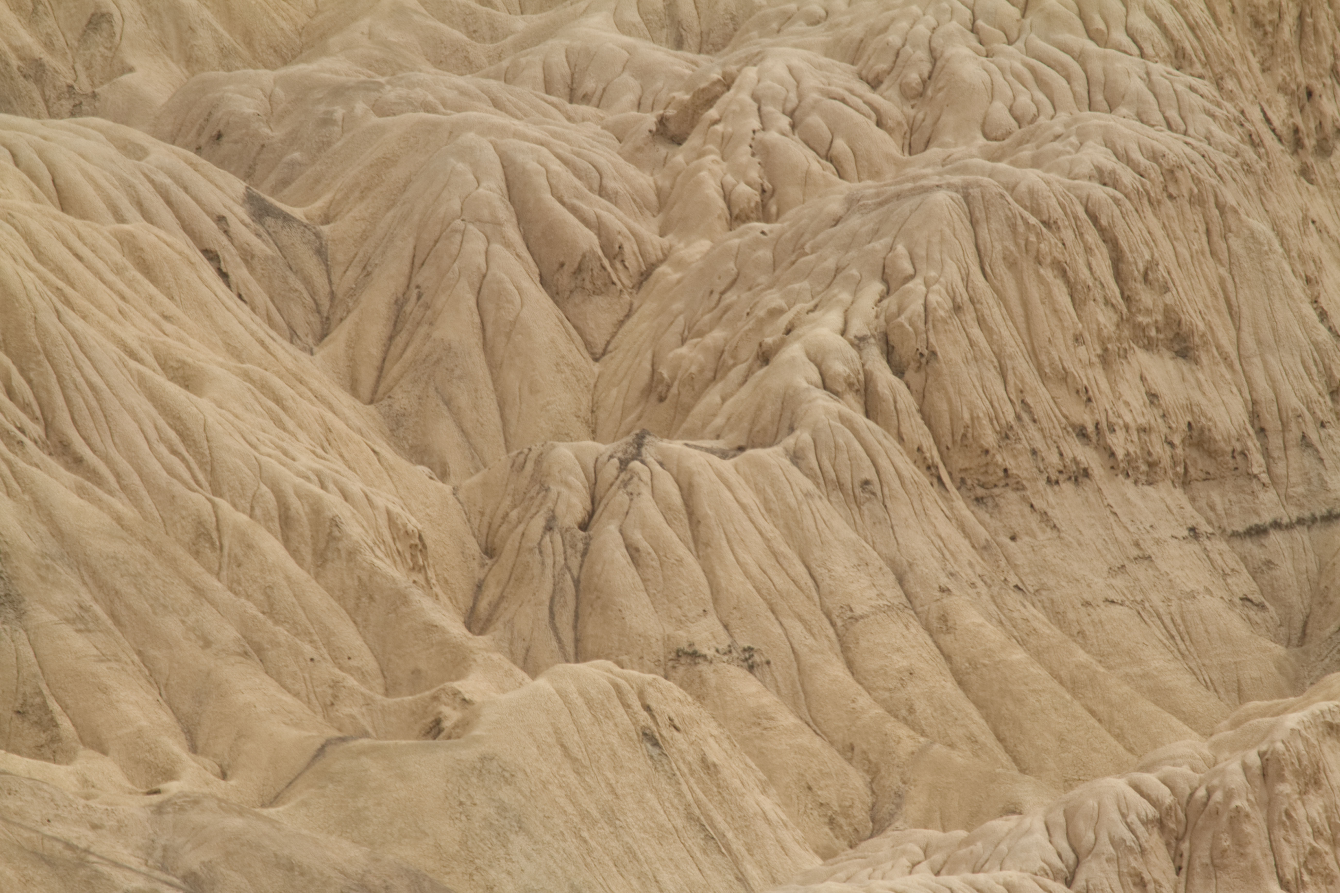
We also got a magnificent view of the Moonscape from this place. The serrated and ridged mountains near Lamayuru look like a typical lunar landscape, hence the name.

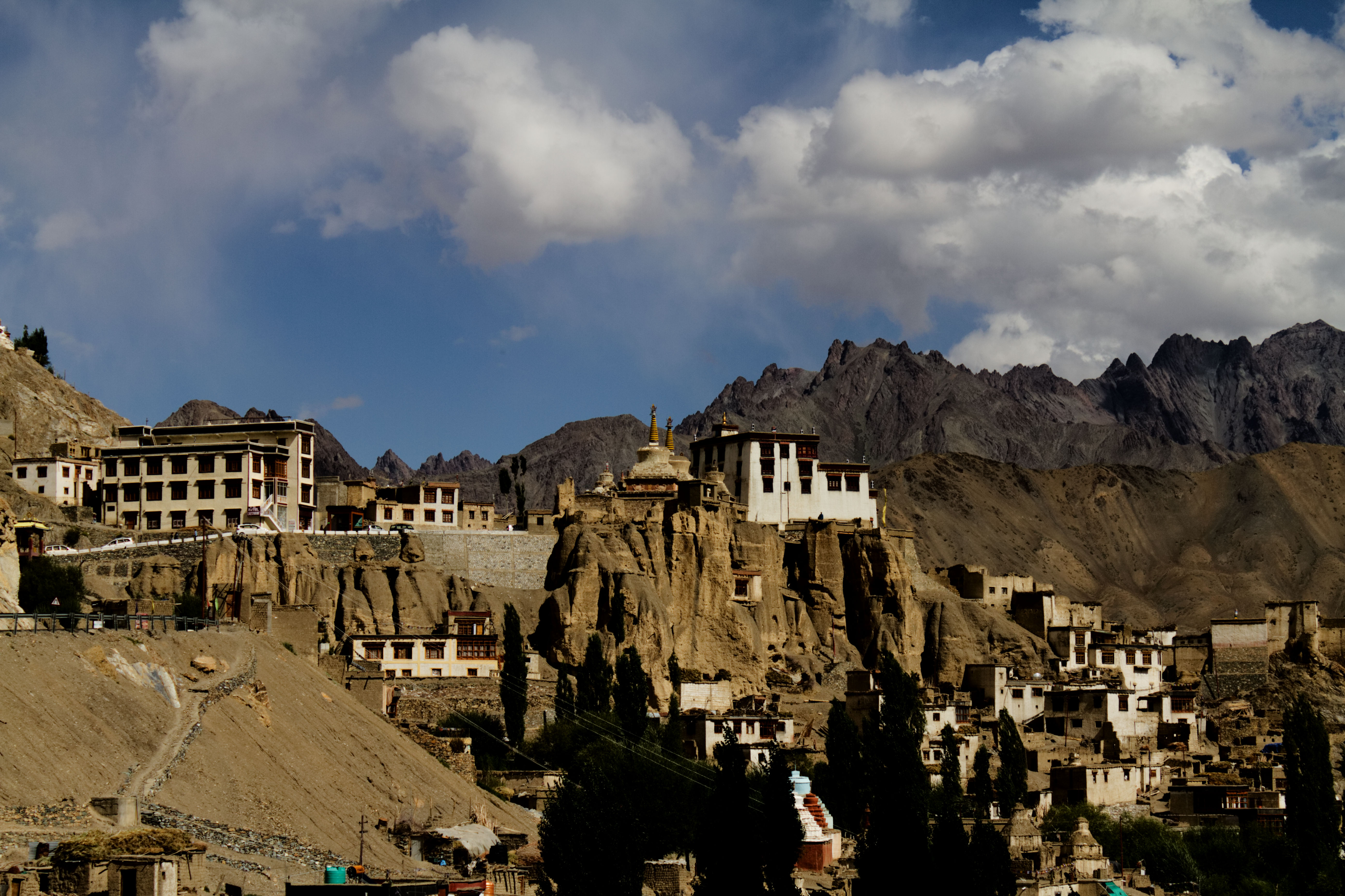
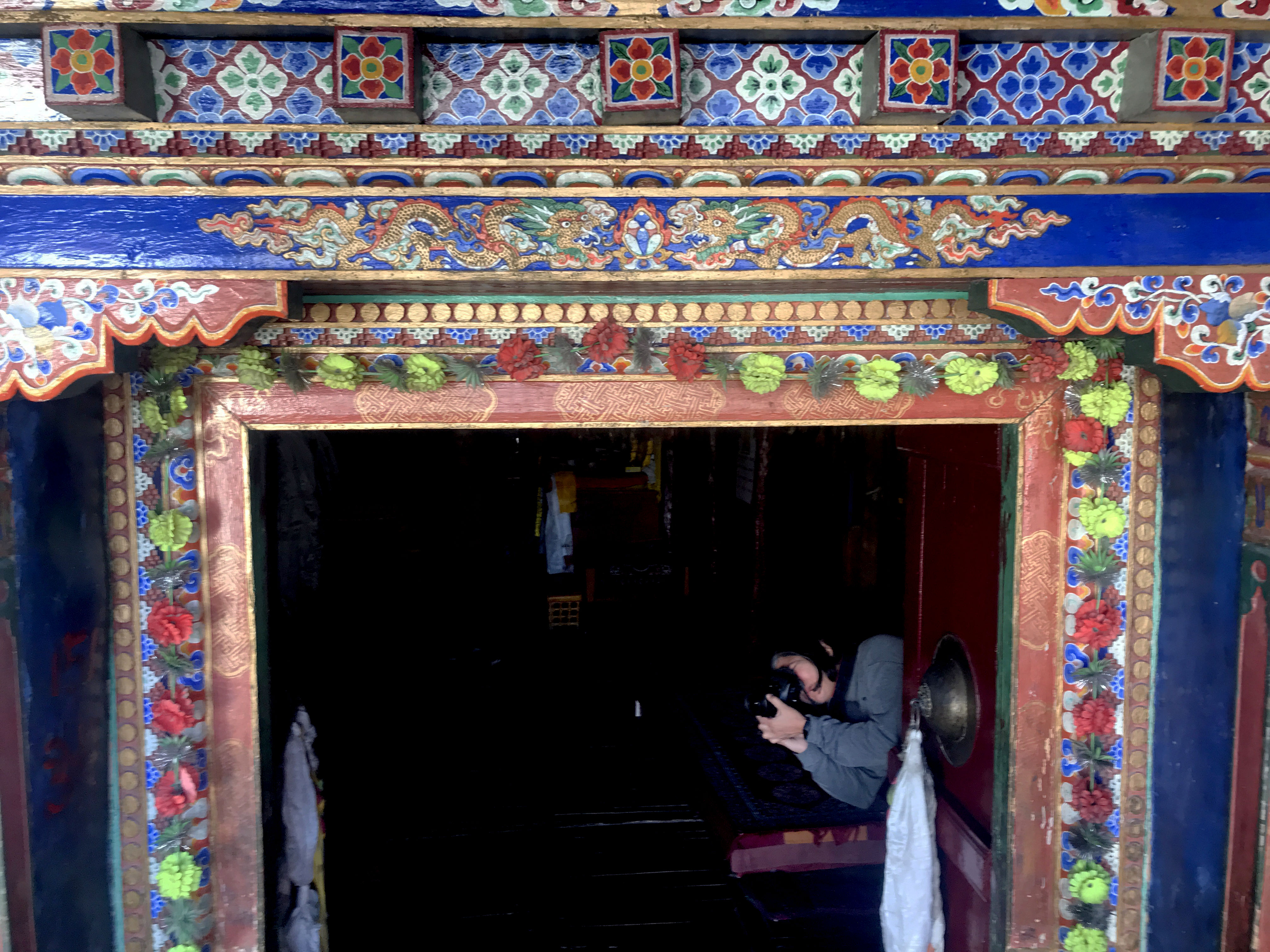
Next stop was the Lamayuru Monastery. Lamayuru monastery is a place which has many legends associated with it. It is one of the oldest and the largest in Ladakh. Out of the five gigantic temples, only one has survived. One can still see some old remnants of the monastery.


As we entered the monastery, I encountered a beautiful old woman dressed in local attire.

When I reached her, she smiled and initiated the conversation, told me her name and asked mine. I requested her to introduce herself again to get it on the video. On second thoughts, instead of breaking into English, as it has become a habit, I should have spoken in Hindi as the locals know Hindi reasonably well.
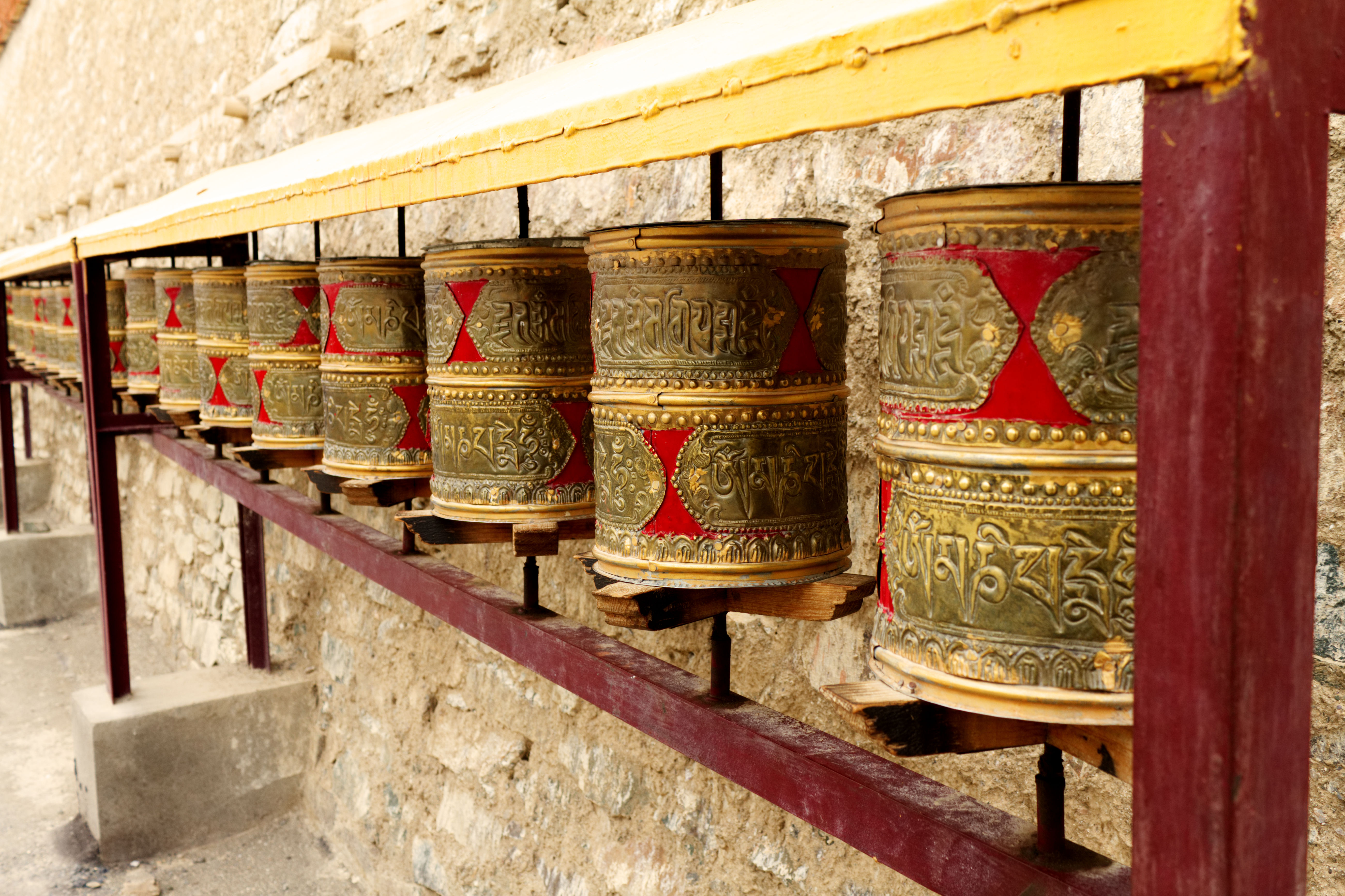
As I followed her, I spotted three more friendly old women, who taught me how to use the prayer wheel. However, as we were moving ahead, they asked for Bakshish. I gathered that this was their livelihood.

These old women sit in a particular corner, quietly praying and whenever a tourist comes, they talk and educate the tourist, post for photographs and videos. In return, all they expect is some bakshish so that they can survive. I learnt later that they have been doing this for many years.


We also visited the other portions of the monastery which houses the school and hostel for the monks, although we could not stay there longer as it was getting late and the place was shutting down for lunch.
We too were hungry, and the best place to eat near Lamayaru is a restaurant right next to the monastery. The restaurant also serves eggs and Tuna (and beer). We opted for Thukpa, momos, omelette, fried rice and some lemon tea. The food was so good that I ended up overeating and all I wanted to do was sleep. I had full intentions to take a nap in the car when Trishu exclaimed that his phone is catching network and has 4g and that was the end of our plans to nap – each of us requested a hotspot from him and were busy uploading pictures to Instagram.
After Lamayuru, we drove through a long straight road amongst the mountains. Trishu wanted to shoot videos and pictures of the road which I later learnt is a fascination for him. He has captured the visuals very well on this phone.
While he was shooting the road, I was fascinated with the unabashed blueness of the sky and wanted to capture that.

After a day’s drive, we arrived at Leh in the evening and realised that the hotel had a limited internet connection. I tried to talk to mom, but the network was bad, and could only send her some pictures from the trip.
The evening was booked for a stroll in the Leh market. I picked up two woollen caps and some essentials for the journey ahead.


Tarique and I indulged in eating soft and succulent lamb kababs from a kabab stall on the roadside of the main market after which we all proceeded towards the German Bakery. Since we were to dine at the Hotel restaurant, we did not eat much but decided to pick up croissants, doughnuts, apple strudel and some more delicacies the next morning before departing for the Nubra Valley.

12th September
Since we woke up early and were ready for the next leg of the journey, Tarique decided to go up to the terrace of the hotel and click some pictures of the mountains, Leh fort and Castle, while I decided to enjoy some quiet time in the hotel garden.

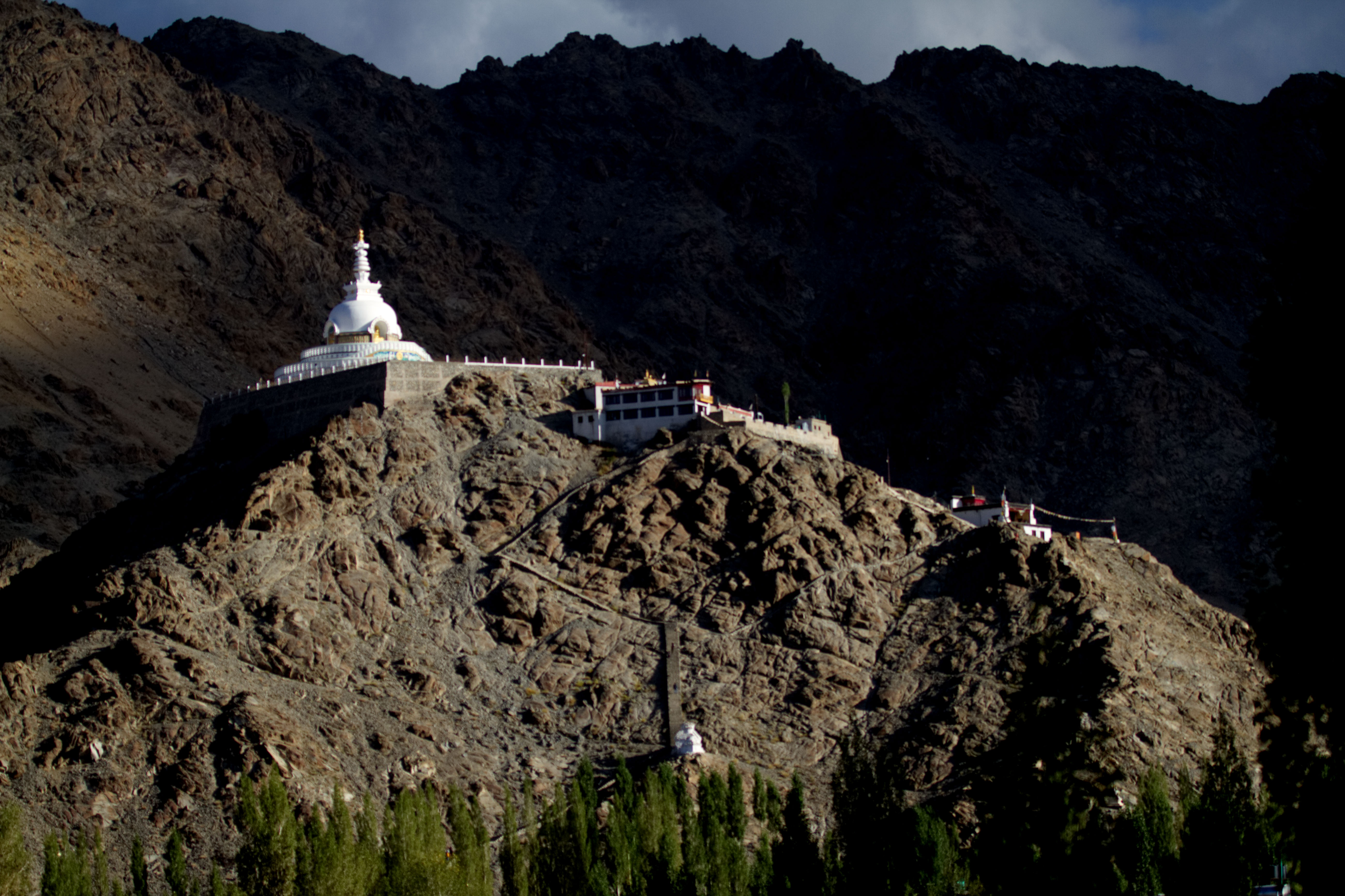

As decided, we picked up the stuff from the German bakery before departing. Today was the 5th day of our 9-day visit to Ladakh. I was kind of disappointed that the holidays will soon end, and that I would have liked to spend more time at each of the places we visited. First stop was the hill of the Leh Monastery and palace. The monastery was not as big as some others but had a charm and the inherent peace. From here we could also see a part of the charming little town of Leh.

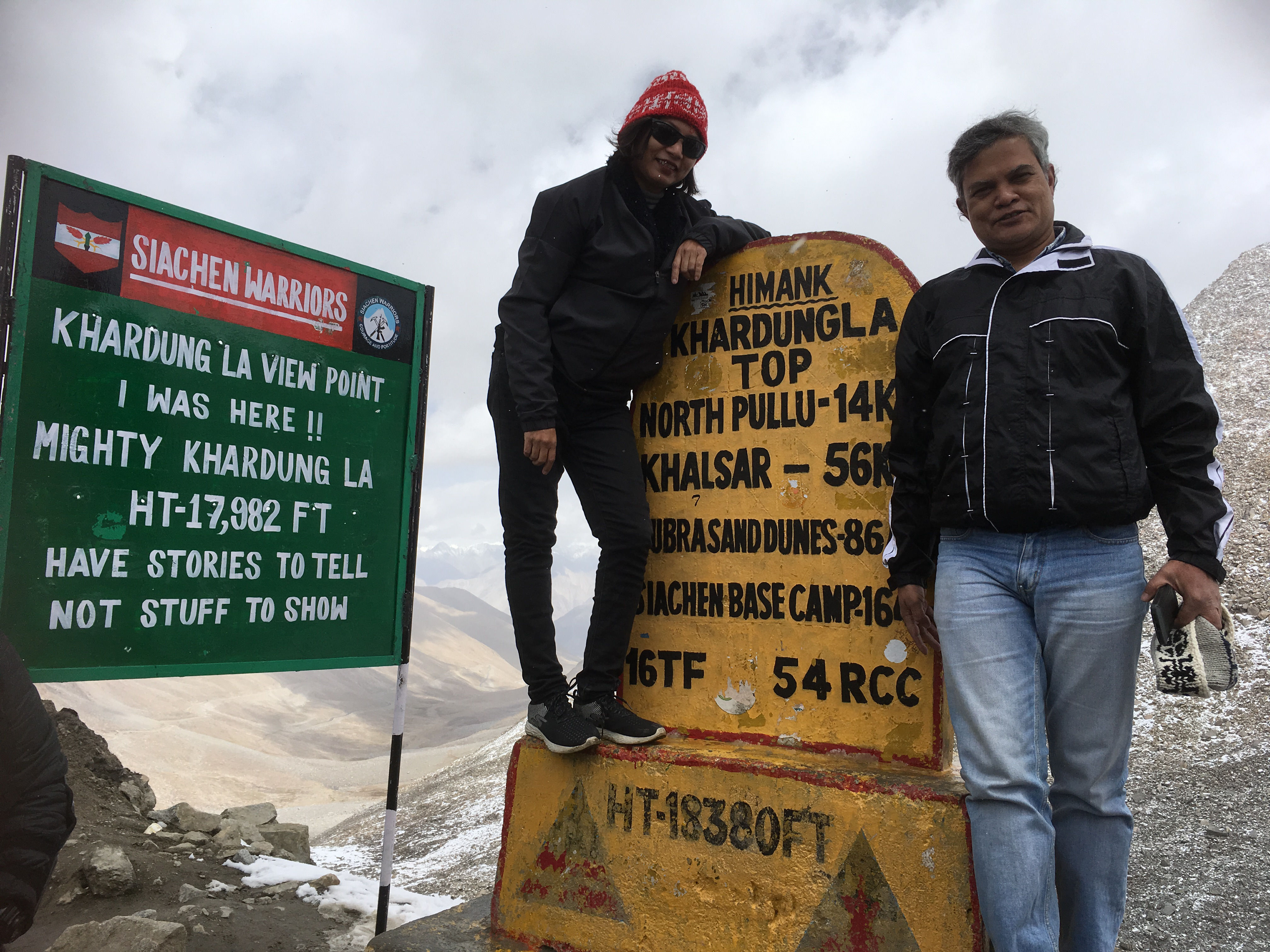
We were very excited to cross the Khardung La. Khardung is the name of a village and La means a pass in Tibetan.
Himanshu showed us the direction of the pass from the monastery, and we quickly jumped in the vehicle and were driven around by Iqbal Bhai on the curvaceous roads leading to the Khardung La. Iqbal Bhai was looking quite dapper today, he had worn a new shirt that was gifted to him by Himanshu. We teased him a bit – after all, he was going home to his wife today. Iqbal Bhai lives in the town of Hundar in the Nubra Valley where we were scheduled to halt for the next two days.
Khardung La is a pass on the Ladakh range and is in the North of Leh. It is a gateway to the Shyok and Nubra Valleys, and the Siachen Glacier lies partway up the Nubra Valley. The Khardung pass was opened to the motor traffic in 1988. The pass is strategically important to India as it is used to carry supplies to the Siachen Glacier.
While the current road was built in the 20th century, this route was once a part of the old silk route that borders on the Karakoram range of mountains.
Our first halt was the South Pullu where we had to stop to show our permits. Pullu in Ladakhi means a place where travellers rest. So this was the southern end of Khardung La where travellers rested, at times overnight, before crossing the mountain pass.
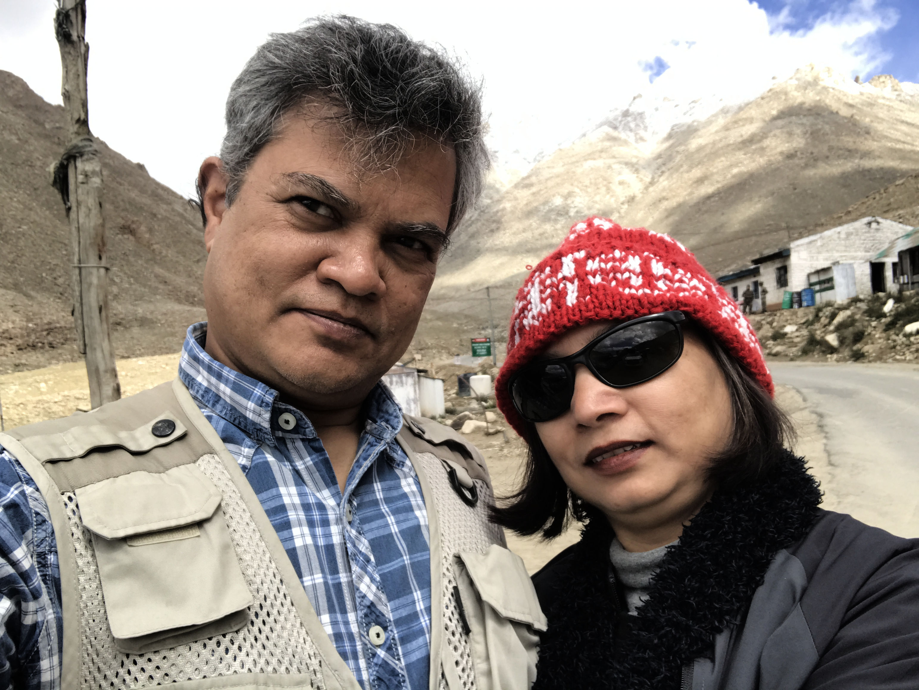
While the formalities were being done, we got down of our vehicle, wore another layer of clothes as it was getting colder at this altitude, and as usual, clicked a few pictures and took some selfies.

South PulluAnd here are the selfies 🙂
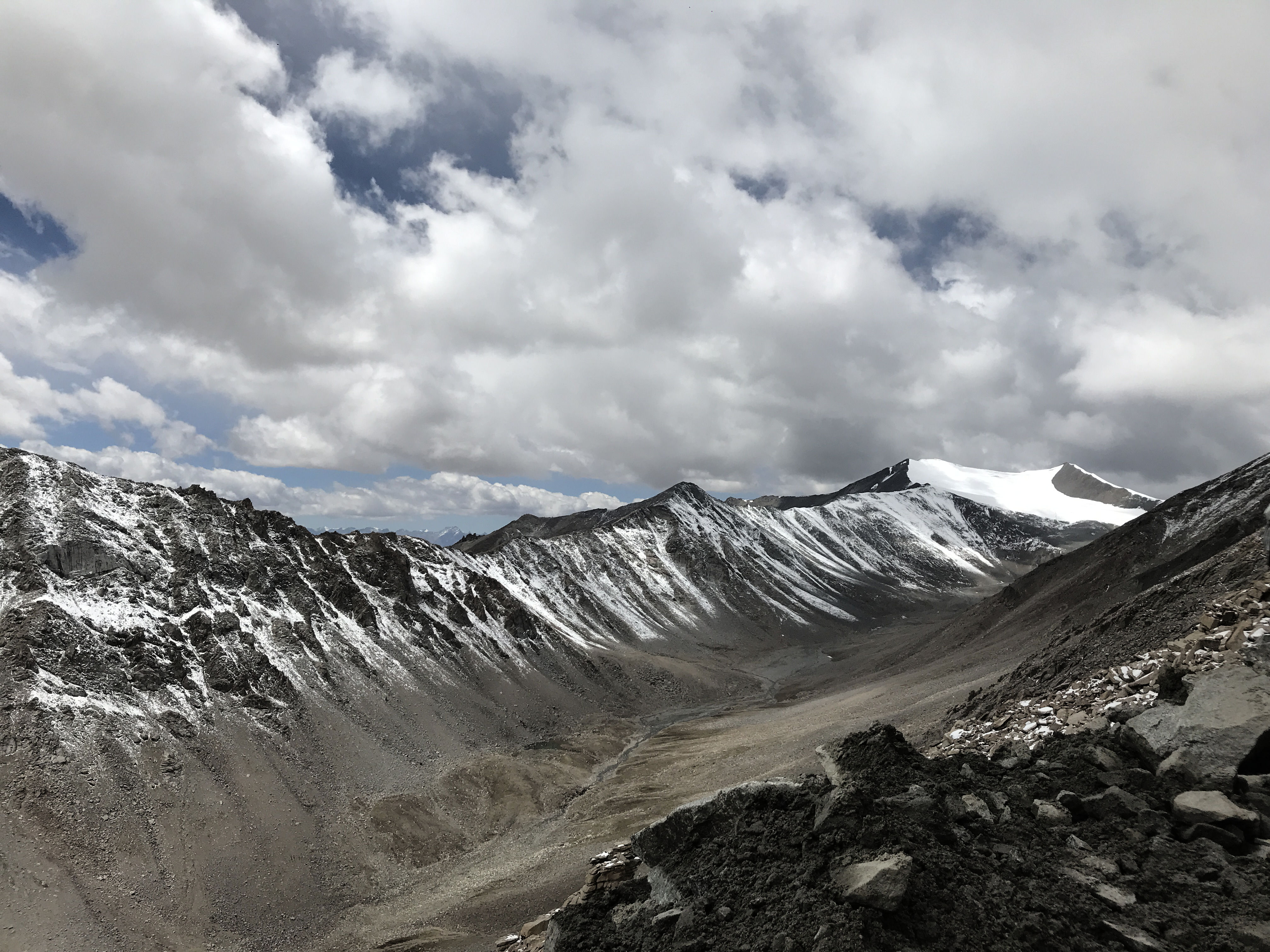
A few km ahead of South Pullu we stopped for a mini break; it had started to snow. We spotted a raptor overhead and heard a marmot call. Took some photographs of the winding road that got us here, and saw part of the glacier, which has shrunk to less than half its original size in the recent years.
A few of Radhika’s “how much longer to reach” and we were at the top of the mountain at Khardung La. At 17982 feet from the sea level to be precise.
I did not experience any altitude sickness whatsoever, but my lungs were choked from breathing the polluted air from the numerous trucks, bikes and cars that were on the road. I was told, that the air pollution is due to the use of kerosene mixed with diesel (as kerosene stops diesel from freezing) and is proving detrimental to the fragile environ of the mountains and therefore soon there would be a limitation on the number of vehicles that can ply on this road.
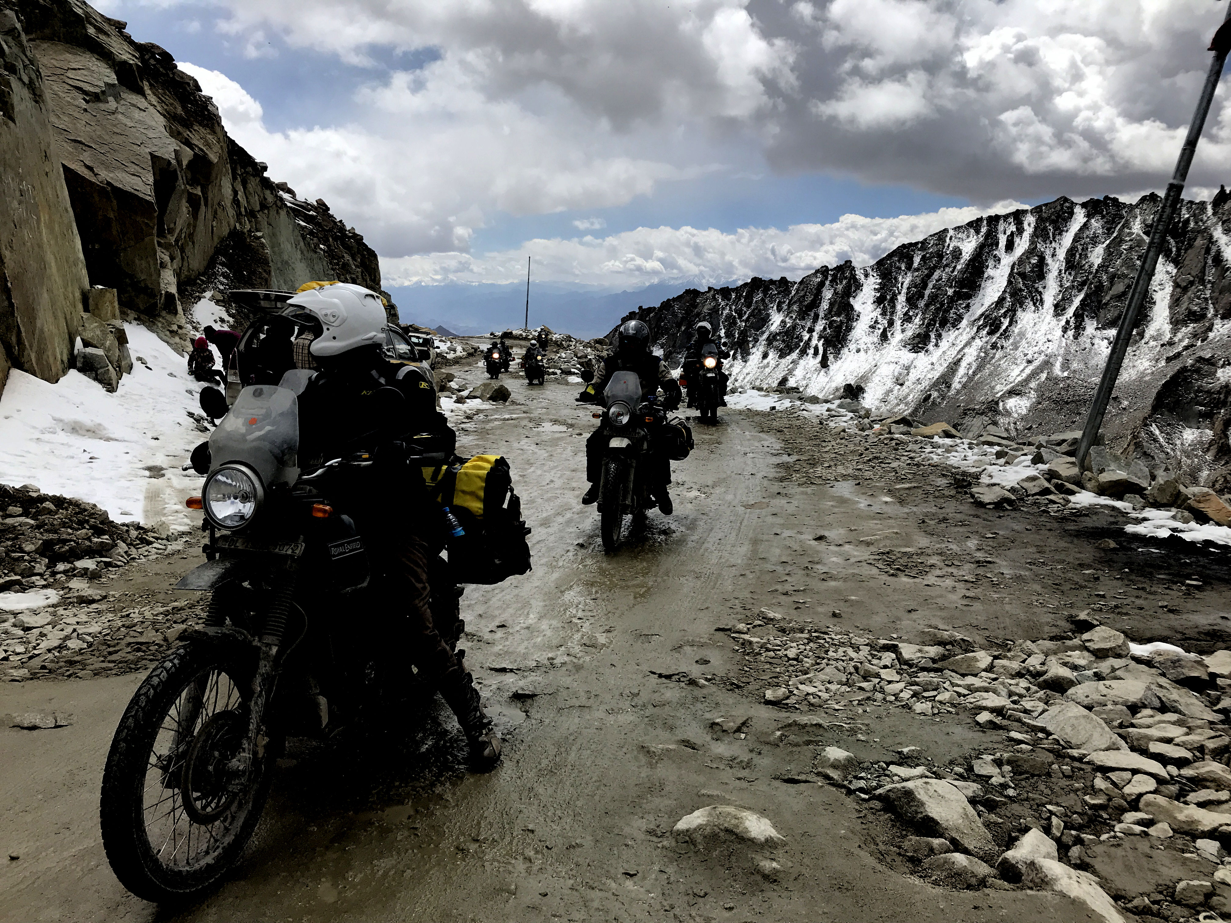
We did have our fun here though, did the normal touristy stuff and started our descent only to realise that the road ahead has been blocked for traffic by the Border Road Organisation (BRO) for some construction work. Someone took out a packet of Kurkure to pass the time.
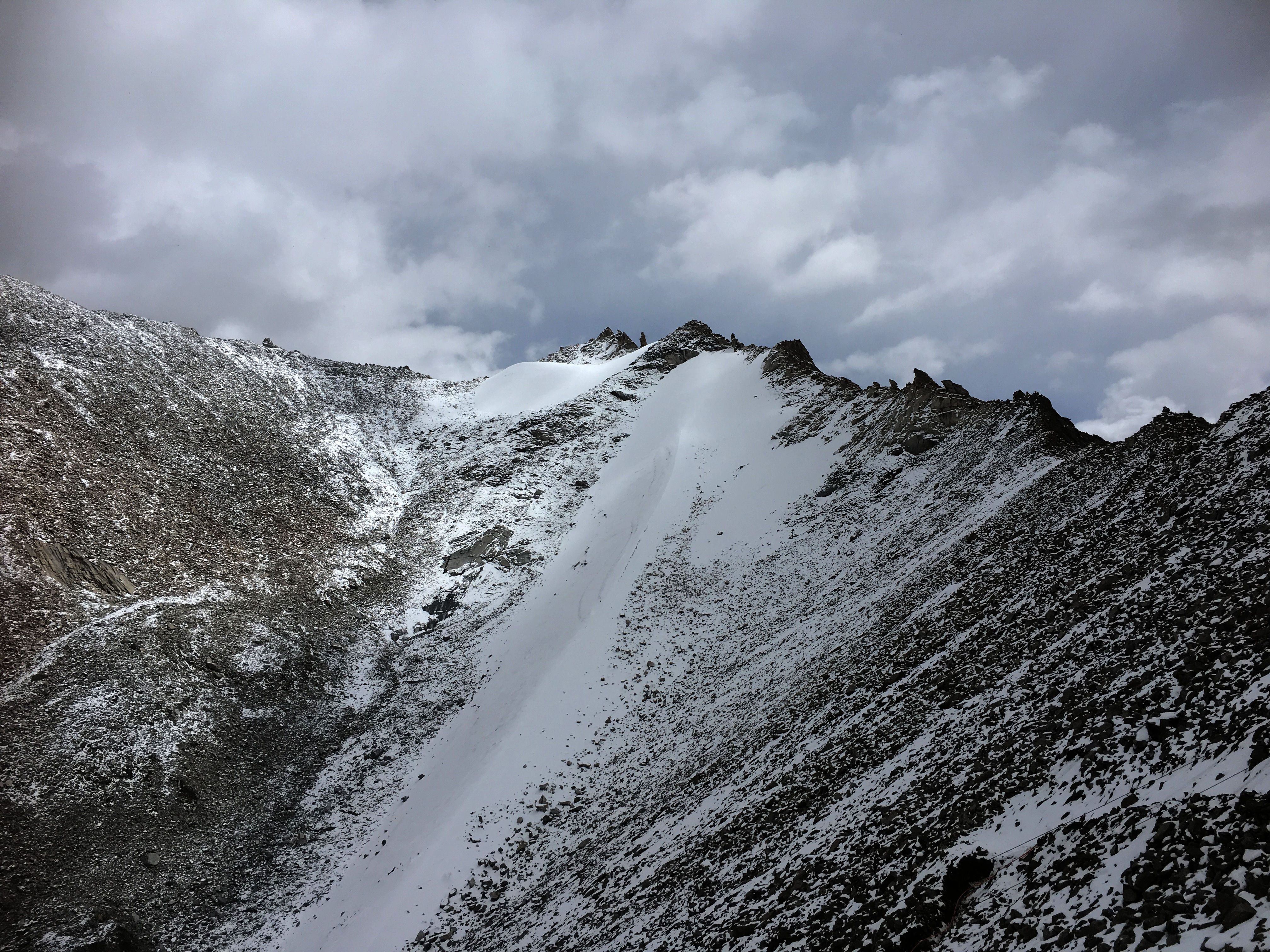
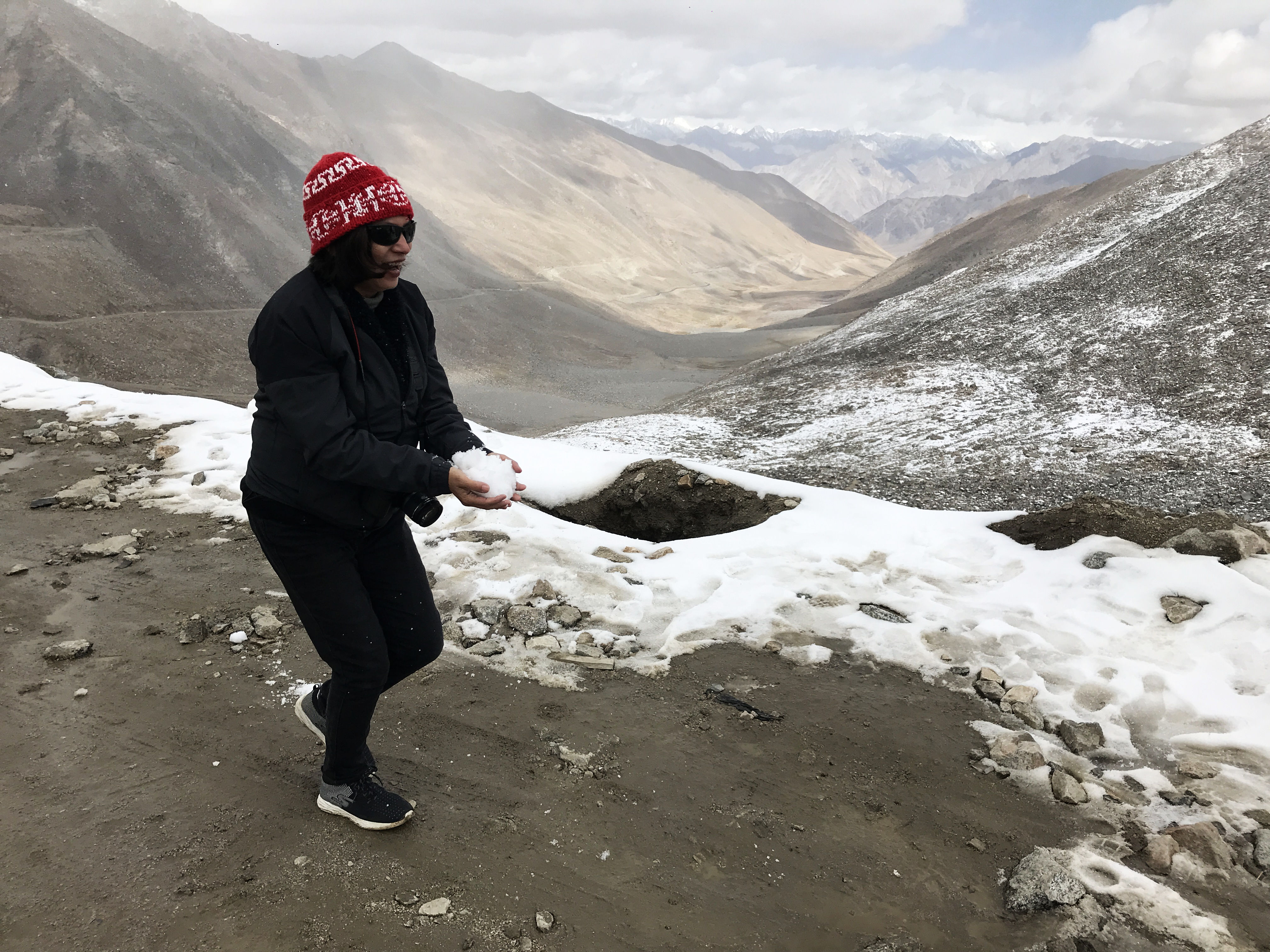
After the traffic cleared up, we moved ahead but stopped once more by the side of the road for a view of the mountains from the other side. This side of Khardung La had more snow, and there was a soft drizzle of snow all around. This was my first real snowfall, and I felt an uncontrollable urge to record it, so I managed to make a small video clip before being urged to climb back in the car.

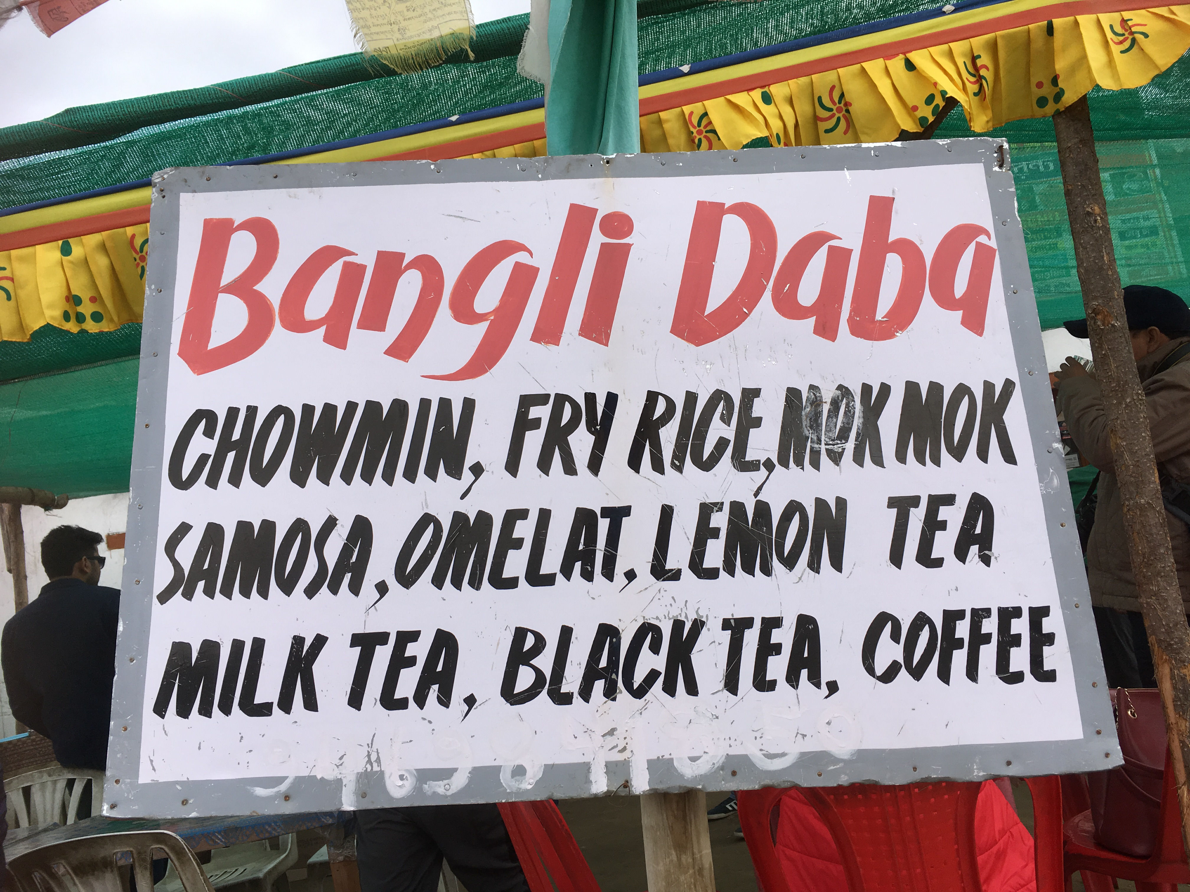
Our next stop was North Pullu to show the papers to the officials. We had decided to stop at the Bangli Dhaba for tea and delicacies from German Bakery. Radhika and I discovered that he was making Maggi.
Mountains and Maggi go together, and for a complete experience, one must have a plateful of steaming hot Maggi on the (not so cold now) mountain tops. The Shop owner was generous and sprinkled more Haldi, Mirchi and masala on our Maggi- which none of us could eat, so I went in the kitchen and made my version of masala Maggi with tomato sauce. I struck a conversation with the owner and learnt he was from Bengal and operated this Dhaba in the summer months for the tourists. On his recommendation, we also snacked on a plate of mok moks (momos) while the Maggi cooked.
The extra layer of clothes and woollen that we had put on at South Pullu came off, and we climbed back in the car to continue our journey towards the Nubra Valley only to stop a km or so later to photograph some Marmots. We did not know we will see a lot of them in our journey ahead so a decent photo was must especially when the opportunity had presented itself.

After climbing down Khardung La, we climbed back up the Shyok valley and drove by the side of Shyok river. The Shyok river is known for its floods, and the name Shyok or Dariya e Shyok is named as “river of death”. Sheo means death in a Turkic dialect. As we climbed, we saw the floodplains of the river and stopped at a place to have a good look.
The Shyok river originates from the Rimo glacier, which is one of the tongues of the Siachen Glacier The Shyok ultimately flows its waters into the Indus river.
The colour of the water was muddy in September, but we were told that it turns to turquoise in the winter months and is a sight to behold.
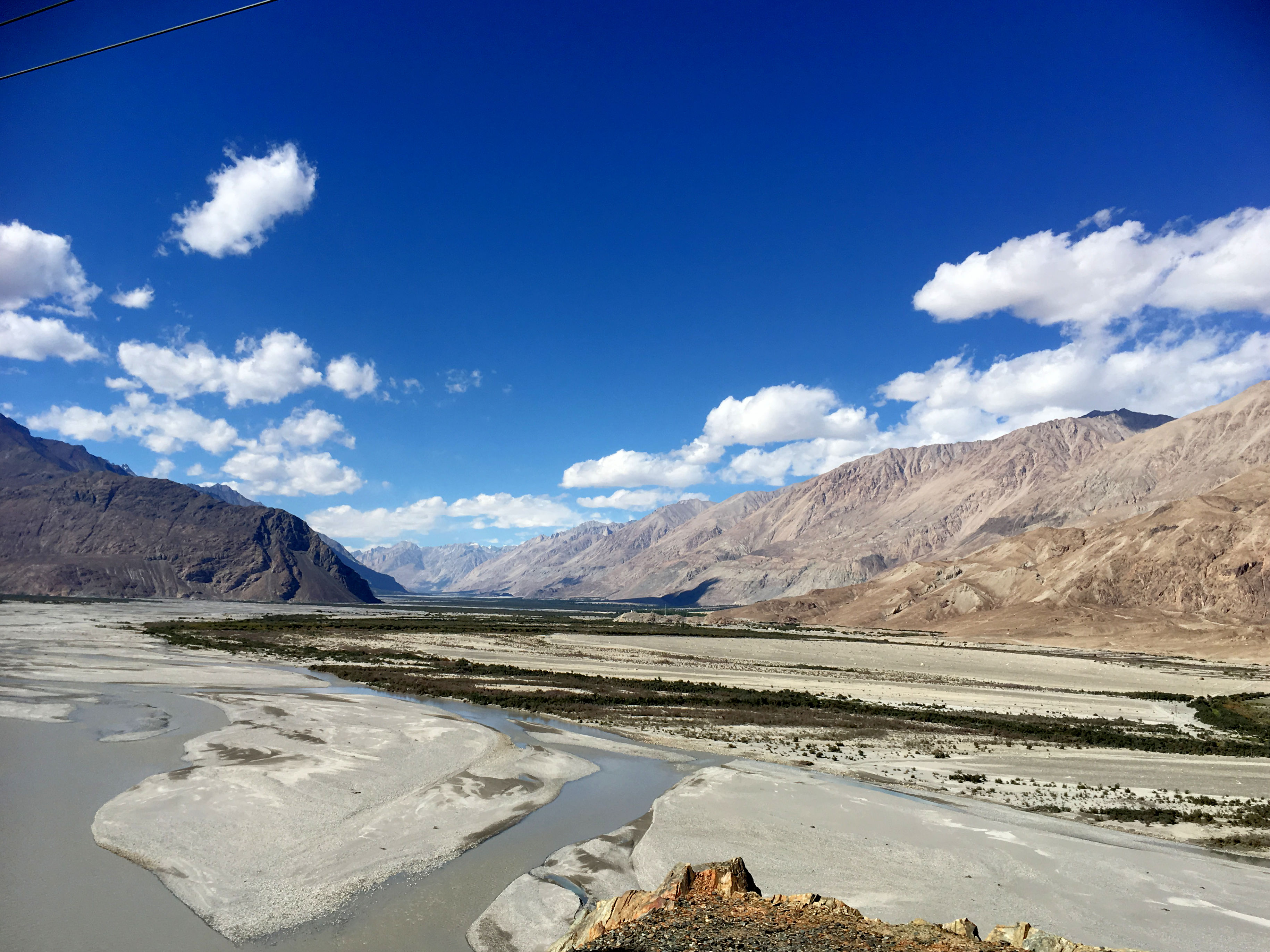
A little ahead the Shyok river meets the Nubra or Siachen river to form a large valley that separates the Ladakh and Karakoram ranges. Along with the river, we too left the Ladakh range and entered the Nubra Valley.
As we approached the Diskit town Monastery, our next stop, we saw a huge golden coloured 33-meter symbol of peace, a Maitreya Buddha facing towards (We were told) Pakistan. The construction of this statue was started in April 2006, and it was consecrated by His Highness the Dalai Lama on the 25th of July 2010. The statue was built to spread the message of world peace and specifically for the prevention of any further war with Pakistan.
Ladakh region has always borne the brunt of wars. And peace is, therefore, everyone’s mantra, and rightly so.


We were kind of hungry by now. While Himanshu and Sanjeev decided not to eat, the four of us dug into platefuls of noodles and fried rice at a cafe near the Diskit Monastery. As had become my habit, I asked the girl on the counter if they had an internet connection, and she readily gave me the wifi password. Next few minutes, as we ate, were spent on uploading the Khardung La photographs to our Instagram accounts.
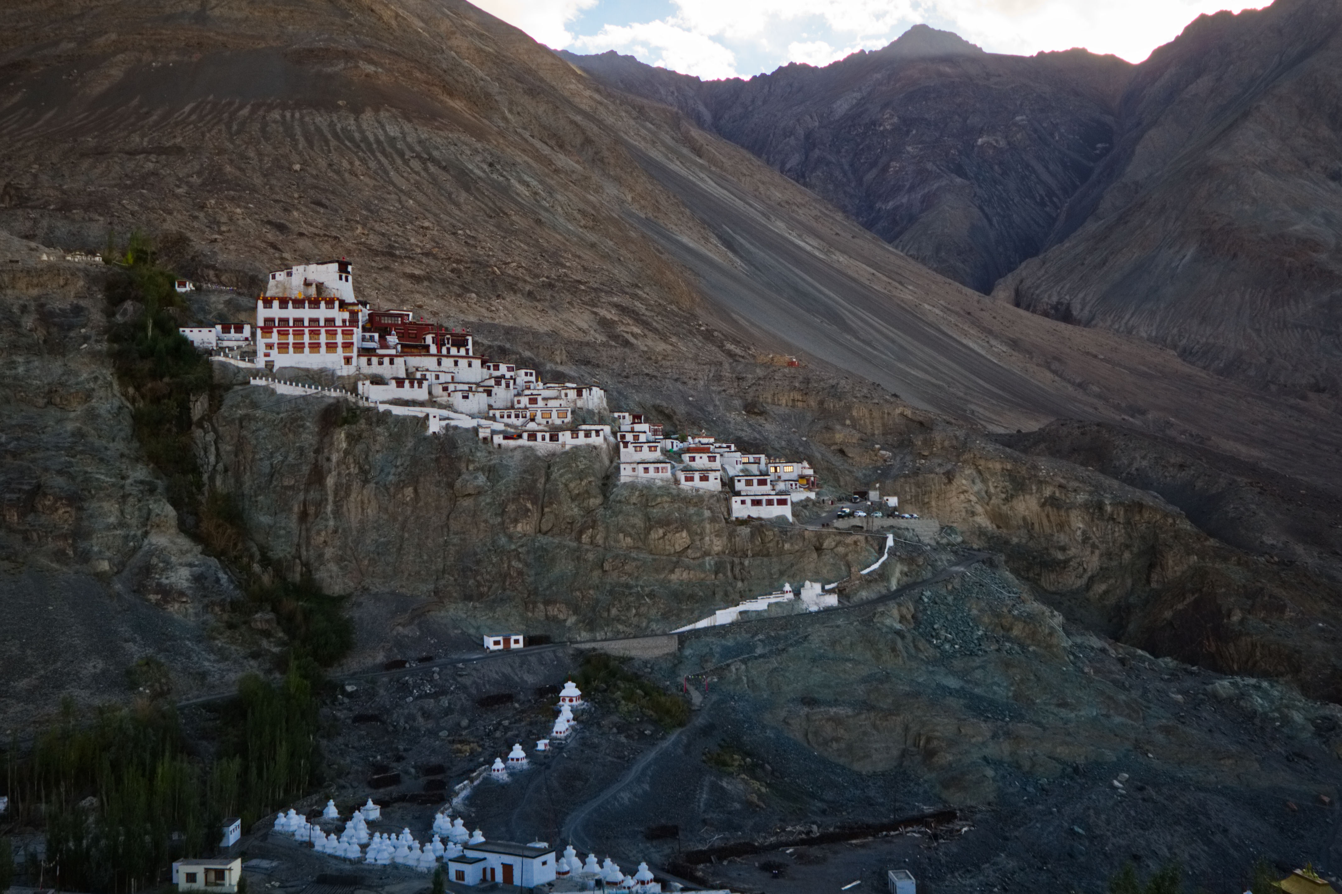
The Diskit Monastery or Diskit Gompa, founded in the 14th century, is the oldest and the largest monastery in the Nubra Valley. Built on a hill just above the floodplains of the Shyok river, at the end of the approach road, it is a striking structure and is visible from even a large distance.
The Nubra valley is at a lower elevation than the Ladakh range, it has a mild climate and has lush vegetation. It is therefore called the Orchard of Ladakh. The valley was a part of the caravan route between Tibet and China. The double-humped Bactrian Camel would travel the route and the ones left behind due to illness, or other reasons have flourished here.
I was a bit tired after climbing the steep stairs and decided to rest in the verandah of the monastery when two kittens spotted me and were all over me.

One of them even demanded that I scratched him and patted my hands whenever I stopped scratching him. I love cats, and I guess they love to reciprocate my affections as well.
Happy with the interaction, I joined the others to visit the temples at the monastery. One interesting part of history the protector room of Diskit monastery has is the mortal remains of the hand and skull of a Mongolian warrior. The remains are shrivelled and real. Legend has it that the monastery is believed to be the place where an evil anti-Buddhist Mongol demon once lived and was killed near the monastery grounds but is said to have been resurrected several times, and the hand and head are of this evil demon.
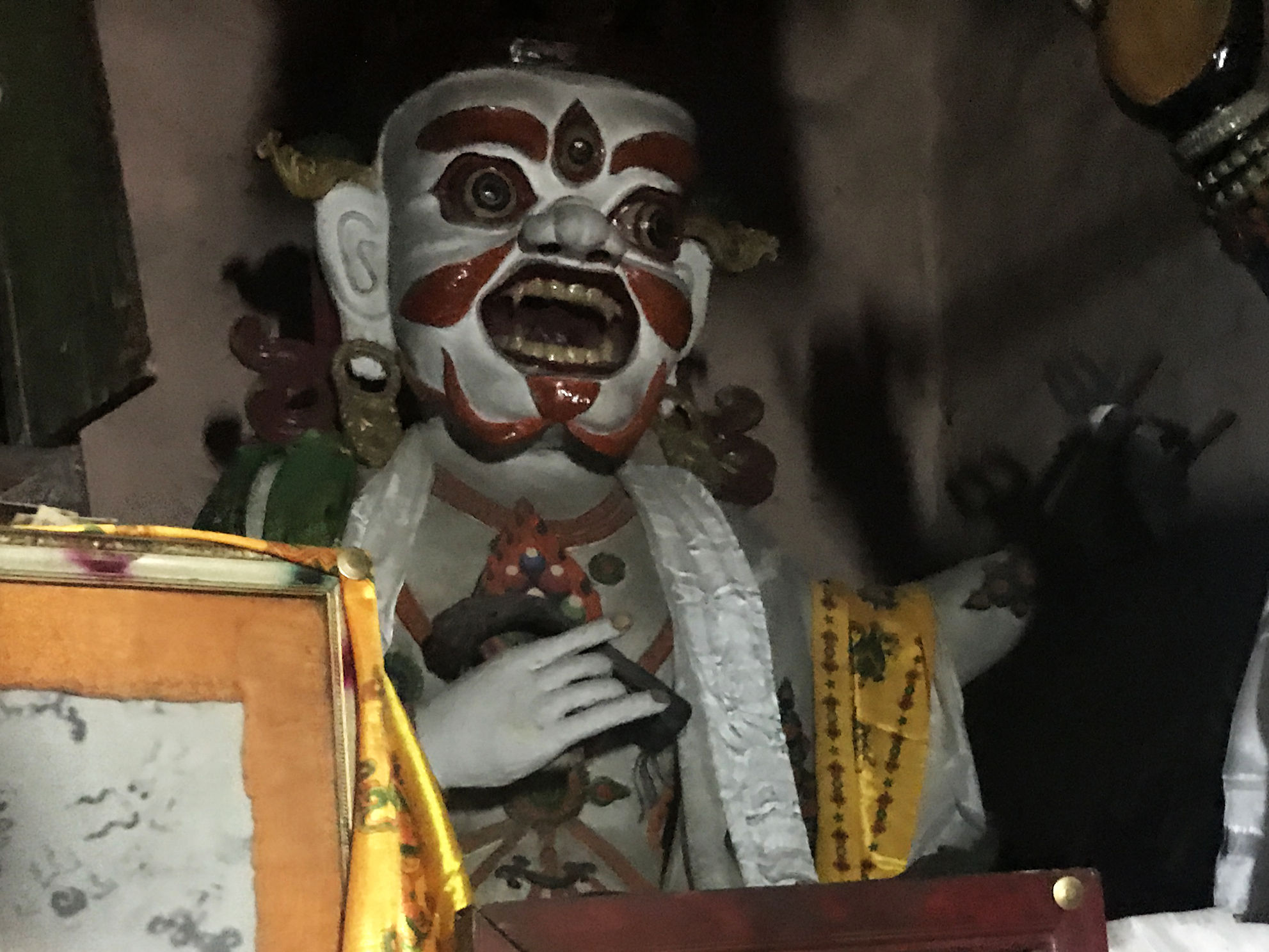
One more thing that I noticed is that the heads of several statues in the protector room (of all the monasteries we visited) are covered.
We spent a considerable amount of time here and clicked several pictures.


As we came out of the monastery, we noticed a very deep well. It was more of a freshwater spring, the path to which, was rickety and dangerous. It is said that the monks regularly used to go down this dangerous path (some monks still do) to get fresh water for the monastery. I could not go further than this point.

Although the monasteries preserve the tradition, modern facilities and technology have reached here too. We saw a few monks using the latest cars and smartphones.
By this time the sun was about to set, and we decided to call it a day and proceed to Hunder which was about 15 km drive. It took us about 30 minutes to reach out campsite at the Desert Oasis camp. While some of us had lemon tea, Sanjeev and Himanshu had also picked up some beer and breezer and the day ended with Gup shup over drinks and pakodas. Post dinner we retired to our camps looking forward to an exciting morning the next day.

In the quiet of the night, we could hear a gurgling sound of water and slept peacefully to the sound of spring flowing somewhere behind our tents.
What an awesome journey! Stunning pics!!
Thank you, Sonal. <3