Ladakh. The name originates from “La-dvags” meaning the land of high passes. Ladakh connected India with Tibet, China and other central Asian countries via the “silk road” the parts of which still exist. I had so far seen only pictures of this amazing place and was always curious about this enigmatic place tucked away in faraway mountains.
When Himanshu announced the tour to Ladakh in June- July, aptly named, “Buddha Rocks tour” I was very disappointed that I won’t be able to visit this amazing place which was in my bucket list for very long.
Tarique insisted that I go, and I insisted that he come along, so a phone call and a while later, Himanshu suggested we all go there in early September. The weather would be good and the inflow of tourists will be far less than the peak summer months. Plans finalised, we booked the tickets and looked forward to the trip of a lifetime.
By last week August, I was checking the temperatures at various places that we were to visit, and I started making a list of clothes, woollen and medicines accordingly. I am a listophile and I get pretty listless without my lists 😀
On 7th September we were to leave for Delhi and our flight to Leh was on the 8th. Delhi is a place I love to go to because a lot of my dear friends from IIMC are in NCR and it makes me immensely happy to meet them.
The flight landed on time and we landed at Shilpa’s door. There was so much to talk, and so little time. Reema met us in the evening and we spent the time chatting and catching up with each other over dinner.
8th September 2018: Leh and Alchi
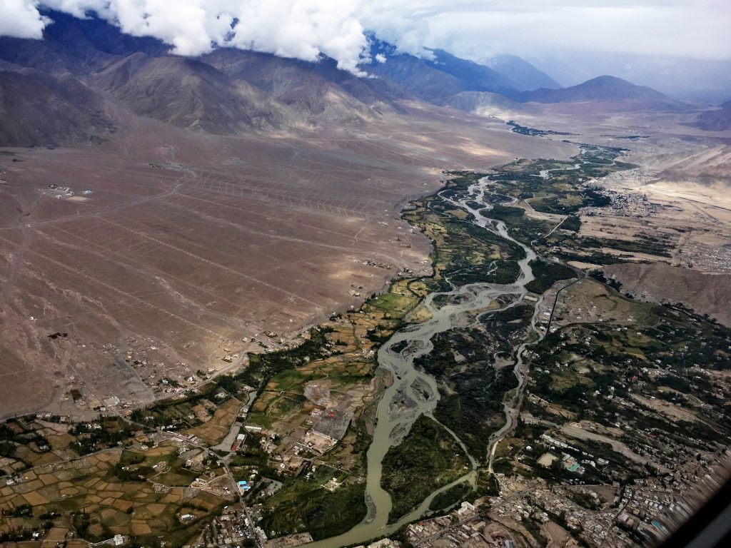
We arrived at the Delhi airport to catch a flight to Leh. Himanshu and Sanjeev joined us and we discovered that the Leh airport is temporarily shut due to bad weather at Leh. The weather, however, improved quickly and our flight departed on time. Despite having window seats, the snow-capped peaks of mighty Himalayas eluded us – they were engulfed in a thick blanket of clouds. However, as we approached Leh, the sky cleared up and the Leh town on the banks of a serpentine Indus river, and its tiny landing strip became visible.
Trishu and Radhika had taken an earlier flight and were waiting for us with Iqbal Bhai at the Leh airport when we landed. Iqbal Bhai was our go-to person for everything throughout the duration of the tour. A superb guide, he has the knowledge of flora, fauna, history and culture of Ladakh and being with him made for a very enriching experience. During our 8 day stay, Iqbal Bhai drove us around through the length and breadth of Ladakh covering a distance of approximately 1200 km.
Leh is at an altitude of 3500 meters (11480 feet). For anyone travelling from the mainland, this altitude can mean a lot of trouble. To tackle the altitude sickness, I and Tarique both had started taking Diamox twice a day as soon as we arrived in Delhi. So except for a bit of light-headedness that lasted about 10 minutes, we did not face any issues. I, however, had to stop taking my diabetes medicine (Janumet- which has metformin) when I took Diamox as it was messing with my digestive system.
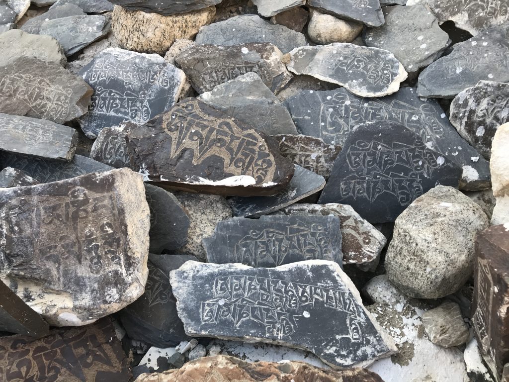
One of the first sights, as we hit the road, was that of the Chorten. These striking, stupa-like structures are built mostly near villages and monasteries, and they symbolise the Buddha, and the five elements of nature – Earth, Water, Fire, Air, and space. Most Chorten also have a Mane Wall along with them, this is a wall built by the followers and believers, and it is made of numerous etched stones kept in rows. It is mostly the six syllable prayer of peace and harmony, Om Mane Padme Hum that is etched on each of the stones that line the Mane wall.
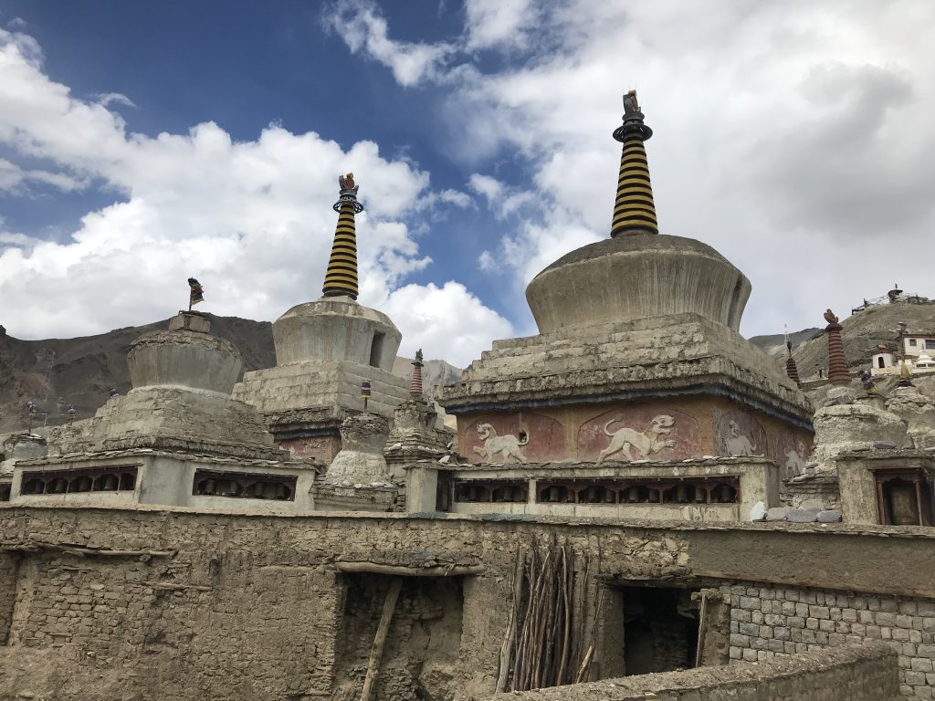 Chortens
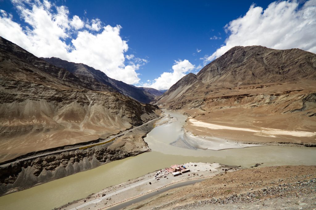
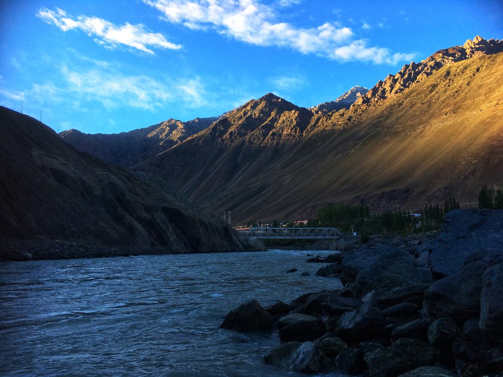
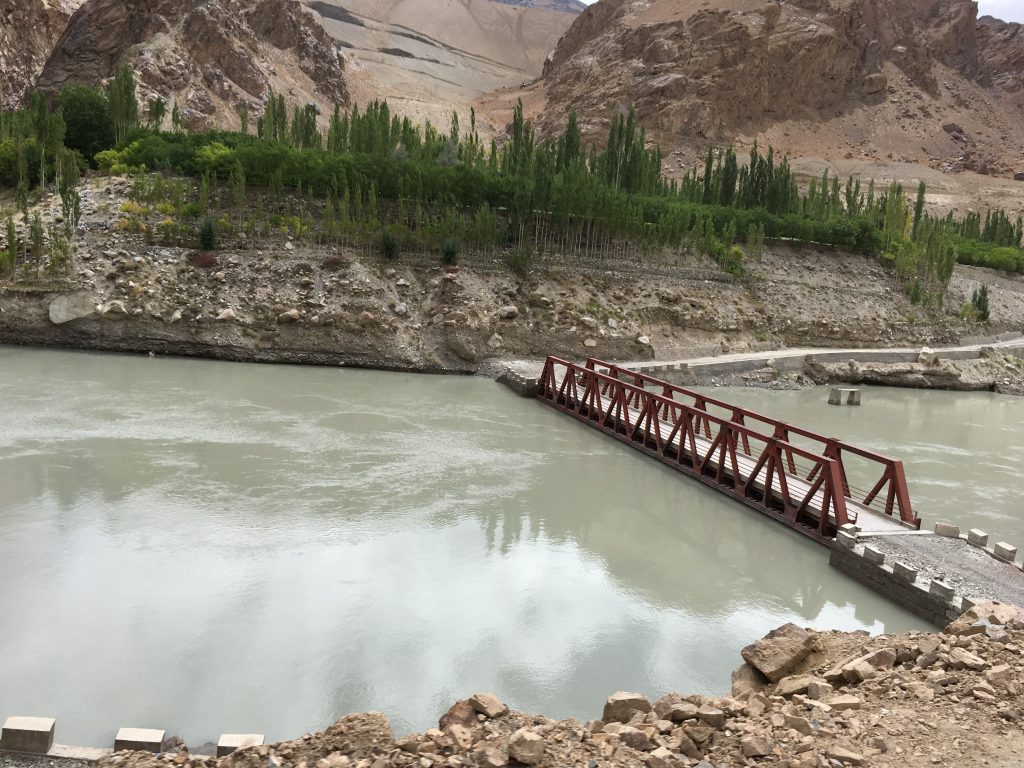
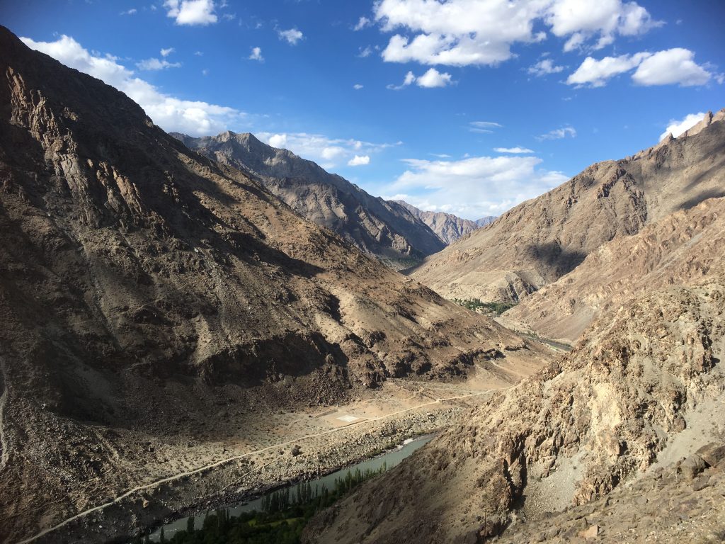
We drove to Alchi directly from the airport. Alchi is at a lower altitude of 3100 meters or approximately 10,000 feet and travelling to Alchi from Leh helped us cope with the altitude better. Enroute we stopped to see the Indus river. Sindhu, as it is called in Hindustani, gives our country its name. The confluence of Indus and Zanskar rivers was a sight to behold.
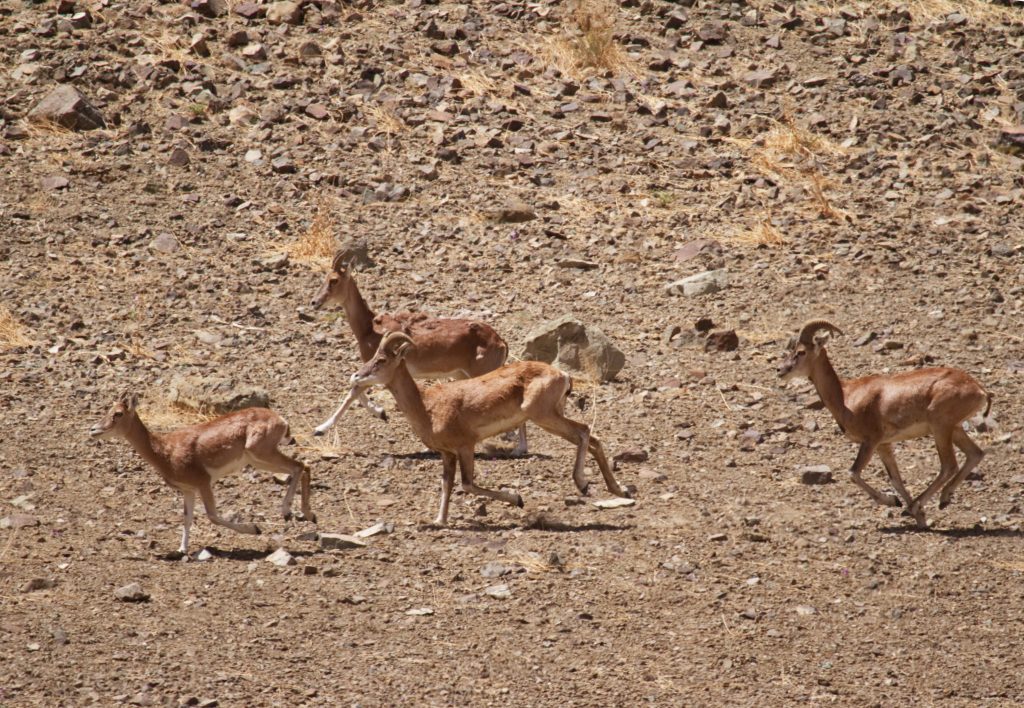
Looking forward to an exciting vacation, we jumped back in the cars only to get down a bit later as Iqbal Bhai spotted a herd of Urials. Urials (Ovis orientalis), or Shapo are wild sheep of Ladakh region and are found in Western Central Asia. It was the start of mating season for them and the male of the species were putting up an amazing display.
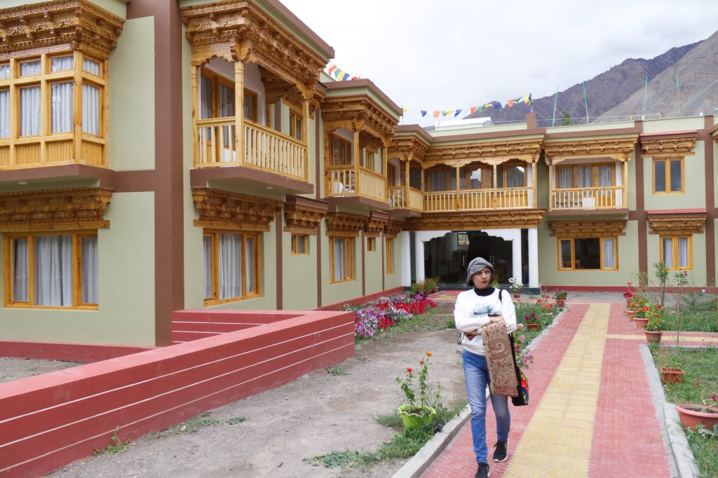
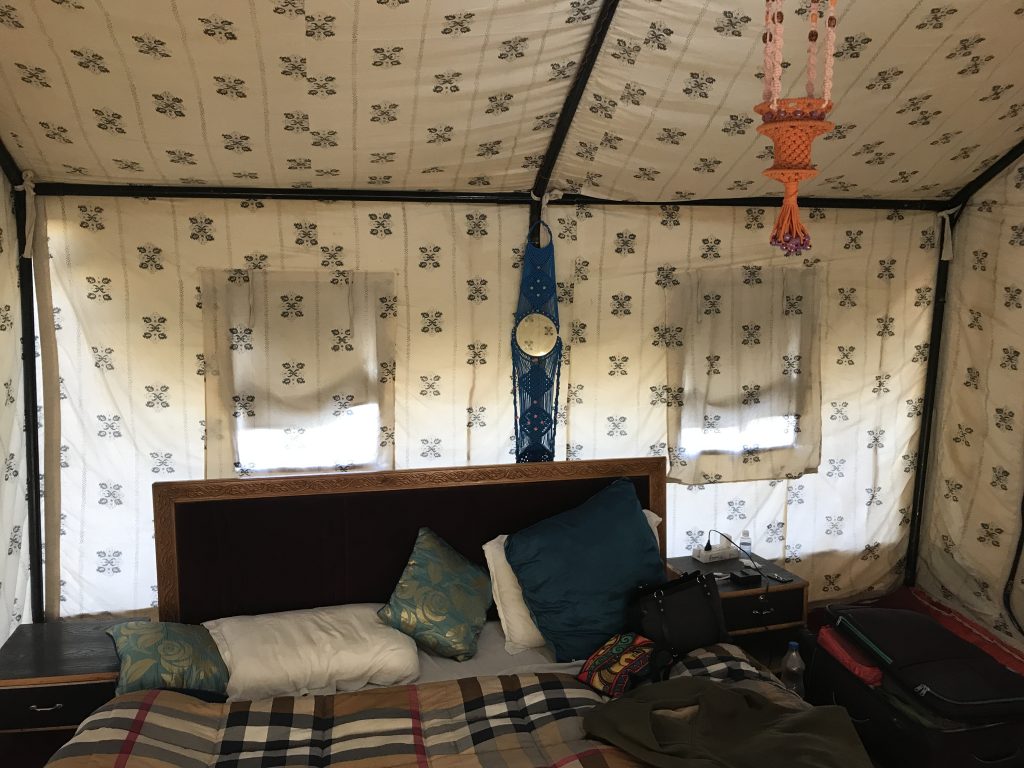
We arrived at Alchi a little after lunchtime, we had already eaten a sumptuous meal of momos and Thukpa en route, we reached our destination. After checking in at the Zimskhang holiday home, at Alchi, we were ready to explore the small monastery town.
Alchi is a historical place and has one of the oldest Buddhist monasteries. It is actually a Chos-‘khor, a place where monks are taught the ways of Buddhism. The Alchi Gompa comes under the Gelugpa order from Likir which looks after the monks and the upkeep of the monastery.
The Alchi Gompa is often called as Ajanta of Ladakh, because of the fine artmanship display on its walls. The paintings on the walls are regarded as one of the oldest and most extensive in the entire region.
The mud sculptures in the monastery are also unique to the region. It is said that the Alchi Gompa is was built between 958 and 1055 AD by the great Guru Rinchen Zangpo who translated the Sanskrit Buddhist texts into Tibetian The artistic and spiritual details of both Buddhism and the Hindu kings of that time in Kashmir and Himachal Pradesh are reflected in the wall paintings in the monastery. These are some of the oldest surviving paintings in Ladakh. The complex also has huge statues of the Buddha and elaborate wood carvings and artwork comparable to the baroque style.
One of the striking features of this monastery is the fact that it is not on a hill like other monasteries of the region, but is on a flat land, next to the river Indus.
ASI has declared this a protected monument and photography inside the monastery is not allowed.
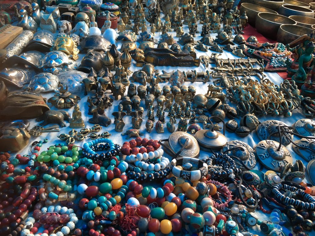
A visit to this monastery is incomplete without first stopping for a cup of tea and some butter cookies at the German bakery opposite the monastery complex and a look at the trinket shops that line the path to the monastery.
It was soon dark and all of us decided to take a pre-dinner walk. It would have been impossible to do all this on the first day of arrival had we stayed back at Leh. However, coming to a lower altitude place, not only gave us a chance to utilize the day but also helped us cope better with altitude change. The dinner was sumptuous and all of us ended up overeating. We eagerly went to our rooms and hit the sack.
9th September: Domkhar – Mulbekh and Kargil
While the others slept, I and Tarique, being early risers, decided to take a walk alongside the Indus river before we departed for Kargil.
The view was breathtaking, the sunrise was spectacular with the reflection of the deep blue sky of in the river. We also saw some snow on the mountain tops of Alchi, and on being told about it, Himanshu mentioned that he had never seen snow near Alchi so early in the season.
Post breakfast we departed for Kargil. The route was planned via the Domkhar Rock Art Sanctuary.
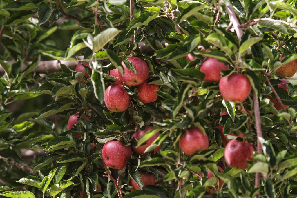
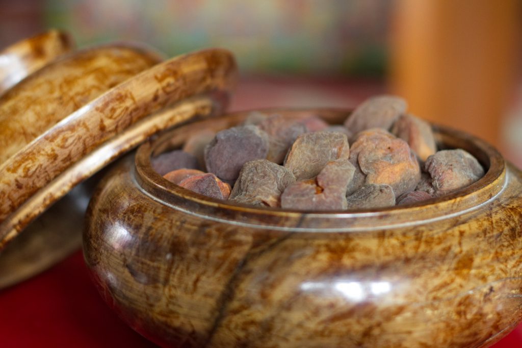
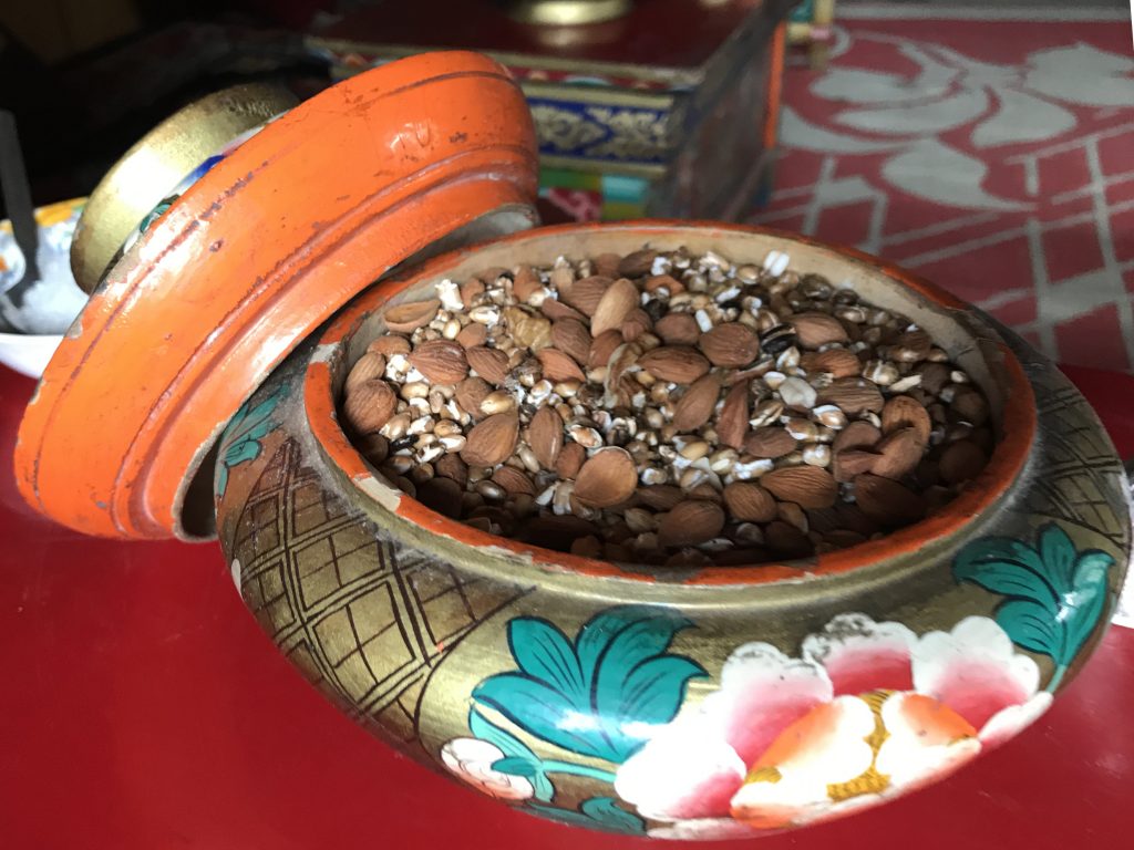
Enroute we stopped to buy fresh fruits and almonds. And saw that absolutely fresh Apples and Apricots were sold by the roadside.
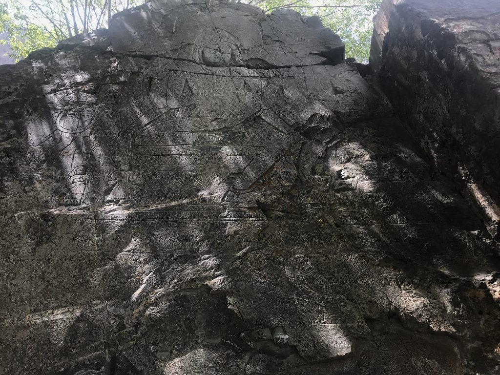
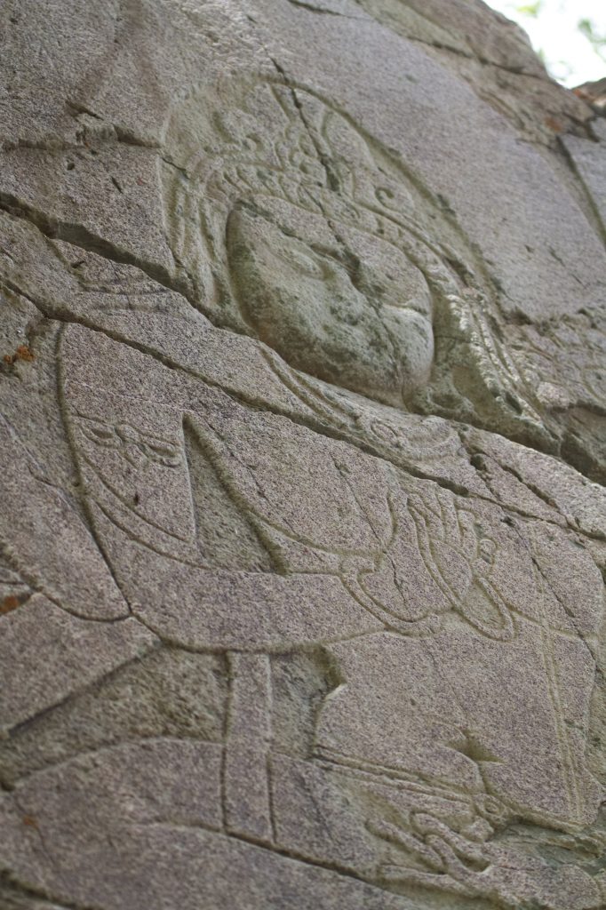
For many centuries traders, travellers, hunters and pilgrims have crossed Ladakh and have left their mark on the rocks of the region in the form of Petroglyphs. These pre-historic art forms are found all across the region, and one such site we visited was on a private property on the banks of Indus in the sleepy little village called Domkhar.
The rock art of Domkhar is on black rocks and is assumed to be 2000-4000 year old. These petroglyphs depict various images of animals, hunting scenes, figurines, calligraphy and symbols.
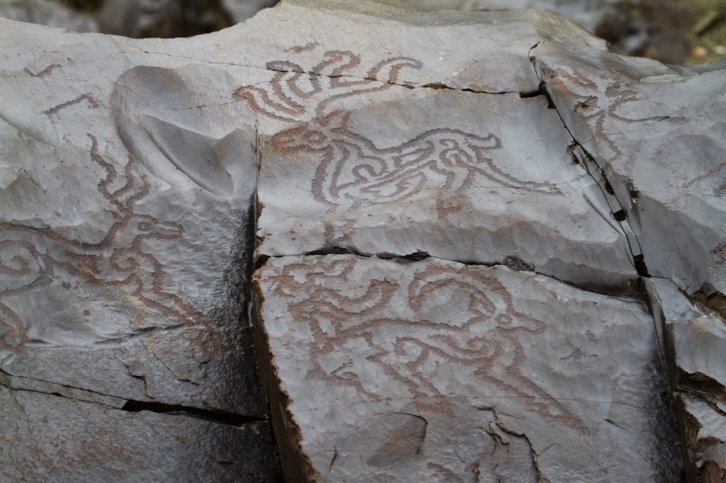
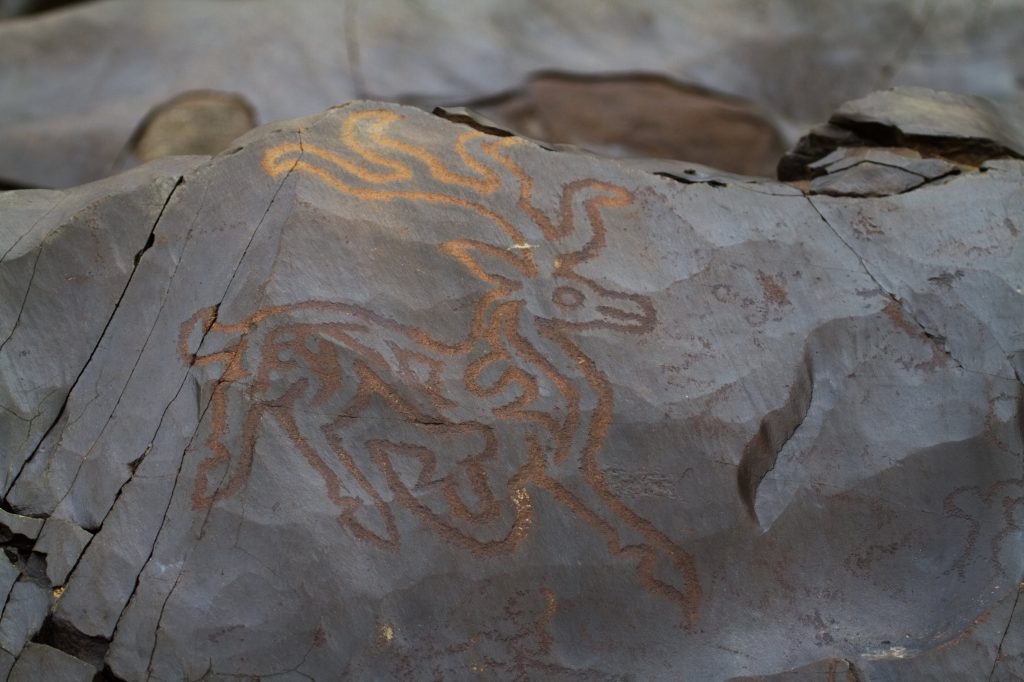
It was a fantastic locale for a photo shoot, and when one travels with like-minded people who are also photographers, an opportunity like this can never be missed.


People of Domkhar grow apricots, apples and numerous vegetables. This is also known as the Apricot region and the apricots here were extremely juicy and sweet.
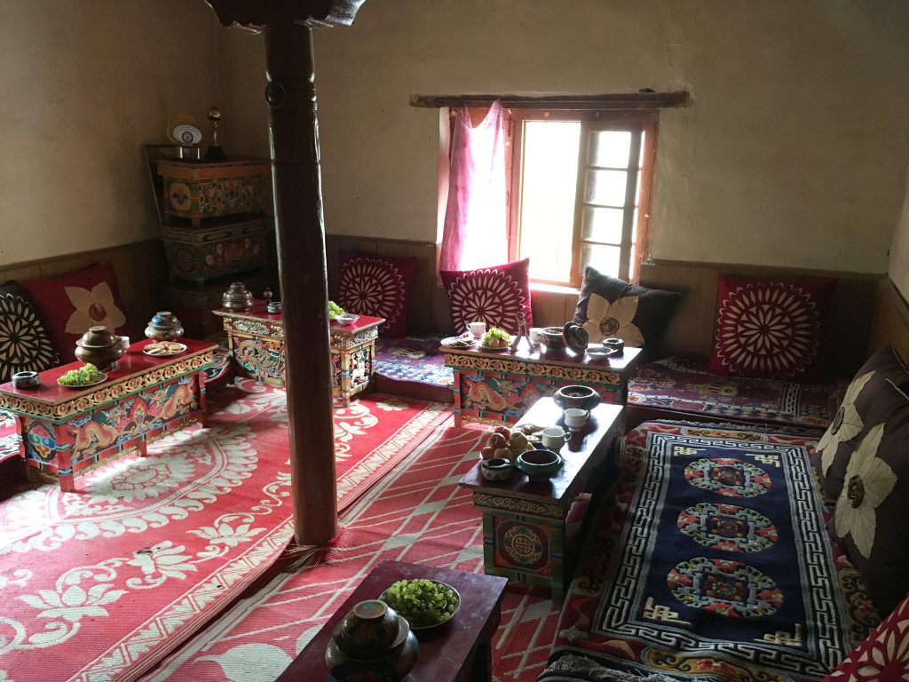
We were invited to the home of the owner of the private land where the Domkhar Rock Art Sanctuary stands and were treated to some snacks and delicious tea.
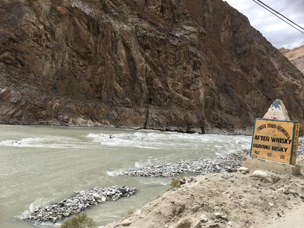
After a satisfying and gratifying break at Domkhar, we continued our journey on the Batalik Road along the Indus river. Batalik is the last Indian town and the river Indus enters Pakistan from here.
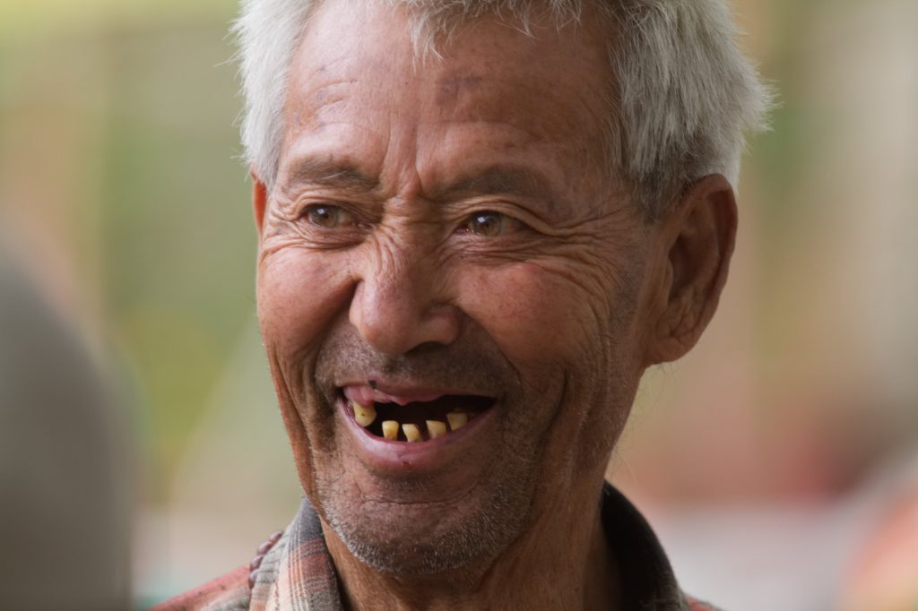
Enroute we passed some Aryan Villages (Hanuthang and Baima). It is believed that the settlers of these villages are of pure Aryan race. These people are indeed different. They have distinct features. Tall with green eyes, high cheekbones, fair skin, they claim to be the pure bloodline of the Aryans and settlers from the army of Alexander. Their attire is also different from the traditional Ladakhi attire and women sport fresh flowers in their headgear. Pity I could not take photographs of villages or the people there.
As we travelled I noticed the river getting wider and Himanshu told us that in 2017, a huge landslide left the road to Batalik unusable as it caused the water levels of Indus to rise very high, submerging a bridge and washing away the road leading to Batalik. The landslide destroyed several homes as Indus grew to dangerous levels. Since then a new road has been constructed at a higher altitude but the portions of the old submerged road can still be seen underwater. One can still see the river dangerously undercutting parts of the mountains posing danger to the road and nearby villages in the future.
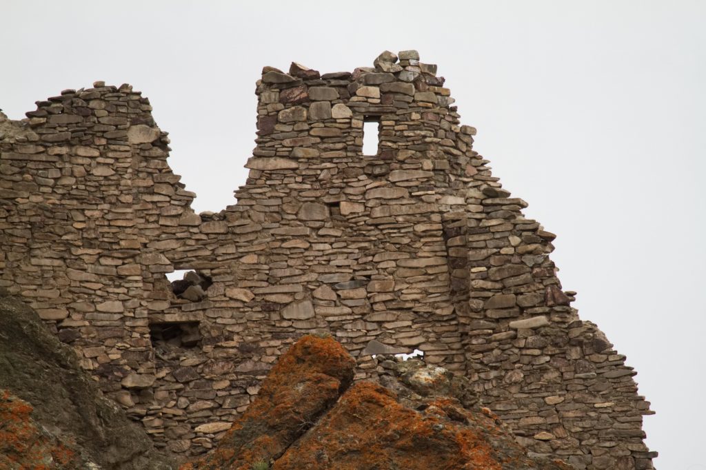
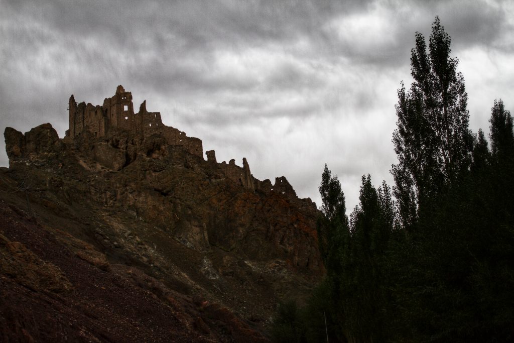
We left the Batalik road and took the Khangral-Sanjak road some 33 km short of the Batalik town and entered a small gorge (Chiktan Valley) that had a freshwater stream as a tributary of Indus. We had lunch on the streamside and continued our journey toward the ruins of the historical Chiktan Fort(or Chiktan Khar). Very sketchy details are available about this fort but it is said that the Fort is a 16th Century fort that was built by Balti craftsmen. Tahtah Khan, the Prince of Baltistan had run away after surviving a failed attempt to kill him. Legend has it that he took shelter in Chiktan and mesmerised by the beauty of the region decided to stay back. He constructed a palace here in the 8th century.
In the 16th century, some Balti Craftsmen built the now famous Chiktan fort as the royal residence of the rulers of the region. With glorious mountains as a backdrop, the fort was built with stone and mud and is said to have marvellous woodwork by the architect Shinkhen Chandan. The castle used timber to support the ceiling and had a revolving wooden room which used the power of winds to rotate the structure. It also is said that this fort was one of the masterpieces of Ladakh and Tibetian Architecture and was a symbol of unity, strength, brotherhood and community for the people of the region.
The castle was attacked several times but was not abandoned until the late 19th century. But now neglect and forces of nature have completely destroyed the woodwork and the castle is in advance stages of decay. Although this captivating fort is completely withered and is in utter ruins, with no signs remaining of the famous woodwork, the regal aura still remains.
After taking a few photos of the fort from a nearby hill, we continued our travel and joined the National Highway NH1 at Khangral. NH 1 (Previously NH 1A) On NH 1, the Leh-Kargil main highway, we climbed up to 12300 feet to go through the Namik La pass – our first from this road trip. (The spelling of Namik is written incorrectly at several places as Namki.)
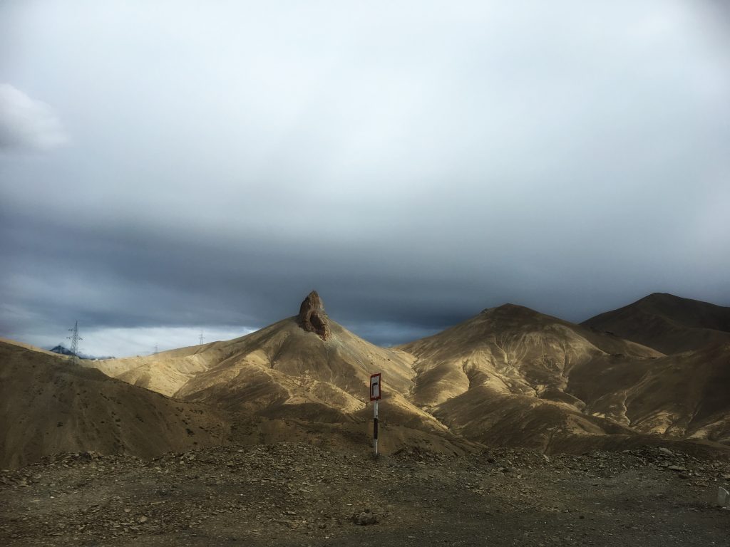
A glorious view of the mountains greeted us as the sun started setting. The Namik La is named so because of the mountain on which this pass is, looks like a pillar (which is Namik in the local Ladakhi language).
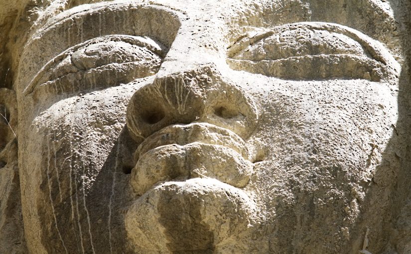
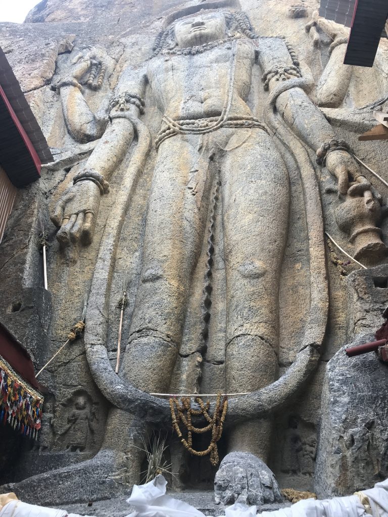
Another hour on the road and we reached Mulbekh to see the four-hand Buddha. This 28 feet Buddha statue, the tallest one in Ladakh, is also one of the most popular ones. Perhaps because of it being on the National Highway that connects Srinagar to Leh (Via Kargil).
While the statue stood on the roadside for a long time, a small monastery has now come up which completely encloses the statue. As per the information available there, it is said that the Buddha was carved here in the 1st century BC during the Kushan period. However, the studies point out that the carving is from the 7th Century. This Buddha statue has a stupa lodged in the hair which a common attribute found in the Maitreya Buddha.
In Ladakhi, the Maitreya Buddha is called Chamba. The Mulbekh buddha we saw had four hands; the lower left arm holds a water pot, or a kamandal, a constant in Indian and Kashmiri Buddhist iconography; the upper left arm has a flower; and the upper right arm, a rosary. Since it is believed that the Maitreya Buddha will be born in a Brahmin family, he also has a sacred thread across his chest. He is adorned with a pearl necklace, bangles and a belt. Also, on both sides of his legs, at the bottom, rows of devotees are carved, facing up to the Buddha.
As per a prophecy, the Maitreya, or Chamba or the Future Buddha is a bodhisattva who will appear on this earth in the future, he will achieve complete enlightenment and teach pure dharma. As per the scriptures, Maitreya will be a successor to the present Gautama Buddha. This prophecy refers to the arrival of Maitreya to a time in future when the dharma would be forgotten by most in this terrestrial world.
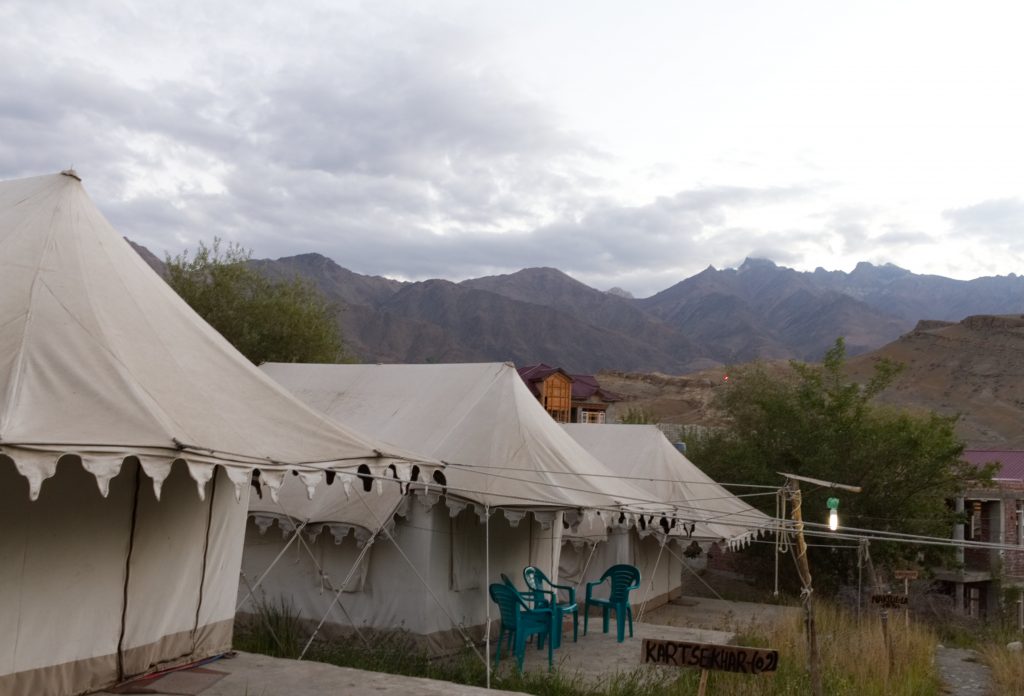
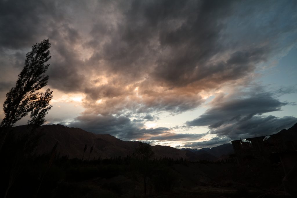
We arrived at the Kargil Tourist Camp, on the edge of Kargil town just in time to see a glorious sunset in the mountains.
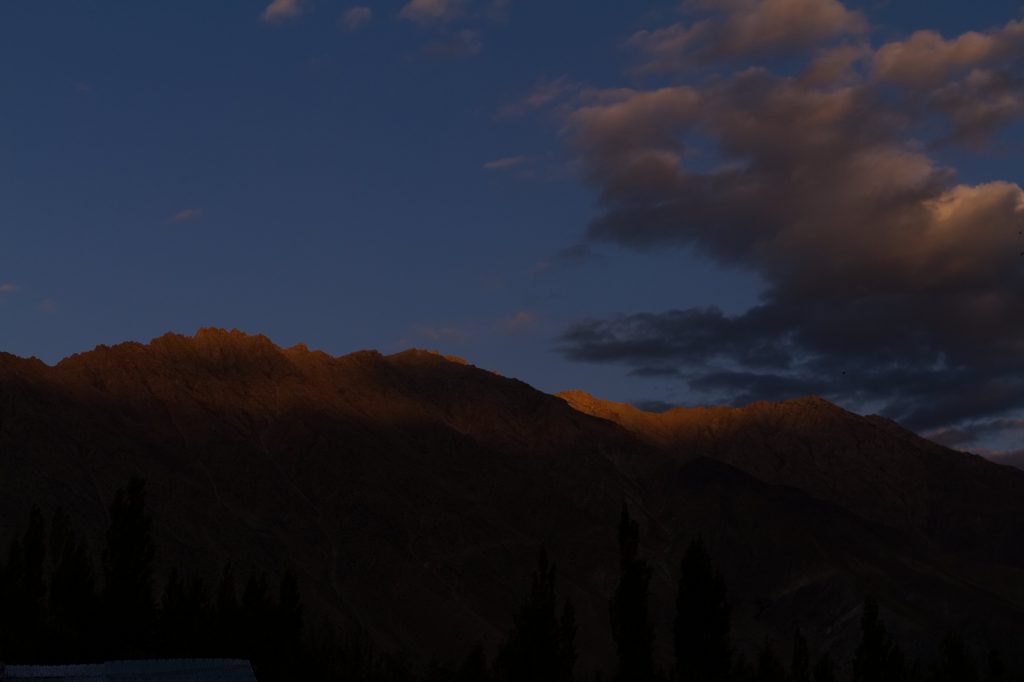
While Sanjeev and Tarique busied themselves trying to take a time-lapse of sunset, I sipped the lemon tea and clicked some pictures. We took a quick dinner and retired early to capture the early rays of sun on the mountains.
10th September: Kartse Khar, Nun Kun Peaks, LOC and Apati
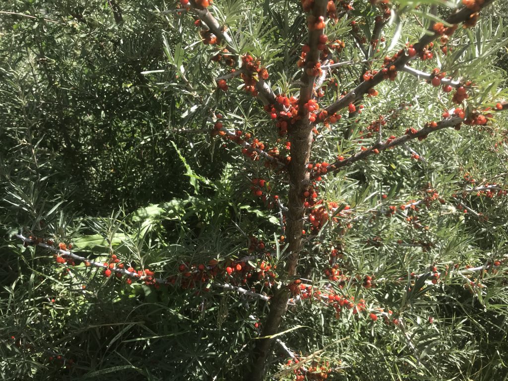
The sun rose in all its glory and the day started getting much warmer. We started early as there was much to do. After a long-ish drive, we stopped just before Sanku for the view of Suru Valley where we saw several thorny shrubs of Seabuckthorn (Hippophae rhamnoides) full with berries. Seabuckthorn grows wild in this region and some of us tasted the berry, which has a peculiar taste. The Seabuckthorn berry juice was marketed under the brand name of Leh berry, and is said to have health benefits. We were not too inclined to taste the juice. Although on second thoughts, I think, I should have tried it at least.
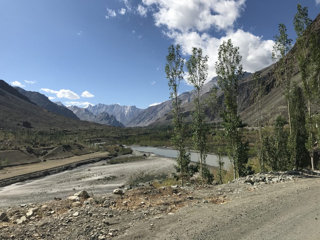 The Suru Valley
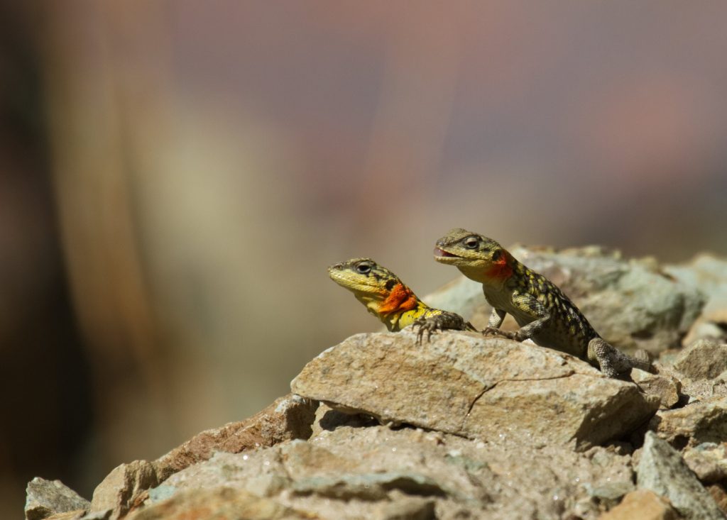
While we were enjoying the view of the valley, several Himalayan Agama (Paralaudakia himalayana) was seen sunning on the rocks.
Rest of the drive was along the river Suru. The Suru river originates near Penzila, the gateway to Zanskar.
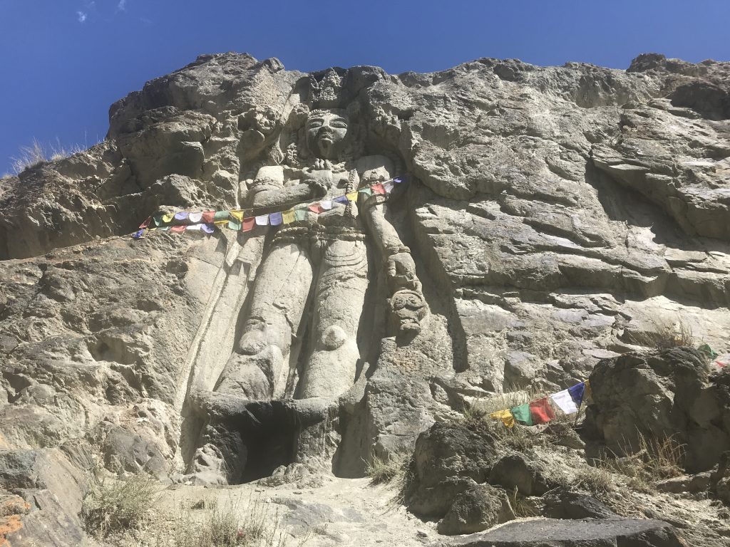
A bit later we crossed the Suru river and took the dirt road as we wanted to visit the village of Kartse Khar known for it’s giant Buddha carving. We parked our car in the outskirts of the village and started on foot along the small stream. After walking for about 800 meters, we encountered a huge Buddha carved in the early 7th century on the rock beside the stream. The statue is about 21 feet high. This is also the future Buddha or Maitreya Buddha. However, what differentiates this one from others is the crown and the body structure. The carving is very detailed, the crown has a triple sharp pointed diadem. Pearl bands hang beneath the crown. Two flying Gandharvas flank the head of the Buddha. A drape comes down from the crown and is twisted on the shoulders and arms. According to some experts, this style is derived from Pativ, a Persian emblem of the royalty adopted by the Kashmiri Buddhists. The lower garment of the Kartse Khar buddha resembles a dhoti.
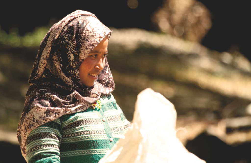
We took several photographs and while Himanshu and Sanjeev were shooting some videos, I chatted with the local women who were in the process of washing, drying and storing the grains for winter. Usually, the women are shy and refuse to be photographed, but I managed to click this beautiful girl-woman as she was less reserved than the others and readily posed.
The morning was getting warmer, it was still just about 11 am so Himanshu decided to take a chance to drive about 15 km to the village Diasma on the Kargil-Zanskar road (also called as Kargil – Padum road) and show us the Nun-Kun peaks from the banks of Suru river. At 23000+ feet the Nun-Kun peaks are the highest peaks in the Ladakh range.
However, by the time we reached the banks of the Suru river, it was almost noon and the peaks were engulfed in the clouds and were barely visible. We did manage to get a few glimpses of the impressive peaks though.
Nun in the local language means white, and Kun means black. Nun is usually covered with snow and appears completely white whereas Kun does show the rock underneath and appears black
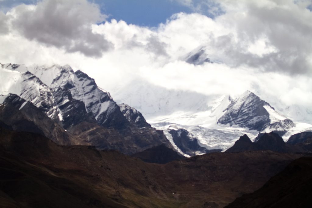

We were a bit disappointed because the view was not clear and the peaks were hidden beneath the clouds, but the view of the valley, the river, the passing clouds and the beautiful surroundings made us forget the disappointment. Trishu had by now learnt how to time-lapse pictures and was busy with Himanshu and Sanjeev taking photos, while Tarique, and I made ourselves busy by taking pictures of the beautiful surroundings and ourselves. I somehow don’t remember what Radhika was doing. Perpahs she was quietly standing there and watching us all go crazy.

By the time we finished taking photographs, we all were really hungry and we still had one stop to make before lunch.
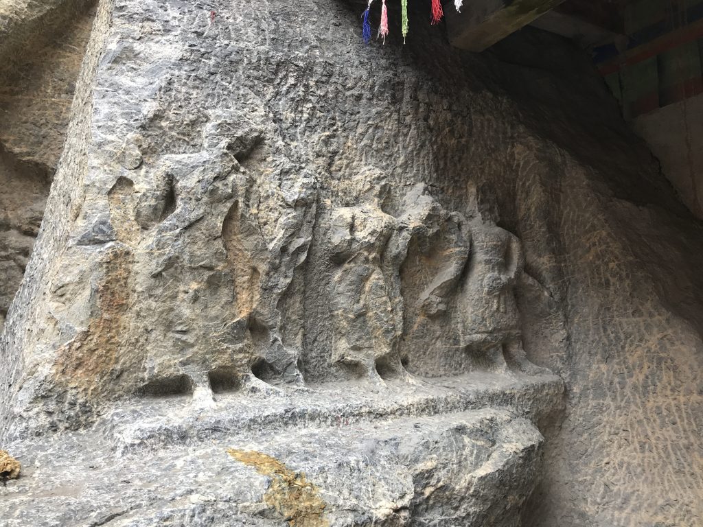
On the Kargil -Padum road, just a few kilometres before Sanku the Suru river takes an impressive turn. Here in the field by the side of road In the village of Skimertse, on a private property is a 13-14 century carving of Buddha that is unlike any other in the entire region. Etched in low relief, it is a representation of the feminine looking Avalokitesvara, flanked by Apsaras on either side. These are more stylised carvings and have elements that are not seen elsewhere. There is a depiction of a warhorse, some disciples, stupa, and an undecipherable script. The Avalokiteshvara has six arms but what they are holding is unclear, although it seems that one of the left arms holds a water pot. There is a stupa etched at the bottom of the slab, but that looks relatively recent as it has not weathered to the extent that the rest of the rock-relief has.
The Stone is lying next to the road, in someone’s field and it seems it got uncovered as a result of a rock fall. It is under no protection and perhaps very few know about it.
Next hurried stop was lunch at a roadside cafe and then we proceeded towards the village of Hundurmaan for the LOC view.
Every Indian is proud of the bravery of our armed forces, and the effort they take us to protect our country’s borders. It made our hearts soar when we saw the tri-colour fluttering in the winds at the LOC on the banks of Drass river, just before the village of Hundermaan.
It is also normal I guess, for any Indian to be curious as to how Pakistan looks. Although the terrain is same, the people similar and we originate from the same roots, or maybe it is the fact that we share the same legacy, a साँझी विरासत that makes us so curious. The dargah on the Pakistan side, the remnants of a village that was and the river bank that divides the two countries is what we could see there.
Photography at this point was not allowed, so we took some shots of the surroundings and continued our travails.
Next stop was Apati Buddha, approximately 15 km from Kargil, in the sleepy little village of Apati in the Sot Valley on the Kargil Batalik road.
This rock-carved Buddha is perhaps the oldest in Ladakh as it is said to be carved at the turn of the 6th Century, approximately the same time when Bamian Buddhas were carved. To reach the Apati Buddha, we carried our already tired bodies through the paved stairs of the traditional and sleepy village of Apati.
It is often said that to find the Buddha, you must take efforts, so we did and climbed innumerable flights of stairs and walked through the stone paved alleys of the village to reach this unexplored carving of Maitreya Buddha. The oldest of the bas-relief buddhas in Ladakh, this 16-foot tall statue is the least known of all.
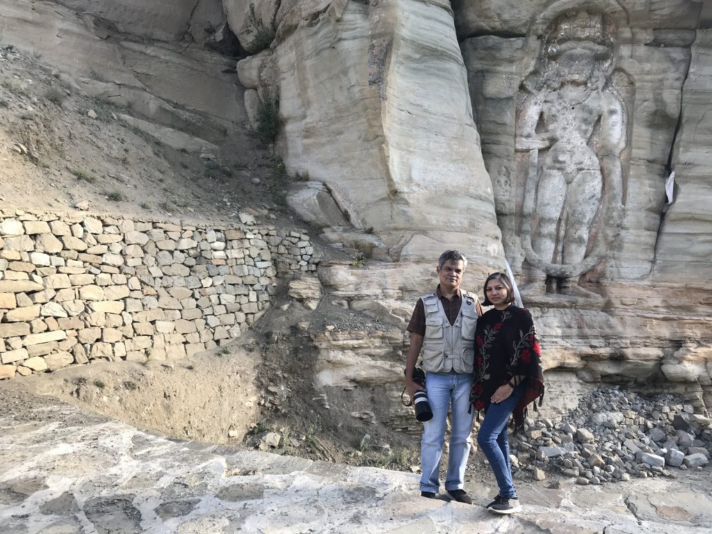
Carved in limestone, the Buddha statue has a triple sharp pointed diadem, the body structure is masculine and very impressive. It seems there were colours and stones used, but one can only see the remnants of these now.

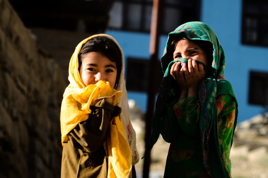
The villages located in the Sot Valley are solely dependent on the snow melts and there is no regular source of water here. Sot in the local language means death, pointing to the lack of water sources in the region. Interestingly, the local people here have a saying about Apati, that when three villages are destroyed by floods, then one Apati is settled. The people, especially children of the village were curious and friendly. some accompanied us right till the Buddha statue and stayed with us till we departed.
A long day for us ended at sunset and we drove back to the Kargil Tourist Camp for a quick bath and dinner.
This was an account of three days out of our 8 day adventure at Ladakh. More to come soon.